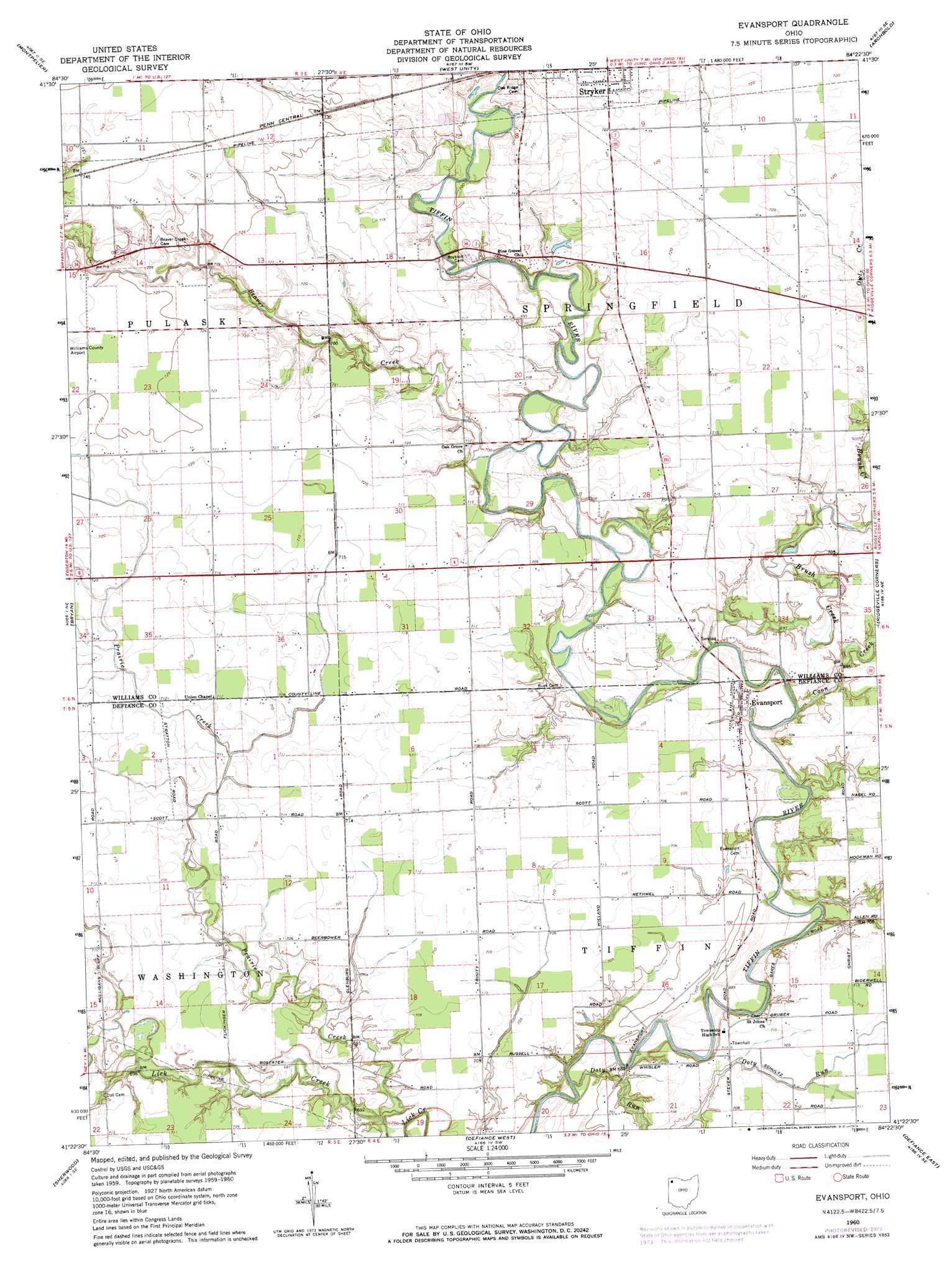
Evansport Topo Map Ohio
To zoom in, hover over the map of Evansport
USGS Topo Quad 41084d4 - 1:24,000 scale
| Topo Map Name: | Evansport |
| USGS Topo Quad ID: | 41084d4 |
| Print Size: | ca. 21 1/4" wide x 27" high |
| Southeast Coordinates: | 41.375° N latitude / 84.375° W longitude |
| Map Center Coordinates: | 41.4375° N latitude / 84.4375° W longitude |
| U.S. State: | OH |
| Filename: | o41084d4.jpg |
| Download Map JPG Image: | Evansport topo map 1:24,000 scale |
| Map Type: | Topographic |
| Topo Series: | 7.5´ |
| Map Scale: | 1:24,000 |
| Source of Map Images: | United States Geological Survey (USGS) |
| Alternate Map Versions: |
Evansport OH 1960, updated 1961 Download PDF Buy paper map Evansport OH 1960, updated 1974 Download PDF Buy paper map Evansport OH 2010 Download PDF Buy paper map Evansport OH 2013 Download PDF Buy paper map Evansport OH 2016 Download PDF Buy paper map |
1:24,000 Topo Quads surrounding Evansport
Nettle Lake |
Pioneer |
Alvordton |
Fayette |
Morenci |
Blakeslee |
Montpelier |
West Unity |
Archbold |
Wauseon |
Edgerton |
Bryan |
Evansport |
Ridgeville Corners |
Napoleon West |
Mark Center |
Sherwood |
Defiance West |
Defiance East |
Florida |
Antwerp |
Paulding |
Junction |
Ayersville |
New Bavaria |
> Back to 41084a1 at 1:100,000 scale
> Back to 41084a1 at 1:250,000 scale
> Back to U.S. Topo Maps home
Evansport topo map: Gazetteer
Evansport: Populated Places
Coys Subdivision elevation 217m 711′Evansport elevation 212m 695′
Glenburg (historical) elevation 216m 708′
Lakeland Woods Estates elevation 222m 728′
Promised Land Subdivision elevation 216m 708′
Riggs Subdivision elevation 216m 708′
Shaffers Acres elevation 221m 725′
Wilna elevation 219m 718′
Evansport: Post Offices
Evansport Post Office elevation 211m 692′Glenburg Post Office (historical) elevation 216m 708′
Evansport: Streams
Beaver Creek elevation 209m 685′Brush Creek elevation 205m 672′
Coon Creek elevation 206m 675′
Doty Run elevation 204m 669′
Prairie Creek elevation 207m 679′
Evansport digital topo map on disk
Buy this Evansport topo map showing relief, roads, GPS coordinates and other geographical features, as a high-resolution digital map file on DVD:
Northern Illinois, Northern Indiana & Southwestern Michigan
Buy digital topo maps: Northern Illinois, Northern Indiana & Southwestern Michigan