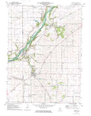
Newark Topo Map Illinois
To zoom in, hover over the map of Newark
USGS Topo Quad 41088e5 - 1:24,000 scale
| Topo Map Name: | Newark |
| USGS Topo Quad ID: | 41088e5 |
| Print Size: | ca. 21 1/4" wide x 27" high |
| Southeast Coordinates: | 41.5° N latitude / 88.5° W longitude |
| Map Center Coordinates: | 41.5625° N latitude / 88.5625° W longitude |
| U.S. State: | IL |
| Filename: | o41088e5.jpg |
| Download Map JPG Image: | Newark topo map 1:24,000 scale |
| Map Type: | Topographic |
| Topo Series: | 7.5´ |
| Map Scale: | 1:24,000 |
| Source of Map Images: | United States Geological Survey (USGS) |
| Alternate Map Versions: |
Newark IL 1971, updated 1973 Download PDF Buy paper map Newark IL 1971, updated 1973 Download PDF Buy paper map Newark IL 2012 Download PDF Buy paper map Newark IL 2015 Download PDF Buy paper map |
1:24,000 Topo Quads surrounding Newark
> Back to 41088e1 at 1:100,000 scale
> Back to 41088a1 at 1:250,000 scale
> Back to U.S. Topo Maps home
Newark topo map: Gazetteer
Newark: Airports
Cushing Field Limited Airport elevation 194m 636′Hemmingsen Airport elevation 195m 639′
Newark: Dams
Milhurst Lake Dam elevation 192m 629′Newark: Parks
Millhurst Fen Nature Preserve elevation 173m 567′Newark: Populated Places
Millbrook elevation 191m 626′Millhurst elevation 171m 561′
Millington elevation 172m 564′
Newark elevation 205m 672′
Newark: Post Offices
Millbrook Post Office elevation 188m 616′Newark: Reservoirs
Milhurst Lake elevation 192m 629′Newark: Streams
Ackleys Run elevation 185m 606′Clear Creek elevation 165m 541′
Hollenback Creek elevation 169m 554′
Knutson Creek elevation 175m 574′
Newark: Woods
Big Grove (historical) elevation 229m 751′Pappoose Grove elevation 195m 639′
Newark digital topo map on disk
Buy this Newark topo map showing relief, roads, GPS coordinates and other geographical features, as a high-resolution digital map file on DVD:
Northern Illinois, Northern Indiana & Southwestern Michigan
Buy digital topo maps: Northern Illinois, Northern Indiana & Southwestern Michigan


