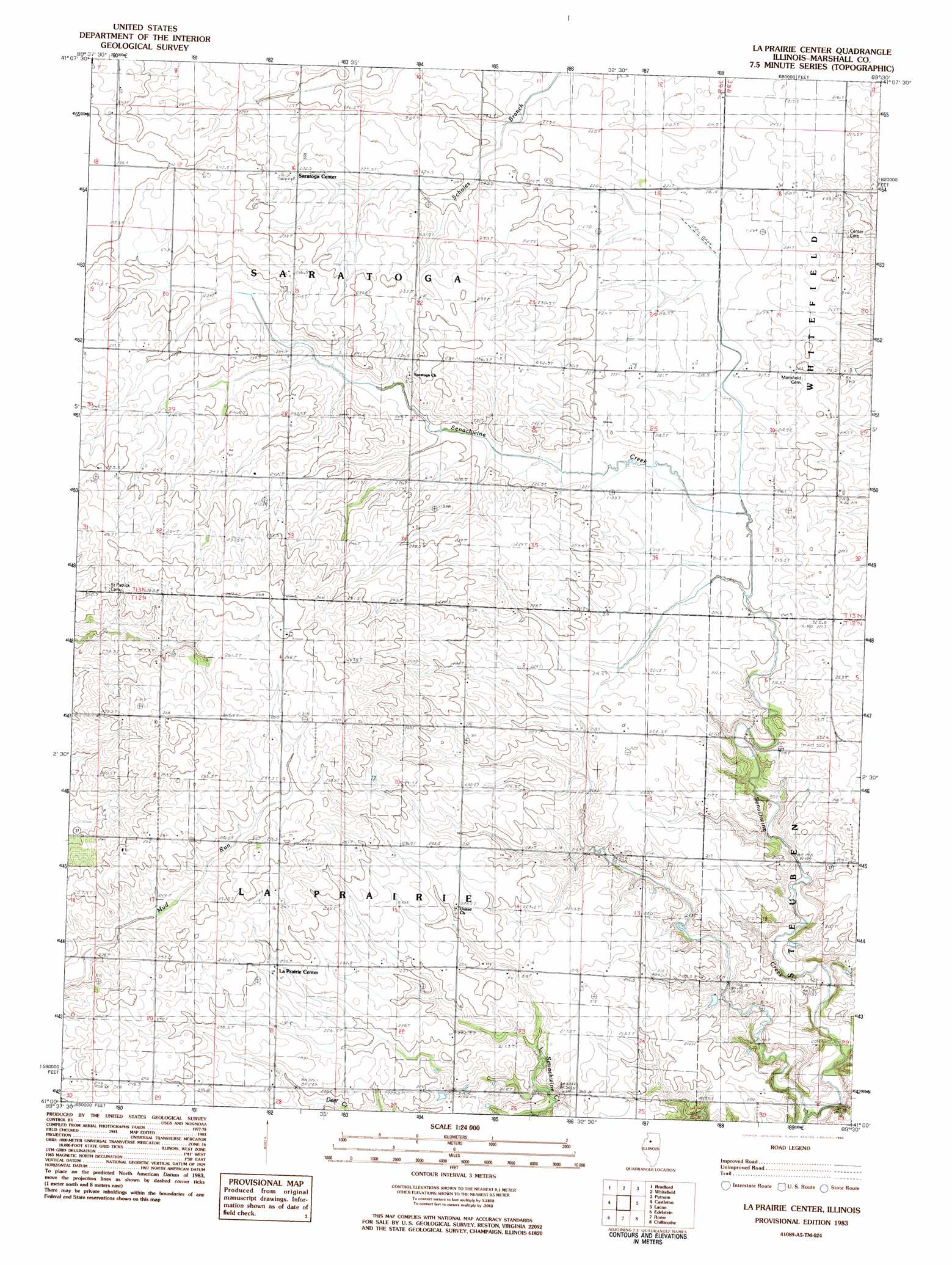
La Prairie Center Topo Map Illinois
To zoom in, hover over the map of La Prairie Center
USGS Topo Quad 41089a5 - 1:24,000 scale
| Topo Map Name: | La Prairie Center |
| USGS Topo Quad ID: | 41089a5 |
| Print Size: | ca. 21 1/4" wide x 27" high |
| Southeast Coordinates: | 41° N latitude / 89.5° W longitude |
| Map Center Coordinates: | 41.0625° N latitude / 89.5625° W longitude |
| U.S. State: | IL |
| Filename: | o41089a5.jpg |
| Download Map JPG Image: | La Prairie Center topo map 1:24,000 scale |
| Map Type: | Topographic |
| Topo Series: | 7.5´ |
| Map Scale: | 1:24,000 |
| Source of Map Images: | United States Geological Survey (USGS) |
| Alternate Map Versions: |
La Prairie Center IL 1983, updated 1984 Download PDF Buy paper map La Prairie Center IL 2012 Download PDF Buy paper map La Prairie Center IL 2015 Download PDF Buy paper map |
1:24,000 Topo Quads surrounding La Prairie Center
Neponset |
Buda |
Wyanet |
Princeton South |
Depue |
Elmira |
Bradford |
Whitefield |
Putnam |
Florid |
Wyoming |
Castleton |
La Prairie Center |
Lacon |
Henry |
Princeville |
Edelstein |
Rome |
Chillicothe |
Washburn |
Oak Hill |
Dunlap |
Spring Bay |
Germantown Hills |
Metamora |
> Back to 41089a1 at 1:100,000 scale
> Back to 41088a1 at 1:250,000 scale
> Back to U.S. Topo Maps home
La Prairie Center topo map: Gazetteer
La Prairie Center: Populated Places
Saratoga Center elevation 233m 764′La Prairie Center digital topo map on disk
Buy this La Prairie Center topo map showing relief, roads, GPS coordinates and other geographical features, as a high-resolution digital map file on DVD:
Northern Illinois, Northern Indiana & Southwestern Michigan
Buy digital topo maps: Northern Illinois, Northern Indiana & Southwestern Michigan