Union Grove Topo Map Illinois
To zoom in, hover over the map of Union Grove
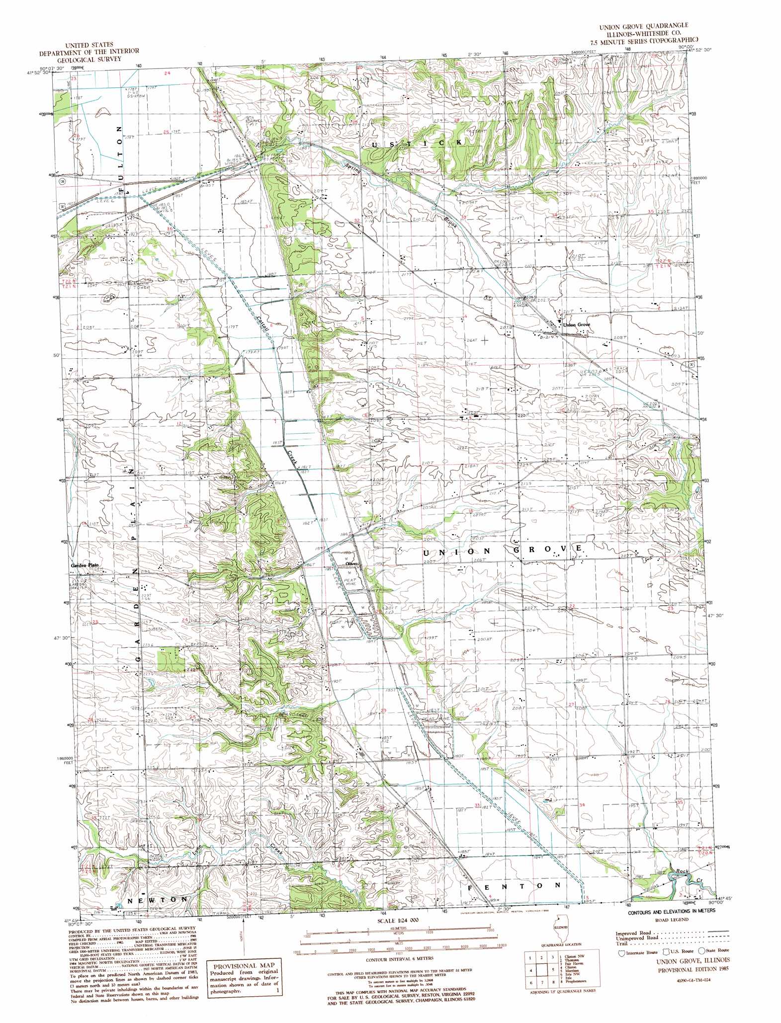
USGS Topo Quad 41090g1 - 1:24,000 scale
| Topo Map Name: | Union Grove |
| USGS Topo Quad ID: | 41090g1 |
| Print Size: | ca. 21 1/4" wide x 27" high |
| Southeast Coordinates: | 41.75° N latitude / 90° W longitude |
| Map Center Coordinates: | 41.8125° N latitude / 90.0625° W longitude |
| U.S. State: | IL |
| Filename: | o41090g1.jpg |
| Download Map JPG Image: | Union Grove topo map 1:24,000 scale |
| Map Type: | Topographic |
| Topo Series: | 7.5´ |
| Map Scale: | 1:24,000 |
| Source of Map Images: | United States Geological Survey (USGS) |
| Alternate Map Versions: |
Union Grove IL 1985, updated 1986 Download PDF Buy paper map Union Grove IL 2012 Download PDF Buy paper map Union Grove IL 2015 Download PDF Buy paper map |
1:24,000 Topo Quads surrounding Union Grove
Miles |
Savanna |
Wacker |
Mount Carroll |
Lanark |
Andover |
Clinton Nw |
Thomson |
Fairhaven |
Milledgeville |
Camanche |
Clinton |
Union Grove |
Morrison |
Como |
Cordova |
Erie Nw |
Erie |
Prophetstown |
Tampico |
Port Byron |
Hillsdale |
Spring Hill |
Hooppole |
Yorktown |
> Back to 41090e1 at 1:100,000 scale
> Back to 41090a1 at 1:250,000 scale
> Back to U.S. Topo Maps home
Union Grove topo map: Gazetteer
Union Grove: Populated Places
Oliver elevation 184m 603′Union Grove elevation 210m 688′
Union Grove: Streams
Spring Brook elevation 178m 583′Union Grove digital topo map on disk
Buy this Union Grove topo map showing relief, roads, GPS coordinates and other geographical features, as a high-resolution digital map file on DVD: