Newhall Topo Map Iowa
To zoom in, hover over the map of Newhall
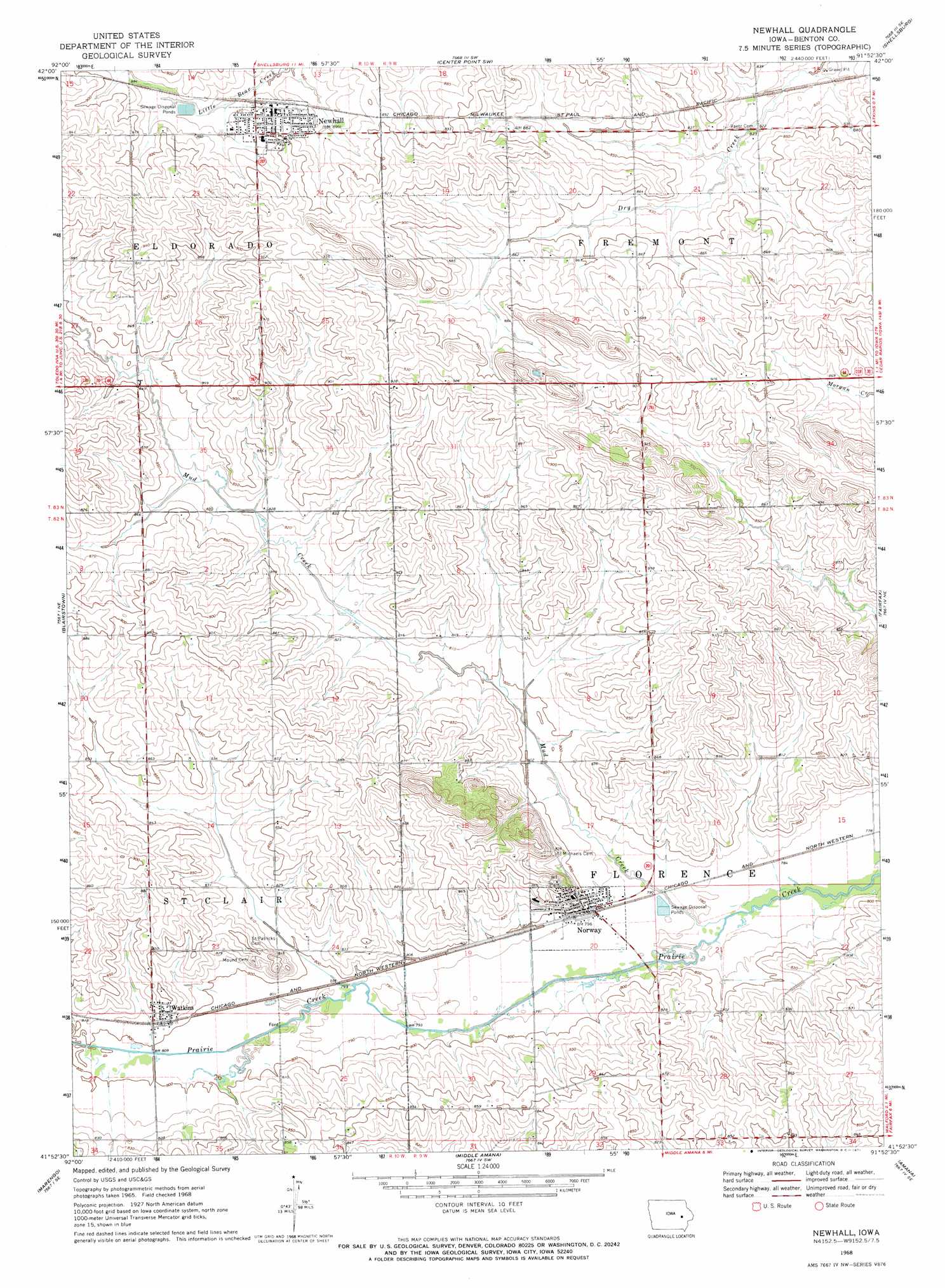
USGS Topo Quad 41091h8 - 1:24,000 scale
| Topo Map Name: | Newhall |
| USGS Topo Quad ID: | 41091h8 |
| Print Size: | ca. 21 1/4" wide x 27" high |
| Southeast Coordinates: | 41.875° N latitude / 91.875° W longitude |
| Map Center Coordinates: | 41.9375° N latitude / 91.9375° W longitude |
| U.S. State: | IA |
| Filename: | o41091h8.jpg |
| Download Map JPG Image: | Newhall topo map 1:24,000 scale |
| Map Type: | Topographic |
| Topo Series: | 7.5´ |
| Map Scale: | 1:24,000 |
| Source of Map Images: | United States Geological Survey (USGS) |
| Alternate Map Versions: |
Newhall IA 1968, updated 1971 Download PDF Buy paper map Newhall IA 2010 Download PDF Buy paper map Newhall IA 2013 Download PDF Buy paper map Newhall IA 2015 Download PDF Buy paper map |
1:24,000 Topo Quads surrounding Newhall
Garrison |
Vinton |
Center Point Nw |
Center Point |
Lafayette |
Keystone North |
Van Horne |
Center Point Sw |
Shellsburg |
Cedar Rapids North |
Keystone South |
Blairstown |
Newhall |
Fairfax |
Cedar Rapids South |
Ladora |
Marengo |
Middle Amana |
Amana |
Swisher |
Williamsburg Nw |
Williamsburg |
Conroy |
Oxford |
Tiffin |
> Back to 41091e1 at 1:100,000 scale
> Back to 41090a1 at 1:250,000 scale
> Back to U.S. Topo Maps home
Newhall topo map: Gazetteer
Newhall: Parks
Tuttle Wildlife Area elevation 243m 797′Newhall: Populated Places
Newhall elevation 267m 875′Norway elevation 247m 810′
Watkins elevation 253m 830′
Newhall: Post Offices
Newhall Post Office elevation 268m 879′Norway Post Office elevation 245m 803′
Watkins Post Office elevation 253m 830′
Newhall digital topo map on disk
Buy this Newhall topo map showing relief, roads, GPS coordinates and other geographical features, as a high-resolution digital map file on DVD: