Brookville Topo Map Iowa
To zoom in, hover over the map of Brookville
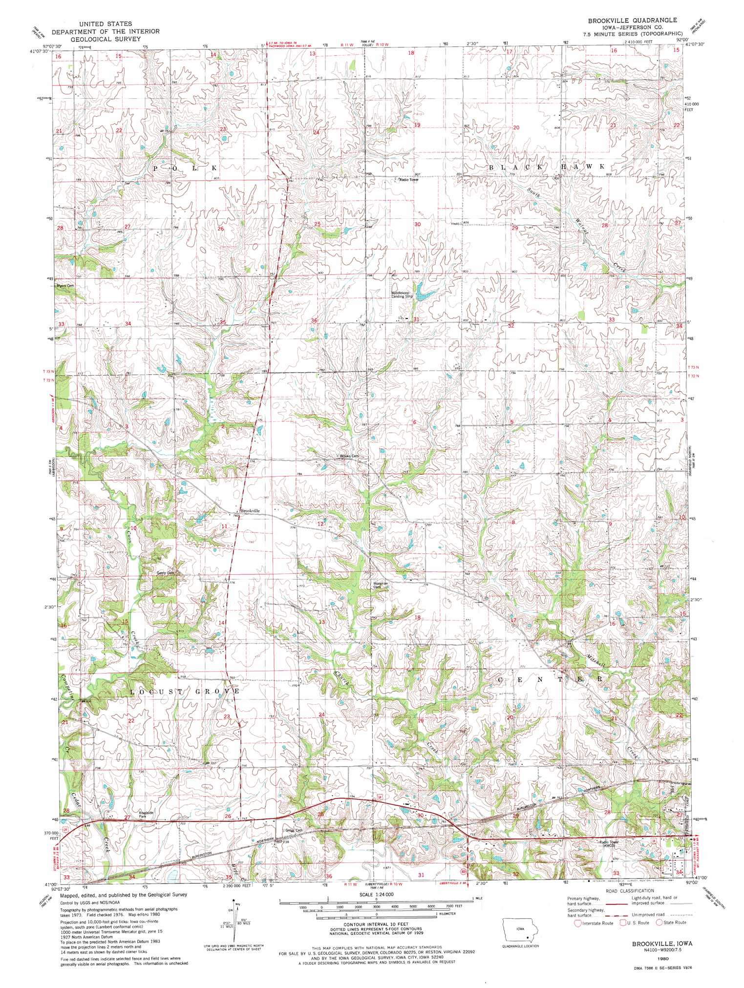
USGS Topo Quad 41092a1 - 1:24,000 scale
| Topo Map Name: | Brookville |
| USGS Topo Quad ID: | 41092a1 |
| Print Size: | ca. 21 1/4" wide x 27" high |
| Southeast Coordinates: | 41° N latitude / 92° W longitude |
| Map Center Coordinates: | 41.0625° N latitude / 92.0625° W longitude |
| U.S. State: | IA |
| Filename: | o41092a1.jpg |
| Download Map JPG Image: | Brookville topo map 1:24,000 scale |
| Map Type: | Topographic |
| Topo Series: | 7.5´ |
| Map Scale: | 1:24,000 |
| Source of Map Images: | United States Geological Survey (USGS) |
| Alternate Map Versions: |
Brookville IA 1980, updated 1981 Download PDF Buy paper map Brookville IA 2010 Download PDF Buy paper map Brookville IA 2013 Download PDF Buy paper map Brookville IA 2015 Download PDF Buy paper map |
1:24,000 Topo Quads surrounding Brookville
Delta |
Sigourney |
Harper |
Keota |
West Chester |
Hedrick |
Pekin |
Ollie |
Richland |
Brighton |
Farson |
Abingdon |
Brookville |
Fairfield North |
Salina |
Agency |
Eldon |
Libertyville |
Fairfield South |
Lockridge West |
Floris |
Selma |
Douds |
Mount Zion |
Stockport |
> Back to 41092a1 at 1:100,000 scale
> Back to 41092a1 at 1:250,000 scale
> Back to U.S. Topo Maps home
Brookville topo map: Gazetteer
Brookville: Airports
Middlekoop Landing Strip elevation 240m 787′Brookville: Parks
Witham Woods elevation 207m 679′Brookville: Populated Places
Bernhart elevation 229m 751′Brookville elevation 238m 780′
Brookville: Post Offices
Bernhart Post Office (historical) elevation 229m 751′Brookville Post Office (historical) elevation 238m 780′
Brookville: Streams
Competine Creek elevation 207m 679′Brookville digital topo map on disk
Buy this Brookville topo map showing relief, roads, GPS coordinates and other geographical features, as a high-resolution digital map file on DVD: