Prairie Rose Lake Topo Map Iowa
To zoom in, hover over the map of Prairie Rose Lake
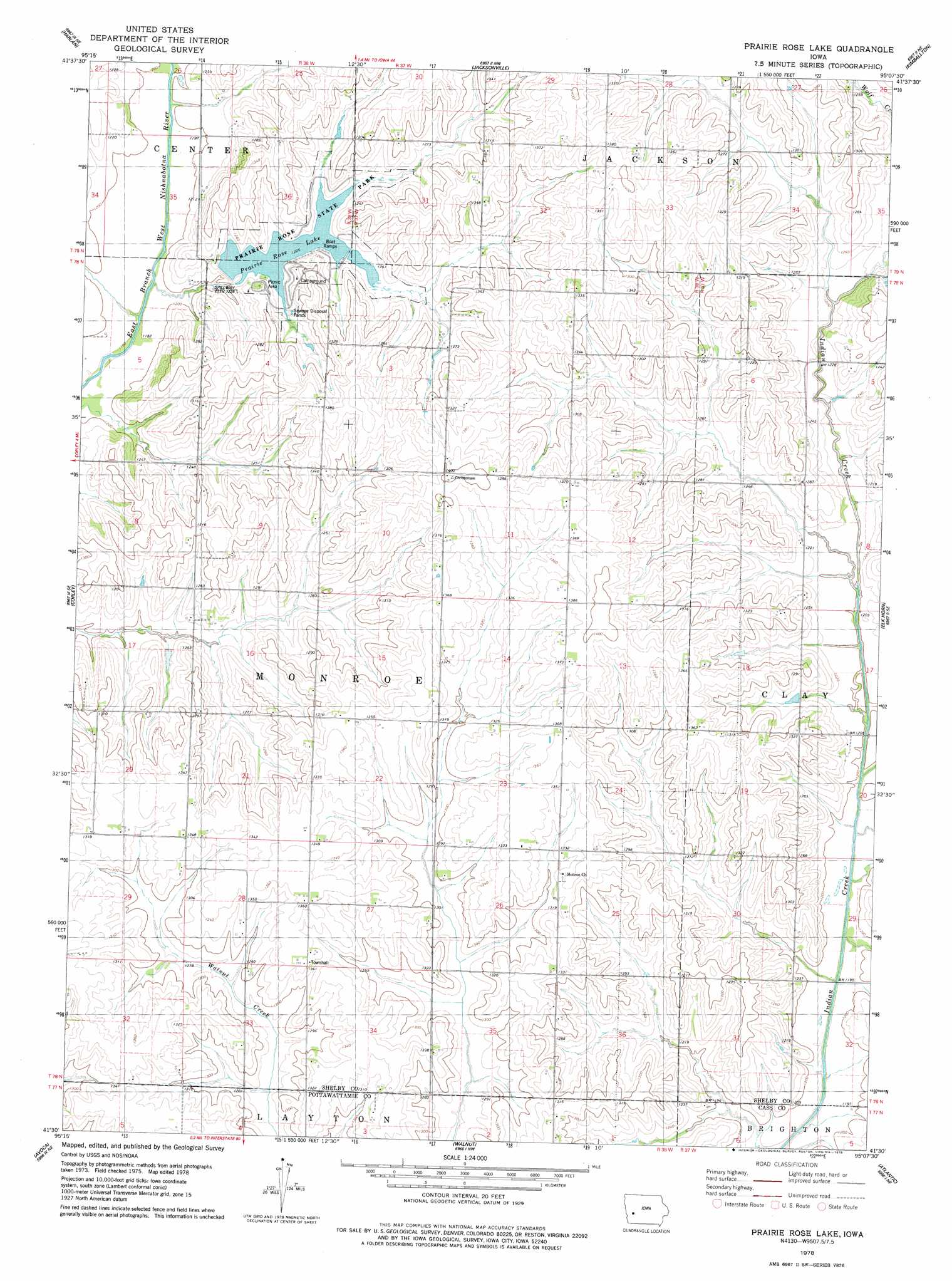
USGS Topo Quad 41095e2 - 1:24,000 scale
| Topo Map Name: | Prairie Rose Lake |
| USGS Topo Quad ID: | 41095e2 |
| Print Size: | ca. 21 1/4" wide x 27" high |
| Southeast Coordinates: | 41.5° N latitude / 95.125° W longitude |
| Map Center Coordinates: | 41.5625° N latitude / 95.1875° W longitude |
| U.S. State: | IA |
| Filename: | o41095e2.jpg |
| Download Map JPG Image: | Prairie Rose Lake topo map 1:24,000 scale |
| Map Type: | Topographic |
| Topo Series: | 7.5´ |
| Map Scale: | 1:24,000 |
| Source of Map Images: | United States Geological Survey (USGS) |
| Alternate Map Versions: |
Prairie Rose Lake IA 1978, updated 1978 Download PDF Buy paper map Prairie Rose Lake IA 2010 Download PDF Buy paper map Prairie Rose Lake IA 2013 Download PDF Buy paper map Prairie Rose Lake IA 2015 Download PDF Buy paper map |
1:24,000 Topo Quads surrounding Prairie Rose Lake
Earling |
Defiance |
Irwin |
Manning Se |
Gray |
Panama |
Harlan |
Jacksonville |
Kimballton |
Audubon |
Shelby |
Corley |
Prairie Rose Lake |
Elk Horn |
Exira West |
Avoca Nw |
Avoca |
Walnut |
Atlantic |
Wiota |
Oakland |
Avoca Se |
Atlantic Sw |
Lewis |
Anita Sw |
> Back to 41095e1 at 1:100,000 scale
> Back to 41094a1 at 1:250,000 scale
> Back to U.S. Topo Maps home
Prairie Rose Lake topo map: Gazetteer
Prairie Rose Lake: Dams
Prairie Rose Lake Dam elevation 365m 1197′Prairie Rose Lake: Lakes
Prairie Rose Lake elevation 373m 1223′Prairie Rose Lake: Parks
Oak Ridge Wildlife Area elevation 393m 1289′Prairie Rose State Park elevation 373m 1223′
Prairie Rose Lake: Populated Places
Rorbeck elevation 396m 1299′Prairie Rose Lake: Post Offices
Prairie Rose Post Office (historical) elevation 407m 1335′Rorbeck Post Office (historical) elevation 396m 1299′
Prairie Rose Lake: Streams
Elkhorn Creek elevation 364m 1194′Squaw Creek elevation 359m 1177′
Prairie Rose Lake digital topo map on disk
Buy this Prairie Rose Lake topo map showing relief, roads, GPS coordinates and other geographical features, as a high-resolution digital map file on DVD: