Baxter Topo Map Wyoming
To zoom in, hover over the map of Baxter
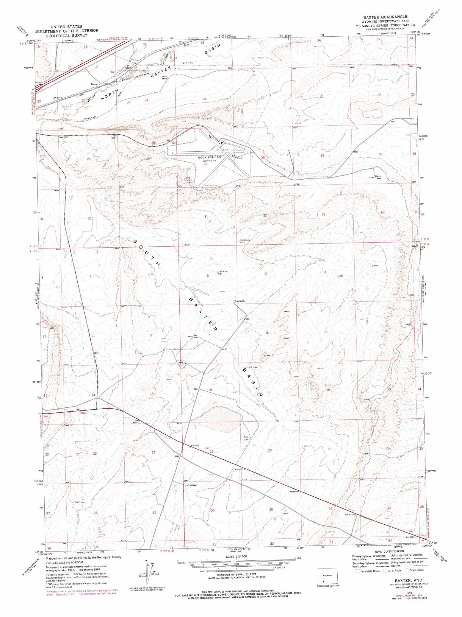
USGS Topo Quad 41109e1 - 1:24,000 scale
| Topo Map Name: | Baxter |
| USGS Topo Quad ID: | 41109e1 |
| Print Size: | ca. 21 1/4" wide x 27" high |
| Southeast Coordinates: | 41.5° N latitude / 109° W longitude |
| Map Center Coordinates: | 41.5625° N latitude / 109.0625° W longitude |
| U.S. State: | WY |
| Filename: | o41109e1.jpg |
| Download Map JPG Image: | Baxter topo map 1:24,000 scale |
| Map Type: | Topographic |
| Topo Series: | 7.5´ |
| Map Scale: | 1:24,000 |
| Source of Map Images: | United States Geological Survey (USGS) |
| Alternate Map Versions: |
Baxter WY 1968, updated 1972 Download PDF Buy paper map Baxter WY 1968, updated 1978 Download PDF Buy paper map Baxter WY 2012 Download PDF Buy paper map Baxter WY 2015 Download PDF Buy paper map |
1:24,000 Topo Quads surrounding Baxter
Clay Buttes Se |
Boars Tusk Sw |
Deer Butte |
South Superior |
Black Rock South |
Pilot Butte |
Reliance |
North Baxter |
Thayer Junction |
Point Of Rocks |
Kanda |
Rock Springs |
Baxter |
Point Of Rocks Sw |
Point Of Rocks Se |
Wilkins Peak |
Kappes Canyon |
Lion Bluffs |
Camel Rock |
Cooper Ridge Ne |
Firehole Basin |
Earnest Butte |
South Baxter |
Mud Springs Ranch |
Burley Draw |
> Back to 41109e1 at 1:100,000 scale
> Back to 41108a1 at 1:250,000 scale
> Back to U.S. Topo Maps home
Baxter topo map: Gazetteer
Baxter: Airports
Rock Springs-Sweetwater County Airport elevation 2055m 6742′Baxter: Basins
South Baxter Basin elevation 1965m 6446′Baxter digital topo map on disk
Buy this Baxter topo map showing relief, roads, GPS coordinates and other geographical features, as a high-resolution digital map file on DVD: