Devils Armchair Topo Map Nevada
To zoom in, hover over the map of Devils Armchair
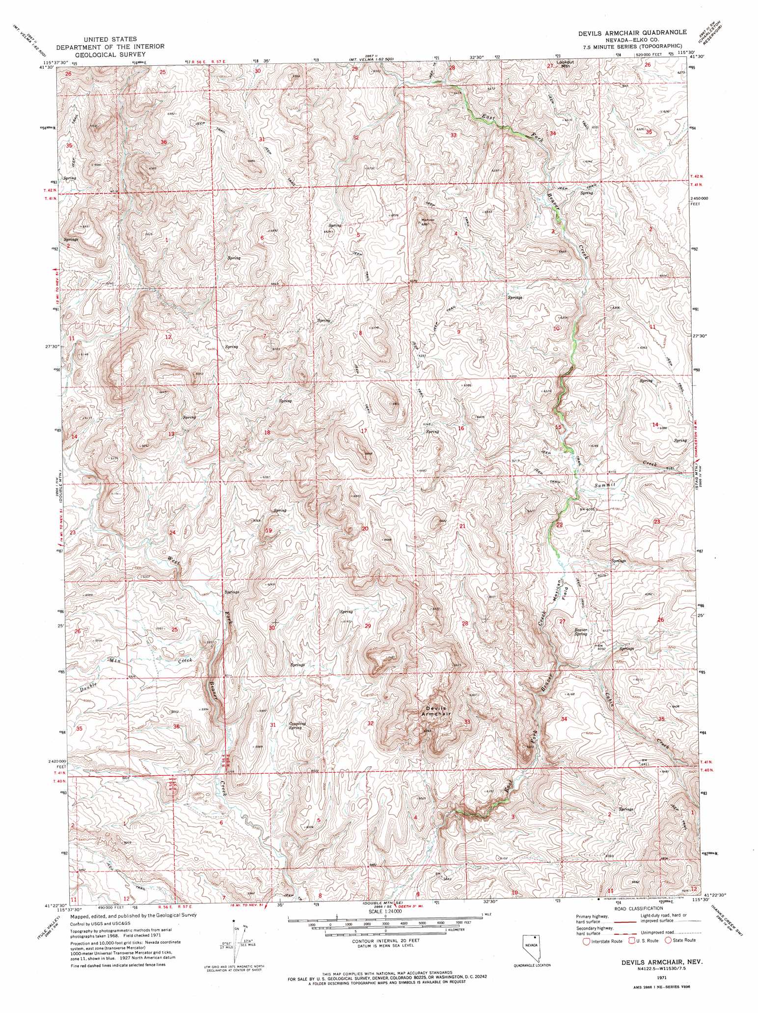
USGS Topo Quad 41115d5 - 1:24,000 scale
| Topo Map Name: | Devils Armchair |
| USGS Topo Quad ID: | 41115d5 |
| Print Size: | ca. 21 1/4" wide x 27" high |
| Southeast Coordinates: | 41.375° N latitude / 115.5° W longitude |
| Map Center Coordinates: | 41.4375° N latitude / 115.5625° W longitude |
| U.S. State: | NV |
| Filename: | o41115d5.jpg |
| Download Map JPG Image: | Devils Armchair topo map 1:24,000 scale |
| Map Type: | Topographic |
| Topo Series: | 7.5´ |
| Map Scale: | 1:24,000 |
| Source of Map Images: | United States Geological Survey (USGS) |
| Alternate Map Versions: |
Devils Armchair NV 1971, updated 1974 Download PDF Buy paper map Devils Armchair NV 2012 Download PDF Buy paper map Devils Armchair NV 2014 Download PDF Buy paper map |
1:24,000 Topo Quads surrounding Devils Armchair
Wild Horse |
Cornwall Mountain |
Annie Creek |
Marys River Basin Nw |
Marys River Basin Ne |
Delaware Creek |
Wagon Springs |
Mount Ichabod |
Charleston Reservoir |
Marys River Basin Se |
North Fork |
Double Mountain |
Devils Armchair |
Stag Mountain |
Hanks Creek Ne |
Mahala Creek East |
Tule Valley |
Double Mountain Se |
Hanks Creek Sw |
Hot Springs Creek |
Wieland Flat |
Coal Mine Basin |
The Narrows |
Peko Peak |
Twin Buttes |
> Back to 41115a1 at 1:100,000 scale
> Back to 41114a1 at 1:250,000 scale
> Back to U.S. Topo Maps home
Devils Armchair topo map: Gazetteer
Devils Armchair: Basins
Devils Armchair elevation 1930m 6332′Devils Armchair: Flats
Mexican Field elevation 1831m 6007′Devils Armchair: Ridges
Rim Rock elevation 1914m 6279′Devils Armchair: Springs
Beaver Spring elevation 1844m 6049′Coupling Spring elevation 1789m 5869′
Rimrock Spring elevation 1947m 6387′
Devils Armchair: Streams
Cabin Creek elevation 1821m 5974′Double Mountain Creek elevation 1761m 5777′
Summit Creek elevation 1842m 6043′
Devils Armchair digital topo map on disk
Buy this Devils Armchair topo map showing relief, roads, GPS coordinates and other geographical features, as a high-resolution digital map file on DVD: