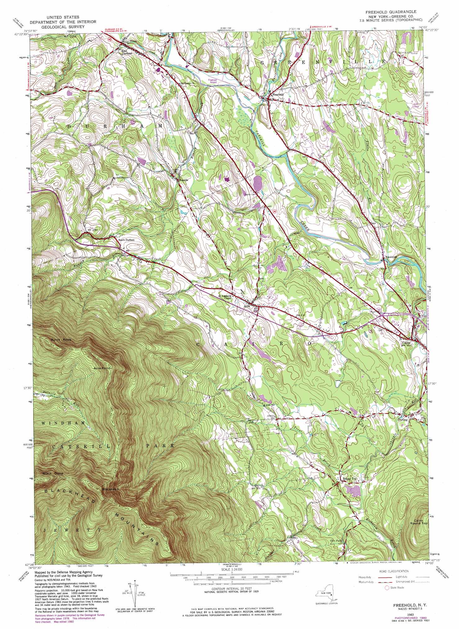
Freehold Topo Map New York
To zoom in, hover over the map of Freehold
USGS Topo Quad 42074c1 - 1:24,000 scale
| Topo Map Name: | Freehold |
| USGS Topo Quad ID: | 42074c1 |
| Print Size: | ca. 21 1/4" wide x 27" high |
| Southeast Coordinates: | 42.25° N latitude / 74° W longitude |
| Map Center Coordinates: | 42.3125° N latitude / 74.0625° W longitude |
| U.S. State: | NY |
| Filename: | o42074c1.jpg |
| Download Map JPG Image: | Freehold topo map 1:24,000 scale |
| Map Type: | Topographic |
| Topo Series: | 7.5´ |
| Map Scale: | 1:24,000 |
| Source of Map Images: | United States Geological Survey (USGS) |
| Alternate Map Versions: |
Freehold NY 1943, updated 1964 Download PDF Buy paper map Freehold NY 1943, updated 1972 Download PDF Buy paper map Freehold NY 1945, updated 1946 Download PDF Buy paper map Freehold NY 2010 Download PDF Buy paper map Freehold NY 2013 Download PDF Buy paper map Freehold NY 2016 Download PDF Buy paper map |
1:24,000 Topo Quads surrounding Freehold
Middleburgh |
Rensselaerville |
Westerlo |
Clarksville |
Delmar |
Livingstonville |
Durham |
Greenville |
Alcove |
Ravena |
Ashland |
Hensonville |
Freehold |
Leeds |
Hudson North |
Lexington |
Hunter |
Kaaterskill |
Cementon |
Hudson South |
Phoenicia |
Bearsville |
Woodstock |
Saugerties |
Clermont |
> Back to 42074a1 at 1:100,000 scale
> Back to 42074a1 at 1:250,000 scale
> Back to U.S. Topo Maps home
Freehold topo map: Gazetteer
Freehold: Airports
Freehold Airport elevation 131m 429′Freehold: Falls
Glen Falls elevation 191m 626′Freehold: Parks
Catskill State Park elevation 858m 2814′Freehold: Populated Places
Acra elevation 199m 652′East Durham elevation 163m 534′
Freehold elevation 129m 423′
Purling elevation 147m 482′
Round Top elevation 184m 603′
South Durham elevation 262m 859′
Sunside elevation 168m 551′
Woodstock elevation 101m 331′
Freehold: Reservoirs
Rockefeller Lake elevation 134m 439′Freehold: Streams
Basic Creek elevation 117m 383′Bowery Creek elevation 130m 426′
Burroughs Creek elevation 132m 433′
Cornwallville Creek elevation 172m 564′
Countryman Kill elevation 182m 597′
Platte Kill elevation 84m 275′
Thorp Creek elevation 131m 429′
Trout Brook elevation 163m 534′
Freehold: Summits
Acra Point elevation 948m 3110′Black Dome elevation 1211m 3973′
Blackhead elevation 1198m 3930′
Burnt Knob elevation 972m 3188′
Freehold: Valleys
Winter Clove elevation 182m 597′Freehold digital topo map on disk
Buy this Freehold topo map showing relief, roads, GPS coordinates and other geographical features, as a high-resolution digital map file on DVD:
New York, Vermont, Connecticut & Western Massachusetts
Buy digital topo maps: New York, Vermont, Connecticut & Western Massachusetts