Mount Morris Topo Map New York
To zoom in, hover over the map of Mount Morris
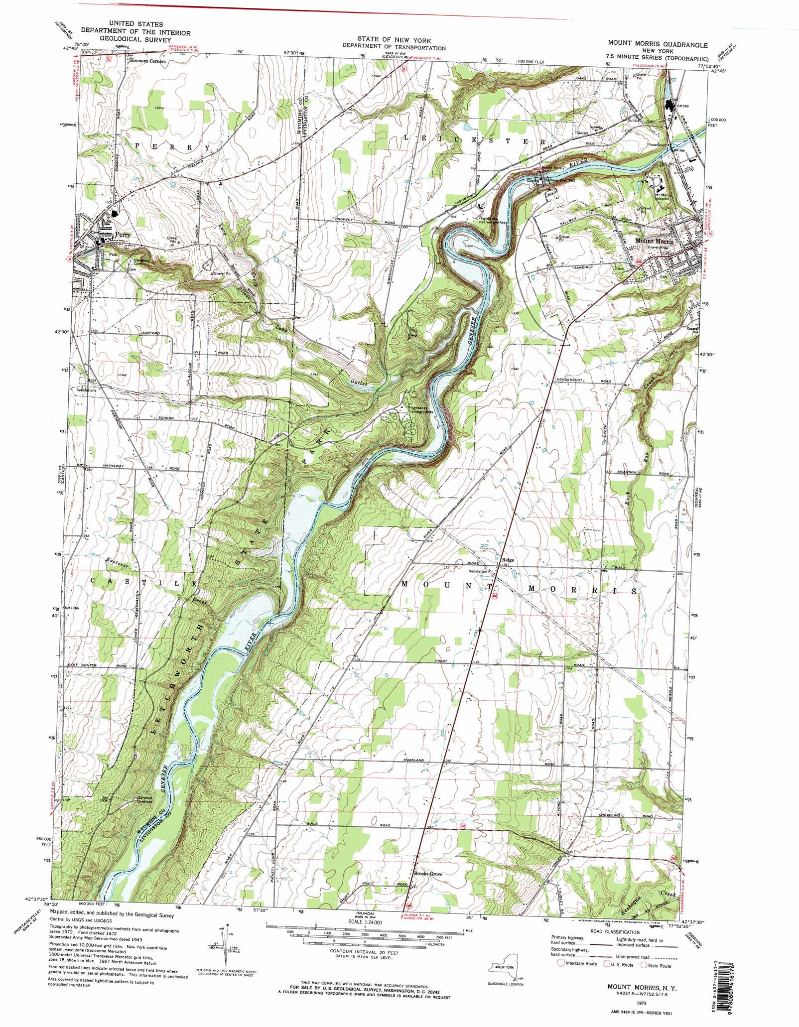
USGS Topo Quad 42077f8 - 1:24,000 scale
| Topo Map Name: | Mount Morris |
| USGS Topo Quad ID: | 42077f8 |
| Print Size: | ca. 21 1/4" wide x 27" high |
| Southeast Coordinates: | 42.625° N latitude / 77.875° W longitude |
| Map Center Coordinates: | 42.6875° N latitude / 77.9375° W longitude |
| U.S. State: | NY |
| Filename: | o42077f8.jpg |
| Download Map JPG Image: | Mount Morris topo map 1:24,000 scale |
| Map Type: | Topographic |
| Topo Series: | 7.5´ |
| Map Scale: | 1:24,000 |
| Source of Map Images: | United States Geological Survey (USGS) |
| Alternate Map Versions: |
Mount Morris NY 1943 Download PDF Buy paper map Mount Morris NY 1943, updated 1960 Download PDF Buy paper map Mount Morris NY 1972, updated 1974 Download PDF Buy paper map Mount Morris NY 1972, updated 1974 Download PDF Buy paper map Mount Morris NY 2010 Download PDF Buy paper map Mount Morris NY 2013 Download PDF Buy paper map Mount Morris NY 2016 Download PDF Buy paper map |
1:24,000 Topo Quads surrounding Mount Morris
Batavia South |
Stafford |
Le Roy |
Caledonia |
Rush |
Dale |
Wyoming |
Leicester |
Geneseo |
Livonia |
Warsaw |
Castile |
Mount Morris |
Sonyea |
Conesus |
Pike |
Portageville |
Nunda |
Ossian |
Dansville |
Houghton |
Fillmore |
Birdsall |
Canaseraga |
Arkport |
> Back to 42077e1 at 1:100,000 scale
> Back to 42076a1 at 1:250,000 scale
> Back to U.S. Topo Maps home
Mount Morris topo map: Gazetteer
Mount Morris: Airports
Tuscarora Plateau Airport elevation 271m 889′Mount Morris: Dams
Mount Morris Dam elevation 181m 593′Mount Morris: Parks
Gardeau Overlook elevation 271m 889′Highbanks Recreation Area elevation 280m 918′
Letchworth State Park elevation 267m 875′
Mount Morris: Populated Places
Brooks Grove elevation 379m 1243′Ridge elevation 358m 1174′
Mount Morris: Reservoirs
Mount Morris Lake elevation 181m 593′Mount Morris: Streams
Eastover Brook elevation 186m 610′Lacy Creek elevation 270m 885′
Silver Lake Outlet elevation 181m 593′
Mount Morris digital topo map on disk
Buy this Mount Morris topo map showing relief, roads, GPS coordinates and other geographical features, as a high-resolution digital map file on DVD:
New York, Vermont, Connecticut & Western Massachusetts
Buy digital topo maps: New York, Vermont, Connecticut & Western Massachusetts