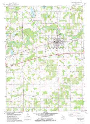
Hartford Topo Map Michigan
To zoom in, hover over the map of Hartford
USGS Topo Quad 42086b2 - 1:24,000 scale
| Topo Map Name: | Hartford |
| USGS Topo Quad ID: | 42086b2 |
| Print Size: | ca. 21 1/4" wide x 27" high |
| Southeast Coordinates: | 42.125° N latitude / 86.125° W longitude |
| Map Center Coordinates: | 42.1875° N latitude / 86.1875° W longitude |
| U.S. State: | MI |
| Filename: | o42086b2.jpg |
| Download Map JPG Image: | Hartford topo map 1:24,000 scale |
| Map Type: | Topographic |
| Topo Series: | 7.5´ |
| Map Scale: | 1:24,000 |
| Source of Map Images: | United States Geological Survey (USGS) |
| Alternate Map Versions: |
Hartford MI 1981, updated 1982 Download PDF Buy paper map Hartford MI 2011 Download PDF Buy paper map Hartford MI 2014 Download PDF Buy paper map Hartford MI 2017 Download PDF Buy paper map |
1:24,000 Topo Quads surrounding Hartford
> Back to 42086a1 at 1:100,000 scale
> Back to 42086a1 at 1:250,000 scale
> Back to U.S. Topo Maps home
Hartford topo map: Gazetteer
Hartford: Crossings
Interchange 46 elevation 207m 679′Hartford: Lakes
Mud Lake elevation 191m 626′Rush Lake elevation 196m 643′
Sassafras Lake elevation 193m 633′
Sherwood Lake elevation 190m 623′
Hartford: Parks
Ely Park elevation 202m 662′Sunset Park elevation 190m 623′
Hartford: Populated Places
Hartford elevation 201m 659′Maple Hill Village Mobile Home Park elevation 202m 662′
Rush Lake Mobile Home Park elevation 205m 672′
Stoughton Corners elevation 201m 659′
Hartford: Post Offices
Hartford Post Office elevation 201m 659′Hartford: Streams
Hog Creek elevation 198m 649′Pine Creek elevation 194m 636′
Hartford digital topo map on disk
Buy this Hartford topo map showing relief, roads, GPS coordinates and other geographical features, as a high-resolution digital map file on DVD:
Northern Illinois, Northern Indiana & Southwestern Michigan
Buy digital topo maps: Northern Illinois, Northern Indiana & Southwestern Michigan


