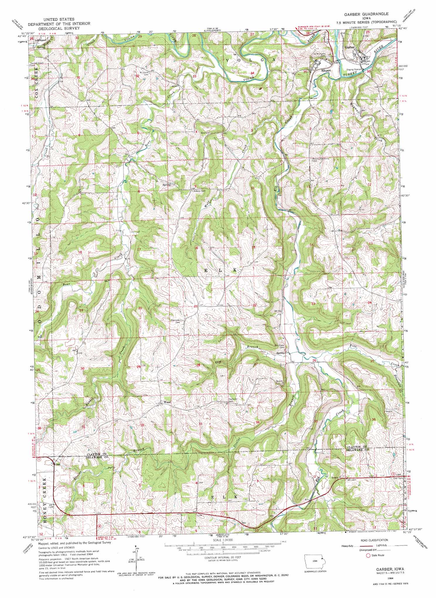
Garber Topo Map Iowa
To zoom in, hover over the map of Garber
USGS Topo Quad 42091f3 - 1:24,000 scale
| Topo Map Name: | Garber |
| USGS Topo Quad ID: | 42091f3 |
| Print Size: | ca. 21 1/4" wide x 27" high |
| Southeast Coordinates: | 42.625° N latitude / 91.25° W longitude |
| Map Center Coordinates: | 42.6875° N latitude / 91.3125° W longitude |
| U.S. State: | IA |
| Filename: | o42091f3.jpg |
| Download Map JPG Image: | Garber topo map 1:24,000 scale |
| Map Type: | Topographic |
| Topo Series: | 7.5´ |
| Map Scale: | 1:24,000 |
| Source of Map Images: | United States Geological Survey (USGS) |
| Alternate Map Versions: |
Garber IA 1964, updated 1967 Download PDF Buy paper map Garber IA 2010 Download PDF Buy paper map Garber IA 2013 Download PDF Buy paper map Garber IA 2015 Download PDF Buy paper map |
1:24,000 Topo Quads surrounding Garber
Gunder |
Saint Olaf |
Farmersburg |
Clayton |
Bagley |
Volga |
Elkader |
Littleport |
Garnavillo |
Guttenberg |
Strawberry Point |
Edgewood |
Garber |
Colesburg |
Turkey River |
Dundee |
Thorpe |
Greeley |
Petersburg |
New Vienna |
Masonville |
Manchester |
Earlville |
Dyersville West |
Dyersville East |
> Back to 42091e1 at 1:100,000 scale
> Back to 42090a1 at 1:250,000 scale
> Back to U.S. Topo Maps home
Garber topo map: Gazetteer
Garber: Bridges
Garber Bridge elevation 195m 639′Garber: Parks
Twin Bridges Park elevation 285m 935′Garber: Populated Places
Elkport elevation 202m 662′Garber elevation 202m 662′
Wood elevation 358m 1174′
Garber: Post Offices
Elkport Post Office (historical) elevation 202m 662′Garber Post Office elevation 202m 662′
Wood Post Office (historical) elevation 358m 1174′
Garber: Streams
Bear Creek elevation 201m 659′Brownfield Creek elevation 242m 793′
Cow Branch elevation 225m 738′
Elk Creek elevation 197m 646′
Pine Creek elevation 227m 744′
Rabbit Creek elevation 237m 777′
Steeles Branch elevation 226m 741′
Volga River elevation 201m 659′
Wayman Creek elevation 195m 639′
Wolf Creek elevation 207m 679′
Garber digital topo map on disk
Buy this Garber topo map showing relief, roads, GPS coordinates and other geographical features, as a high-resolution digital map file on DVD: