Aureola Topo Map Iowa
To zoom in, hover over the map of Aureola
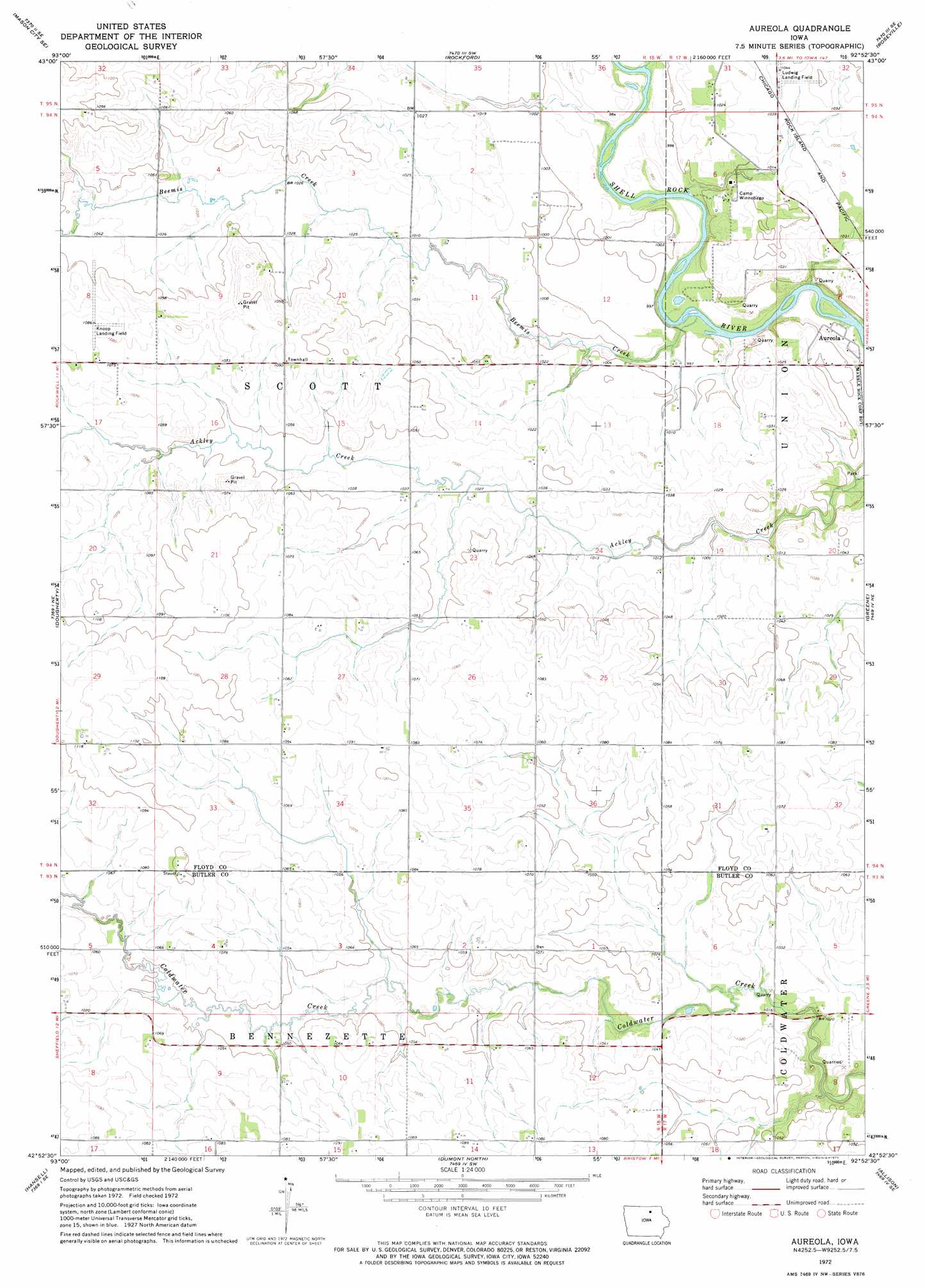
USGS Topo Quad 42092h8 - 1:24,000 scale
| Topo Map Name: | Aureola |
| USGS Topo Quad ID: | 42092h8 |
| Print Size: | ca. 21 1/4" wide x 27" high |
| Southeast Coordinates: | 42.875° N latitude / 92.875° W longitude |
| Map Center Coordinates: | 42.9375° N latitude / 92.9375° W longitude |
| U.S. State: | IA |
| Filename: | o42092h8.jpg |
| Download Map JPG Image: | Aureola topo map 1:24,000 scale |
| Map Type: | Topographic |
| Topo Series: | 7.5´ |
| Map Scale: | 1:24,000 |
| Source of Map Images: | United States Geological Survey (USGS) |
| Alternate Map Versions: |
Aureola IA 1972, updated 1975 Download PDF Buy paper map Aureola IA 2010 Download PDF Buy paper map Aureola IA 2013 Download PDF Buy paper map Aureola IA 2015 Download PDF Buy paper map |
1:24,000 Topo Quads surrounding Aureola
Mason City |
Nora Springs |
Rudd |
Orchard |
Floyd |
Hanford |
Mason City Se |
Rockford |
Roseville |
Charles City |
Sheffield |
Dougherty |
Aureola |
Greene |
Nashua Nw |
Hampton North |
Hansell |
Dumont North |
Allison |
Clarksville |
Hampton South |
Ackley Ne |
Dumont South |
Butler Center |
Coster |
> Back to 42092e1 at 1:100,000 scale
> Back to 42092a1 at 1:250,000 scale
> Back to U.S. Topo Maps home
Aureola topo map: Gazetteer
Aureola: Airports
Knoop Airport elevation 326m 1069′Aureola: Parks
Ackley Creek Park elevation 303m 994′Cedar Hills Park elevation 314m 1030′
Aureola: Populated Places
Aureola elevation 297m 974′Aureola: Post Offices
Belgrove Post Office (historical) elevation 317m 1040′Scott Post Office (historical) elevation 313m 1026′
Aureola: Streams
Beemis Creek elevation 293m 961′Aureola digital topo map on disk
Buy this Aureola topo map showing relief, roads, GPS coordinates and other geographical features, as a high-resolution digital map file on DVD: