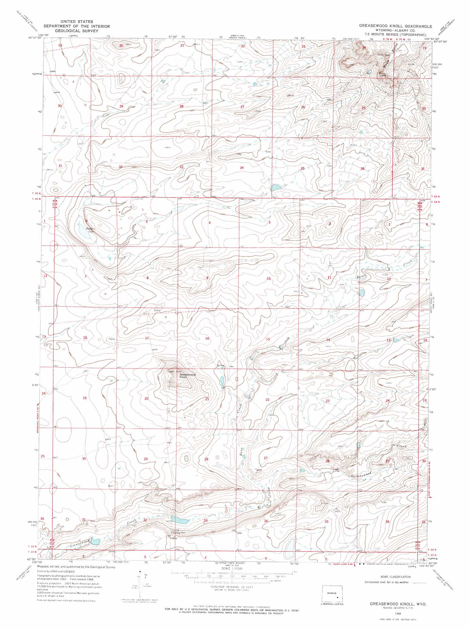
Greasewood Knoll Topo Map Wyoming
To zoom in, hover over the map of Greasewood Knoll
USGS Topo Quad 42105a8 - 1:24,000 scale
| Topo Map Name: | Greasewood Knoll |
| USGS Topo Quad ID: | 42105a8 |
| Print Size: | ca. 21 1/4" wide x 27" high |
| Southeast Coordinates: | 42° N latitude / 105.875° W longitude |
| Map Center Coordinates: | 42.0625° N latitude / 105.9375° W longitude |
| U.S. State: | WY |
| Filename: | o42105a8.jpg |
| Download Map JPG Image: | Greasewood Knoll topo map 1:24,000 scale |
| Map Type: | Topographic |
| Topo Series: | 7.5´ |
| Map Scale: | 1:24,000 |
| Source of Map Images: | United States Geological Survey (USGS) |
| Alternate Map Versions: |
Greasewood Knoll WY 1968, updated 1972 Download PDF Buy paper map Greasewood Knoll WY 2012 Download PDF Buy paper map Greasewood Knoll WY 2015 Download PDF Buy paper map |
1:24,000 Topo Quads surrounding Greasewood Knoll
Moss Agate Reservoir |
Chalk Hills |
Pass Creek |
Marshall |
Toltec |
Walker Draw Nw |
Big Charlie Lakes |
Boot Heel |
Rogers Creek |
Cottonwood Creek |
T B Ranch |
Walker Draw Se |
Greasewood Knoll |
Boot Heel Se |
Pinto Creek |
Medicine Bow |
Aurora Lake |
Pine Tree Ridge |
Sevenmile Spring |
Ayres Spring |
Pine Ridge |
Foote Creek Lake |
Wilcox |
Cannonball Cut |
Mcgill Lakes |
> Back to 42105a1 at 1:100,000 scale
> Back to 42104a1 at 1:250,000 scale
> Back to U.S. Topo Maps home
Greasewood Knoll topo map: Gazetteer
Greasewood Knoll: Lakes
Badger Lake elevation 2081m 6827′Greasewood Knoll: Streams
Bone Creek elevation 2073m 6801′Greasewood Knoll: Summits
Buck Point elevation 2227m 7306′Greasewood Knoll elevation 2131m 6991′
Greasewood Knoll digital topo map on disk
Buy this Greasewood Knoll topo map showing relief, roads, GPS coordinates and other geographical features, as a high-resolution digital map file on DVD:
Eastern Wyoming & Western South Dakota
Buy digital topo maps: Eastern Wyoming & Western South Dakota