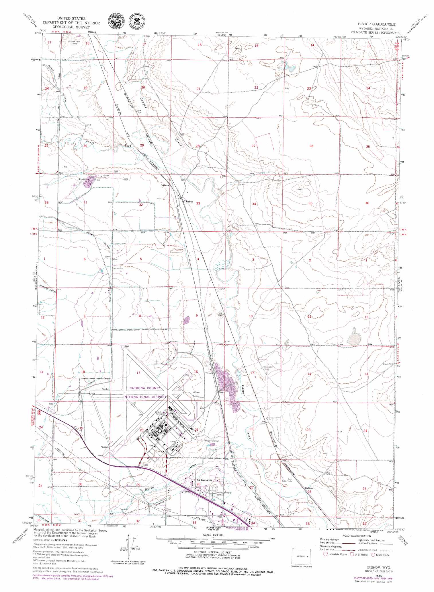
Bishop Topo Map Wyoming
To zoom in, hover over the map of Bishop
USGS Topo Quad 42106h4 - 1:24,000 scale
| Topo Map Name: | Bishop |
| USGS Topo Quad ID: | 42106h4 |
| Print Size: | ca. 21 1/4" wide x 27" high |
| Southeast Coordinates: | 42.875° N latitude / 106.375° W longitude |
| Map Center Coordinates: | 42.9375° N latitude / 106.4375° W longitude |
| U.S. State: | WY |
| Filename: | o42106h4.jpg |
| Download Map JPG Image: | Bishop topo map 1:24,000 scale |
| Map Type: | Topographic |
| Topo Series: | 7.5´ |
| Map Scale: | 1:24,000 |
| Source of Map Images: | United States Geological Survey (USGS) |
| Alternate Map Versions: |
Bishop WY 1952 Download PDF Buy paper map Bishop WY 1960, updated 1963 Download PDF Buy paper map Bishop WY 1960, updated 1972 Download PDF Buy paper map Bishop WY 1960, updated 1973 Download PDF Buy paper map Bishop WY 1960, updated 1979 Download PDF Buy paper map Bishop WY 2012 Download PDF Buy paper map Bishop WY 2015 Download PDF Buy paper map |
1:24,000 Topo Quads surrounding Bishop
Reynolds Reservoir |
Merino |
Statzer Point |
Teapot Rock |
Seven L Creek West |
Burlington Lake |
Smith Flats |
Illco |
Mcpherson Draw |
Mckenzie Flat |
Emigrant Gap Nw |
Emigrant Gap Ne |
Bishop |
The Reefs |
Pratts Soda Lakes |
Oil Mountain |
Emigrant Gap |
Goose Egg |
Casper |
Brookhurst |
Clarkson Hill |
Bessemer Mountain |
Freeland |
Crimson Dawn |
Otter Creek |
> Back to 42106e1 at 1:100,000 scale
> Back to 42106a1 at 1:250,000 scale
> Back to U.S. Topo Maps home
Bishop topo map: Gazetteer
Bishop: Airports
Natrona County International Airport elevation 1625m 5331′Bishop: Populated Places
Air Base Acres elevation 1616m 5301′Bishop elevation 1607m 5272′
Bishop: Post Offices
Bishop Post Office (historical) elevation 1607m 5272′Bishop: Streams
South Fork Casper Creek elevation 1605m 5265′Bishop: Valleys
Sixmile Draw elevation 1588m 5209′Bishop digital topo map on disk
Buy this Bishop topo map showing relief, roads, GPS coordinates and other geographical features, as a high-resolution digital map file on DVD:
Eastern Wyoming & Western South Dakota
Buy digital topo maps: Eastern Wyoming & Western South Dakota