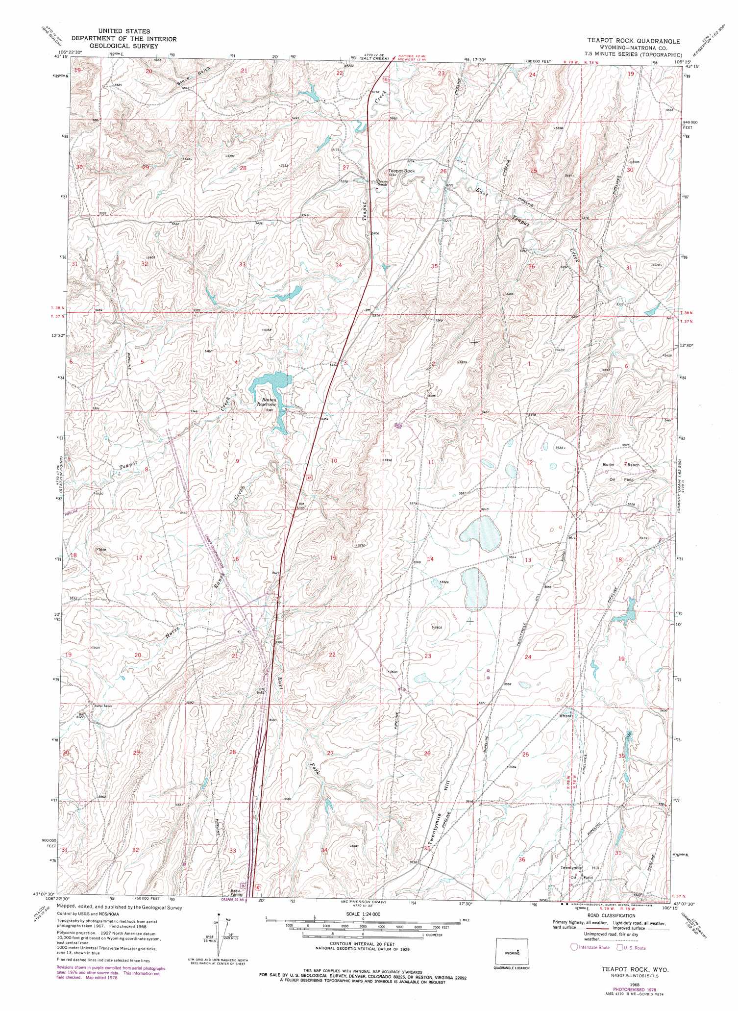
Teapot Rock Topo Map Wyoming
To zoom in, hover over the map of Teapot Rock
USGS Topo Quad 43106b3 - 1:24,000 scale
| Topo Map Name: | Teapot Rock |
| USGS Topo Quad ID: | 43106b3 |
| Print Size: | ca. 21 1/4" wide x 27" high |
| Southeast Coordinates: | 43.125° N latitude / 106.25° W longitude |
| Map Center Coordinates: | 43.1875° N latitude / 106.3125° W longitude |
| U.S. State: | WY |
| Filename: | o43106b3.jpg |
| Download Map JPG Image: | Teapot Rock topo map 1:24,000 scale |
| Map Type: | Topographic |
| Topo Series: | 7.5´ |
| Map Scale: | 1:24,000 |
| Source of Map Images: | United States Geological Survey (USGS) |
| Alternate Map Versions: |
Teapot Rock WY 1968, updated 1972 Download PDF Buy paper map Teapot Rock WY 1968, updated 1978 Download PDF Buy paper map Teapot Rock WY 2012 Download PDF Buy paper map Teapot Rock WY 2015 Download PDF Buy paper map |
1:24,000 Topo Quads surrounding Teapot Rock
Salt Canyon |
Government Creek |
Midwest |
Edgerton |
Sawmill Canyon |
Camel Hump Reservoir |
Big Gulch |
Salt Creek |
Gillam Draw West |
Gillam Draw East |
Merino |
Statzer Point |
Teapot Rock |
Seven L Creek West |
Seven L Creek East |
Smith Flats |
Illco |
Mcpherson Draw |
Mckenzie Flat |
Beauchamp Reservoir |
Emigrant Gap Ne |
Bishop |
The Reefs |
Pratts Soda Lakes |
Campbell Hill |
> Back to 43106a1 at 1:100,000 scale
> Back to 43106a1 at 1:250,000 scale
> Back to U.S. Topo Maps home
Teapot Rock topo map: Gazetteer
Teapot Rock: Dams
John Beaton Dam elevation 1605m 5265′Teapot Rock: Oilfields
Twentymile Hill Oil Field elevation 1724m 5656′Teapot Rock: Reservoirs
Beaton Reservoir elevation 1604m 5262′John Beaton Reservoir elevation 1605m 5265′
Teapot Rock: Streams
East Fork Horse Ranch Creek elevation 1614m 5295′East Teapot Creek elevation 1581m 5187′
Horse Ranch Creek elevation 1610m 5282′
Teapot Rock: Summits
Teapot Rock elevation 1616m 5301′Teapot Rock digital topo map on disk
Buy this Teapot Rock topo map showing relief, roads, GPS coordinates and other geographical features, as a high-resolution digital map file on DVD:
Eastern Wyoming & Western South Dakota
Buy digital topo maps: Eastern Wyoming & Western South Dakota