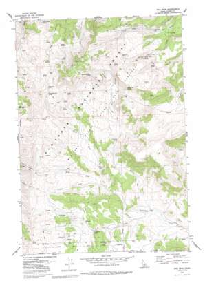
Ibex Peak Topo Map Idaho
To zoom in, hover over the map of Ibex Peak
USGS Topo Quad 42114a1 - 1:24,000 scale
| Topo Map Name: | Ibex Peak |
| USGS Topo Quad ID: | 42114a1 |
| Print Size: | ca. 21 1/4" wide x 27" high |
| Southeast Coordinates: | 42° N latitude / 114° W longitude |
| Map Center Coordinates: | 42.0625° N latitude / 114.0625° W longitude |
| U.S. State: | ID |
| Filename: | o42114a1.jpg |
| Download Map JPG Image: | Ibex Peak topo map 1:24,000 scale |
| Map Type: | Topographic |
| Topo Series: | 7.5´ |
| Map Scale: | 1:24,000 |
| Source of Map Images: | United States Geological Survey (USGS) |
| Alternate Map Versions: |
Ibex Peak ID 1977, updated 1978 Download PDF Buy paper map Ibex Peak ID 1977, updated 1986 Download PDF Buy paper map Ibex Peak ID 2001, updated 2006 Download PDF Buy paper map Ibex Peak ID 2011 Download PDF Buy paper map Ibex Peak ID 2013 Download PDF Buy paper map |
| FStopo: | US Forest Service topo Ibex Peak is available: Download FStopo PDF Download FStopo TIF |
1:24,000 Topo Quads surrounding Ibex Peak
> Back to 42114a1 at 1:100,000 scale
> Back to 42114a1 at 1:250,000 scale
> Back to U.S. Topo Maps home
Ibex Peak topo map: Gazetteer
Ibex Peak: Gaps
Beaverdam Pass elevation 2010m 6594′Daves Pass elevation 1829m 6000′
Ibex Peak: Mines
Worthington Mine elevation 1619m 5311′Ibex Peak: Springs
Beaverdam Pass Spring elevation 1963m 6440′Chalk Spring elevation 1911m 6269′
Daves Pass Spring elevation 1883m 6177′
Dry Gulch Spring elevation 1646m 5400′
Hole in the Wall Spring elevation 1970m 6463′
Lone Cedar Spring elevation 1760m 5774′
Lone Pine Spring elevation 1948m 6391′
Mabey Spring elevation 1812m 5944′
Mabey Spring Number 2 elevation 1835m 6020′
Magpie Spring elevation 1840m 6036′
N W Spring elevation 1675m 5495′
Orangeburg Spring elevation 1596m 5236′
Owens Corral Spring elevation 1846m 6056′
Point Spring elevation 1752m 5748′
Rock Spring elevation 1893m 6210′
Rodeo Spring elevation 1792m 5879′
Sage Hen Spring elevation 1948m 6391′
Section 9 Spring elevation 1662m 5452′
Sheep Spring elevation 1991m 6532′
Swede Spring elevation 1928m 6325′
Tent Spring elevation 1863m 6112′
Triple Spring elevation 1932m 6338′
Twin Springs elevation 1974m 6476′
Ibex Peak: Streams
Beaverdam Creek elevation 1514m 4967′Carlson Creek elevation 1604m 5262′
Left Hand Fork Beaverdam Creek elevation 1604m 5262′
N E Creek elevation 1529m 5016′
Right Hand Fork Beaverdam Creek elevation 1604m 5262′
Ibex Peak: Summits
Ibex Peak elevation 2199m 7214′Lbex Peak elevation 2199m 7214′
Ibex Peak: Valleys
Carlson Canyon elevation 1734m 5688′Dry Gulch elevation 1545m 5068′
Johnnys Canyon elevation 1674m 5492′
N E Canyon elevation 1595m 5232′
Ibex Peak digital topo map on disk
Buy this Ibex Peak topo map showing relief, roads, GPS coordinates and other geographical features, as a high-resolution digital map file on DVD:


