Rogerson Topo Map Idaho
To zoom in, hover over the map of Rogerson
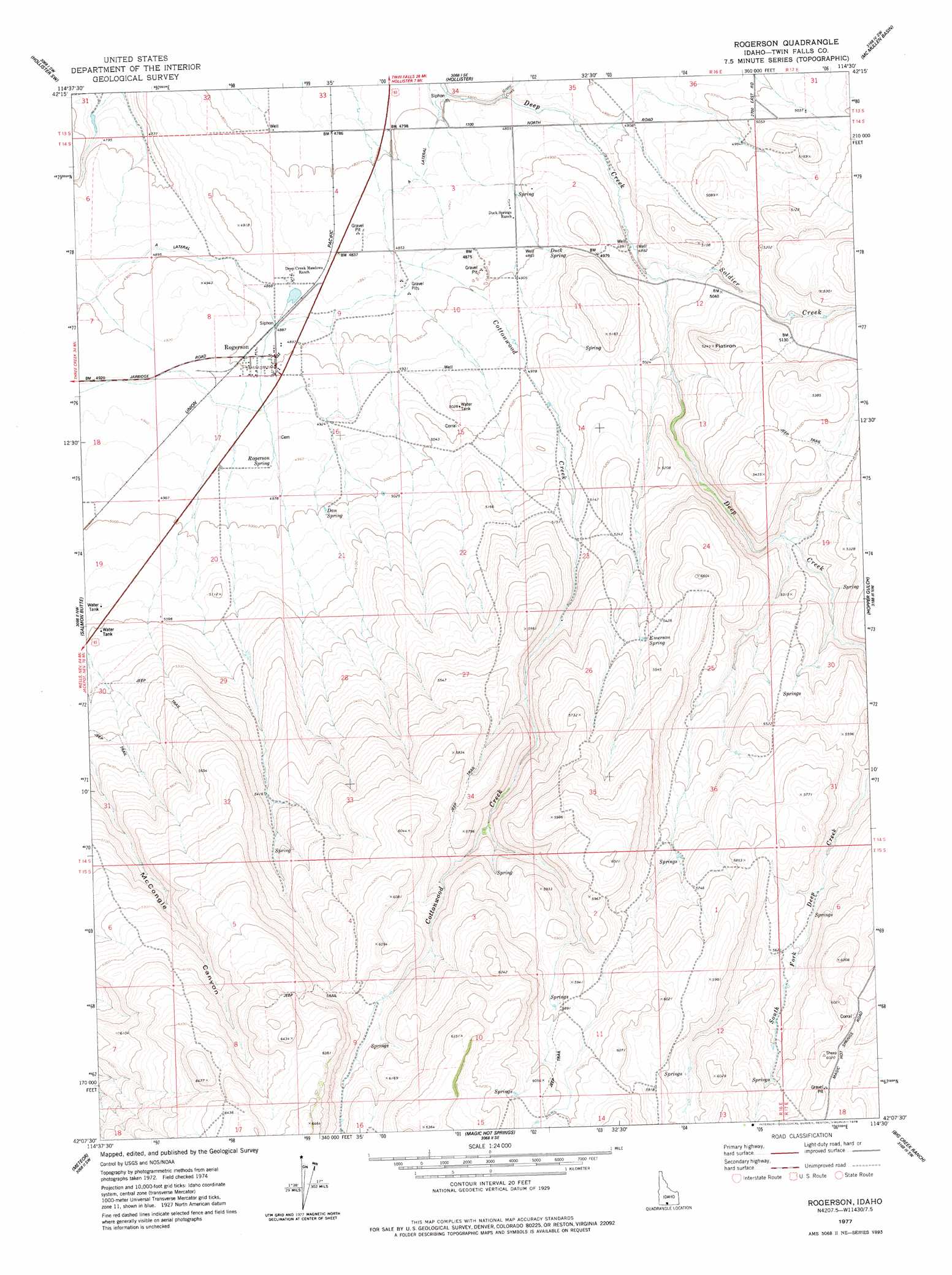
USGS Topo Quad 42114b5 - 1:24,000 scale
| Topo Map Name: | Rogerson |
| USGS Topo Quad ID: | 42114b5 |
| Print Size: | ca. 21 1/4" wide x 27" high |
| Southeast Coordinates: | 42.125° N latitude / 114.5° W longitude |
| Map Center Coordinates: | 42.1875° N latitude / 114.5625° W longitude |
| U.S. State: | ID |
| Filename: | o42114b5.jpg |
| Download Map JPG Image: | Rogerson topo map 1:24,000 scale |
| Map Type: | Topographic |
| Topo Series: | 7.5´ |
| Map Scale: | 1:24,000 |
| Source of Map Images: | United States Geological Survey (USGS) |
| Alternate Map Versions: |
Rogerson ID 1977, updated 1978 Download PDF Buy paper map Rogerson ID 2010 Download PDF Buy paper map Rogerson ID 2013 Download PDF Buy paper map |
1:24,000 Topo Quads surrounding Rogerson
Roseworth Ne |
Berger Butte |
Berger |
Hub Butte |
Stricker Butte |
Roseworth Se |
Hollister Sw |
Hollister |
Mcmullen Basin |
Grand View Peak |
Browns Bench North |
Salmon Butte |
Rogerson |
Hopper Gulch |
Pike Mountain |
Browns Bench South |
Norton Canyon |
Magic Hot Springs |
Big Creek Ranch |
Timber Butte |
Browns Bench Ranch |
Jackpot |
East Of Jackpot |
Gollaher Mountain |
Stratton Spring |
> Back to 42114a1 at 1:100,000 scale
> Back to 42114a1 at 1:250,000 scale
> Back to U.S. Topo Maps home
Rogerson topo map: Gazetteer
Rogerson: Canals
A Lateral elevation 1466m 4809′Rogerson: Populated Places
Rogerson elevation 1493m 4898′Rogerson: Springs
Dan Spring elevation 1526m 5006′Duck Spring elevation 1499m 4917′
Emerson Spring elevation 1654m 5426′
Rogerson Spring elevation 1511m 4957′
Rogerson: Streams
Green Creek elevation 1466m 4809′Soldier Creek elevation 1497m 4911′
Rogerson: Summits
Flatiron elevation 1595m 5232′Rogerson digital topo map on disk
Buy this Rogerson topo map showing relief, roads, GPS coordinates and other geographical features, as a high-resolution digital map file on DVD: