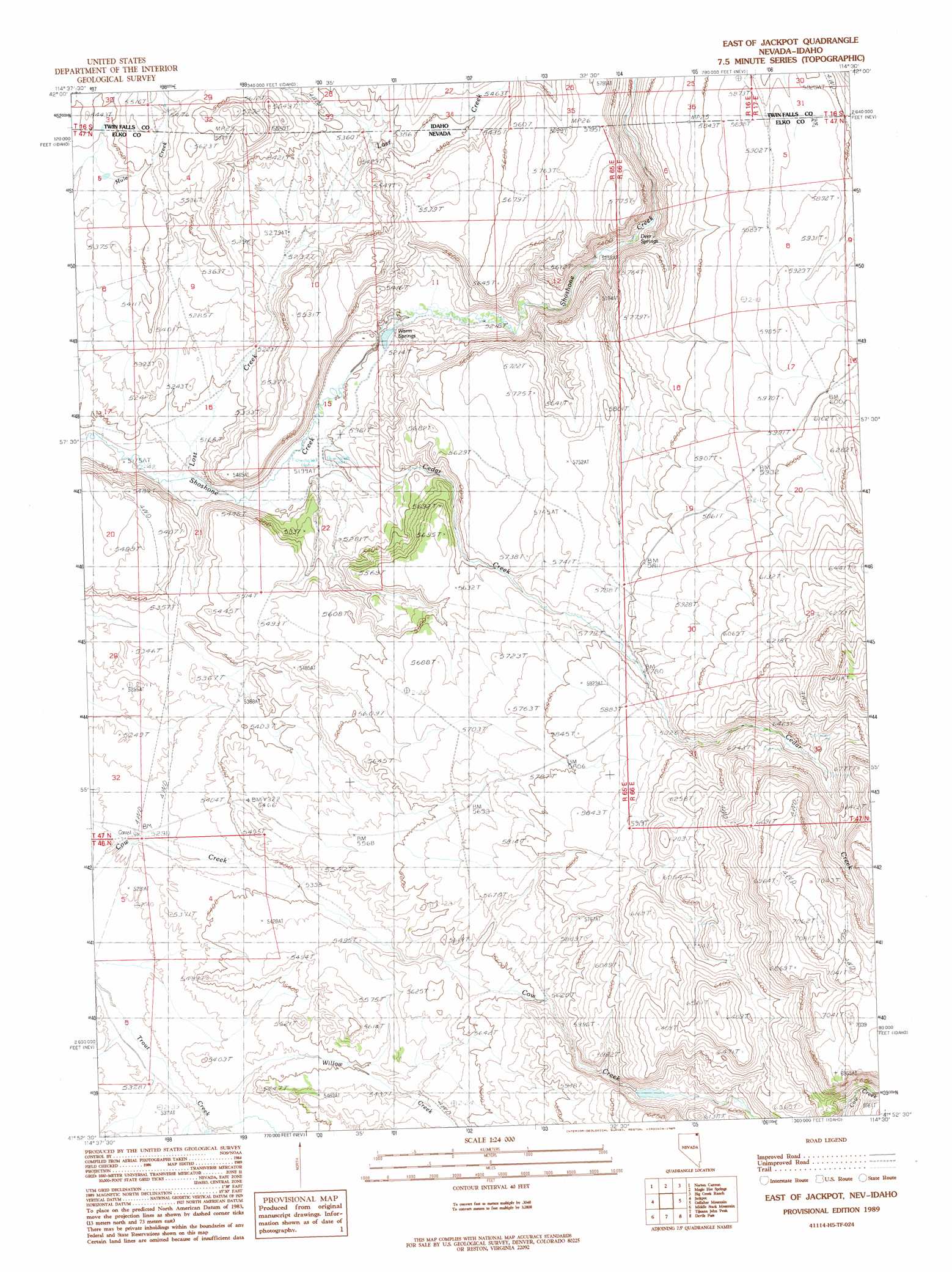
East Of Jackpot Topo Map Nevada
To zoom in, hover over the map of East Of Jackpot
USGS Topo Quad 41114h5 - 1:24,000 scale
| Topo Map Name: | East Of Jackpot |
| USGS Topo Quad ID: | 41114h5 |
| Print Size: | ca. 21 1/4" wide x 27" high |
| Southeast Coordinates: | 41.875° N latitude / 114.5° W longitude |
| Map Center Coordinates: | 41.9375° N latitude / 114.5625° W longitude |
| U.S. States: | NV, ID |
| Filename: | o41114h5.jpg |
| Download Map JPG Image: | East Of Jackpot topo map 1:24,000 scale |
| Map Type: | Topographic |
| Topo Series: | 7.5´ |
| Map Scale: | 1:24,000 |
| Source of Map Images: | United States Geological Survey (USGS) |
| Alternate Map Versions: |
East of Jackpot NV 1989, updated 1989 Download PDF Buy paper map East of Jackpot NV 2012 Download PDF Buy paper map East of Jackpot NV 2014 Download PDF Buy paper map |
1:24,000 Topo Quads surrounding East Of Jackpot
Browns Bench North |
Salmon Butte |
Rogerson |
Hopper Gulch |
Pike Mountain |
Browns Bench South |
Norton Canyon |
Magic Hot Springs |
Big Creek Ranch |
Timber Butte |
Browns Bench Ranch |
Jackpot |
East Of Jackpot |
Gollaher Mountain |
Stratton Spring |
Contact |
Middle Stack Mountain |
Tijuana John Peak |
Devils Pass |
Mustang Draw |
Henry |
Blanchard Mountain |
Texas Spring |
Emigrant Springs |
Dry Canyon |
> Back to 41114e1 at 1:100,000 scale
> Back to 41114a1 at 1:250,000 scale
> Back to U.S. Topo Maps home
East Of Jackpot topo map: Gazetteer
East Of Jackpot: Dams
Nevada Noname Four Dam elevation 1798m 5898′Nevada Noname Three Dam elevation 1689m 5541′
East Of Jackpot: Springs
Deer Springs elevation 1625m 5331′Hale Spring elevation 1650m 5413′
Warm Springs elevation 1586m 5203′
East Of Jackpot: Streams
Cedar Creek elevation 1666m 5465′Lost Creek elevation 1573m 5160′
Lost Creek elevation 1573m 5160′
Willow Creek elevation 1613m 5291′
East Of Jackpot: Valleys
Lost Canyon elevation 1573m 5160′East Of Jackpot digital topo map on disk
Buy this East Of Jackpot topo map showing relief, roads, GPS coordinates and other geographical features, as a high-resolution digital map file on DVD: