Battle Creek Ranch Topo Map Oregon
To zoom in, hover over the map of Battle Creek Ranch
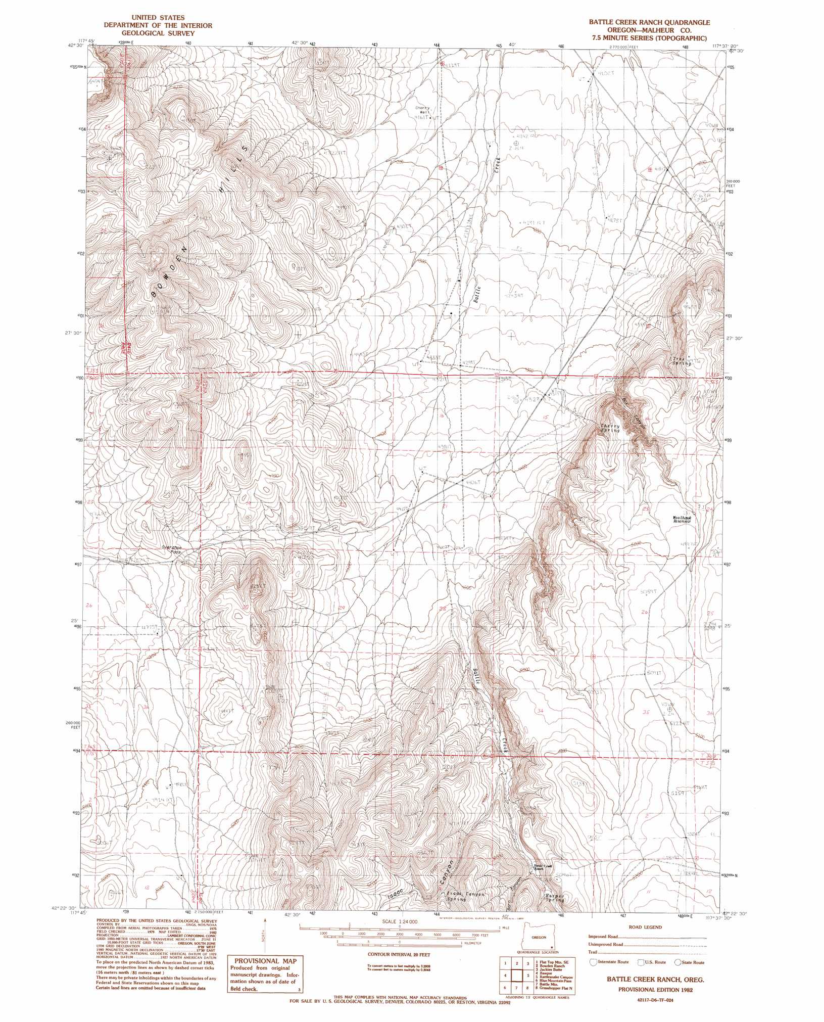
USGS Topo Quad 42117d6 - 1:24,000 scale
| Topo Map Name: | Battle Creek Ranch |
| USGS Topo Quad ID: | 42117d6 |
| Print Size: | ca. 21 1/4" wide x 27" high |
| Southeast Coordinates: | 42.375° N latitude / 117.625° W longitude |
| Map Center Coordinates: | 42.4375° N latitude / 117.6875° W longitude |
| U.S. State: | OR |
| Filename: | o42117d6.jpg |
| Download Map JPG Image: | Battle Creek Ranch topo map 1:24,000 scale |
| Map Type: | Topographic |
| Topo Series: | 7.5´ |
| Map Scale: | 1:24,000 |
| Source of Map Images: | United States Geological Survey (USGS) |
| Alternate Map Versions: |
Battle Creek Ranch OR 1982, updated 1983 Download PDF Buy paper map Battle Creek Ranch OR 2011 Download PDF Buy paper map Battle Creek Ranch OR 2014 Download PDF Buy paper map |
1:24,000 Topo Quads surrounding Battle Creek Ranch
Flat Top Mountain |
Anderson Reservoir |
The Basin |
Rockhouse Reservoir |
Indian Fort |
Rome State Airport |
Flat Top Mountain Se |
Bowden Ranch |
Jackies Butte |
Caviatta Ridge |
Three Man Butte Well |
Basque |
Battle Creek Ranch |
Rattlesnake Canyon |
Peacock Lake |
Blue Mountain Basin |
Blue Mountain Pass |
Battle Mountain |
Grasshopper Flat North |
Starvation Spring |
Oregon Canyon Ranch |
Bowden Waterhole |
Jackson Summit |
Grasshopper Flat South |
Chipmunk Basin |
> Back to 42117a1 at 1:100,000 scale
> Back to 42116a1 at 1:250,000 scale
> Back to U.S. Topo Maps home
Battle Creek Ranch topo map: Gazetteer
Battle Creek Ranch: Gaps
Overshoe Pass elevation 1455m 4773′Battle Creek Ranch: Reservoirs
Woolhawk Reservoir elevation 1513m 4963′Battle Creek Ranch: Springs
Cherry Spring elevation 1482m 4862′Harper Spring elevation 1487m 4878′
Isaac Canyon Spring elevation 1504m 4934′
Tree Spring elevation 1419m 4655′
Battle Creek Ranch: Valleys
Barn Canyon elevation 1471m 4826′Box Canyon elevation 1338m 4389′
Isaac Canyon elevation 1463m 4799′
Battle Creek Ranch: Wells
Cherry Well elevation 1268m 4160′Battle Creek Ranch digital topo map on disk
Buy this Battle Creek Ranch topo map showing relief, roads, GPS coordinates and other geographical features, as a high-resolution digital map file on DVD: