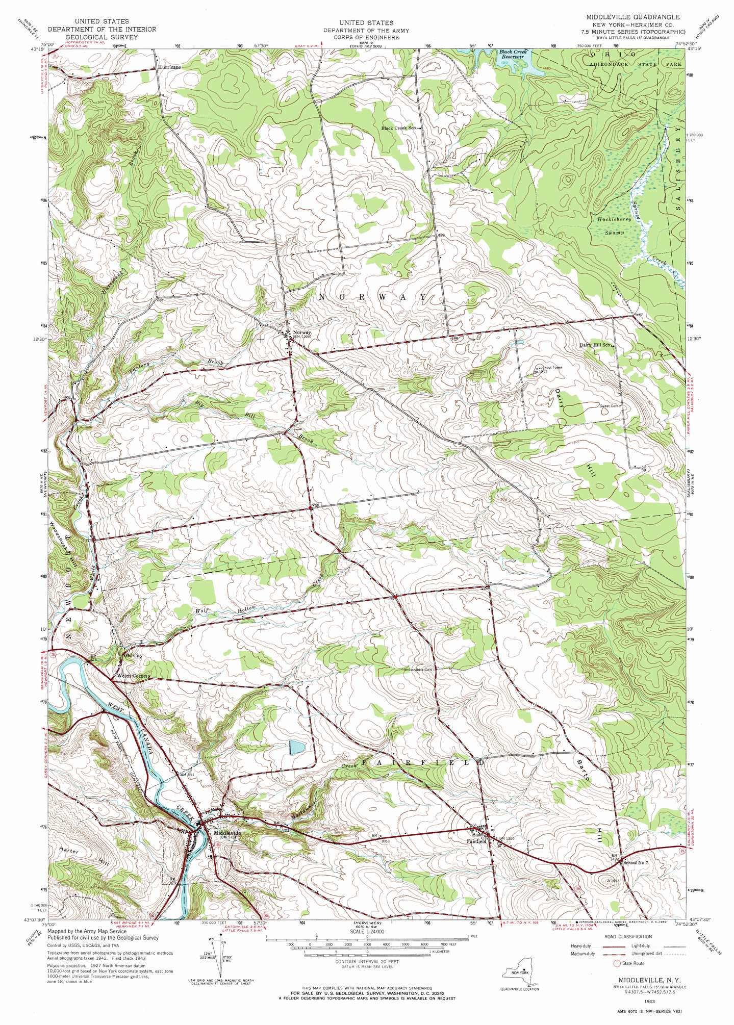
Middleville Topo Map New York
To zoom in, hover over the map of Middleville
USGS Topo Quad 43074b8 - 1:24,000 scale
| Topo Map Name: | Middleville |
| USGS Topo Quad ID: | 43074b8 |
| Print Size: | ca. 21 1/4" wide x 27" high |
| Southeast Coordinates: | 43.125° N latitude / 74.875° W longitude |
| Map Center Coordinates: | 43.1875° N latitude / 74.9375° W longitude |
| U.S. State: | NY |
| Filename: | o43074b8.jpg |
| Download Map JPG Image: | Middleville topo map 1:24,000 scale |
| Map Type: | Topographic |
| Topo Series: | 7.5´ |
| Map Scale: | 1:24,000 |
| Source of Map Images: | United States Geological Survey (USGS) |
| Alternate Map Versions: |
Middleville NY 1943, updated 1960 Download PDF Buy paper map Middleville NY 1943, updated 1969 Download PDF Buy paper map Middleville NY 1943, updated 1969 Download PDF Buy paper map Middleville NY 2010 Download PDF Buy paper map Middleville NY 2013 Download PDF Buy paper map Middleville NY 2016 Download PDF Buy paper map |
1:24,000 Topo Quads surrounding Middleville
Forestport |
North Wilmurt |
Morehouseville |
||
Remsen |
Hinckley |
Jerseyfield Lake |
||
South Trenton |
Newport |
Middleville |
Salisbury |
Stratford |
Utica East |
Ilion |
Herkimer |
Little Falls |
Oppenheim |
West Winfield |
Millers Mills |
Jordanville |
Van Hornesville |
Fort Plain |
> Back to 43074a1 at 1:100,000 scale
> Back to 43074a1 at 1:250,000 scale
> Back to U.S. Topo Maps home
Middleville topo map: Gazetteer
Middleville: Populated Places
Fairfield elevation 386m 1266′Hurricane elevation 439m 1440′
Middleville elevation 182m 597′
Norway elevation 406m 1332′
Old City elevation 237m 777′
Middleville: Streams
Big Bill Brook elevation 273m 895′City Brook elevation 177m 580′
Factory Brook elevation 262m 859′
Hurricane Brook elevation 262m 859′
Maltanner Creek elevation 164m 538′
Middleville: Summits
Barto Hill elevation 502m 1646′Dairy Hill elevation 562m 1843′
Woodchuck Hill elevation 288m 944′
Middleville: Swamps
Huckleberry Swamp elevation 423m 1387′Middleville digital topo map on disk
Buy this Middleville topo map showing relief, roads, GPS coordinates and other geographical features, as a high-resolution digital map file on DVD:
New York, Vermont, Connecticut & Western Massachusetts
Buy digital topo maps: New York, Vermont, Connecticut & Western Massachusetts