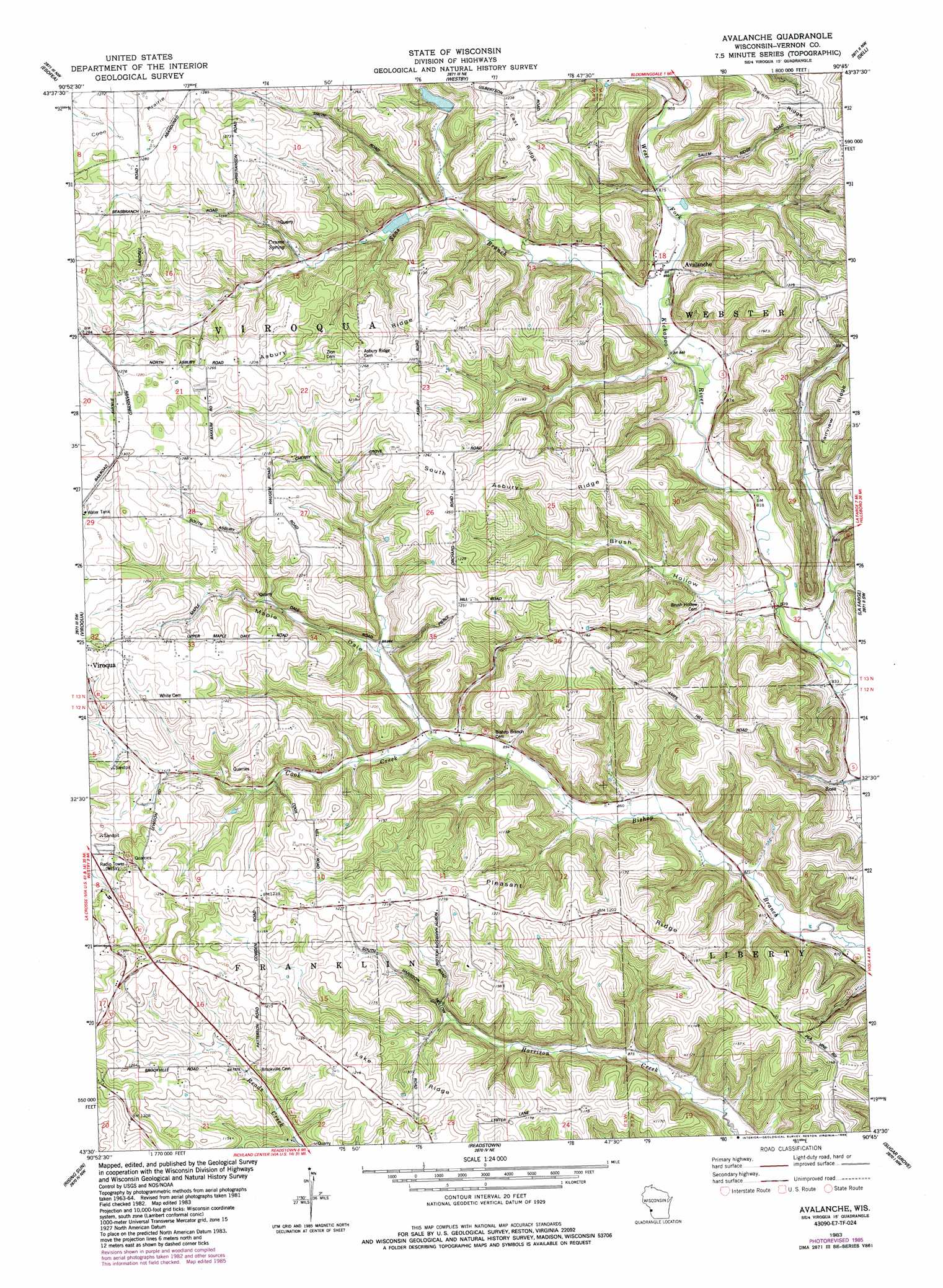
Avalanche Topo Map Wisconsin
To zoom in, hover over the map of Avalanche
USGS Topo Quad 43090e7 - 1:24,000 scale
| Topo Map Name: | Avalanche |
| USGS Topo Quad ID: | 43090e7 |
| Print Size: | ca. 21 1/4" wide x 27" high |
| Southeast Coordinates: | 43.5° N latitude / 90.75° W longitude |
| Map Center Coordinates: | 43.5625° N latitude / 90.8125° W longitude |
| U.S. State: | WI |
| Filename: | o43090e7.jpg |
| Download Map JPG Image: | Avalanche topo map 1:24,000 scale |
| Map Type: | Topographic |
| Topo Series: | 7.5´ |
| Map Scale: | 1:24,000 |
| Source of Map Images: | United States Geological Survey (USGS) |
| Alternate Map Versions: |
Avalanche WI 1983, updated 1983 Download PDF Buy paper map Avalanche WI 1983, updated 1985 Download PDF Buy paper map Avalanche WI 2010 Download PDF Buy paper map Avalanche WI 2013 Download PDF Buy paper map Avalanche WI 2016 Download PDF Buy paper map |
1:24,000 Topo Quads surrounding Avalanche
Saint Joseph |
Middle Ridge |
Melvina |
Saint Marys |
Wilton |
Coon Valley |
Esofea |
Westby |
Dell |
Ontario |
Newton |
Viroqua |
Avalanche |
La Farge |
West Lima |
Retreat |
Rising Sun |
Readstown |
Sugar Grove |
Sabin |
Ferryville |
Mount Sterling |
Gays Mills |
Mount Zion |
Boaz |
> Back to 43090e1 at 1:100,000 scale
> Back to 43090a1 at 1:250,000 scale
> Back to U.S. Topo Maps home
Avalanche topo map: Gazetteer
Avalanche: Dams
West Fork Kickapoo 17 D 2592.2 Dam elevation 290m 951′West Fork Kickapoo 4 D 2592.2 Dam elevation 302m 990′
West Fork Kickapoo 5 D 2592.2 Dam elevation 330m 1082′
Avalanche: Populated Places
Avalanche elevation 260m 853′Ross elevation 242m 793′
Avalanche: Reservoirs
5 Reservoir elevation 330m 1082′5 Reservoir elevation 302m 990′
7 Reservoir elevation 290m 951′
Avalanche: Ridges
Asbury Ridge elevation 381m 1250′East Ridge elevation 385m 1263′
Lake Ridge elevation 368m 1207′
Pleasant Ridge elevation 350m 1148′
South Asbury Ridge elevation 378m 1240′
Avalanche: Springs
Crume Spring elevation 332m 1089′Avalanche: Streams
Cook Creek elevation 287m 941′Rocky Run elevation 242m 793′
Seas Branch elevation 256m 839′
Avalanche: Valleys
Brush Hollow elevation 248m 813′Maple Dale elevation 279m 915′
Avalanche digital topo map on disk
Buy this Avalanche topo map showing relief, roads, GPS coordinates and other geographical features, as a high-resolution digital map file on DVD: