Vaughn Well Topo Map Oregon
To zoom in, hover over the map of Vaughn Well
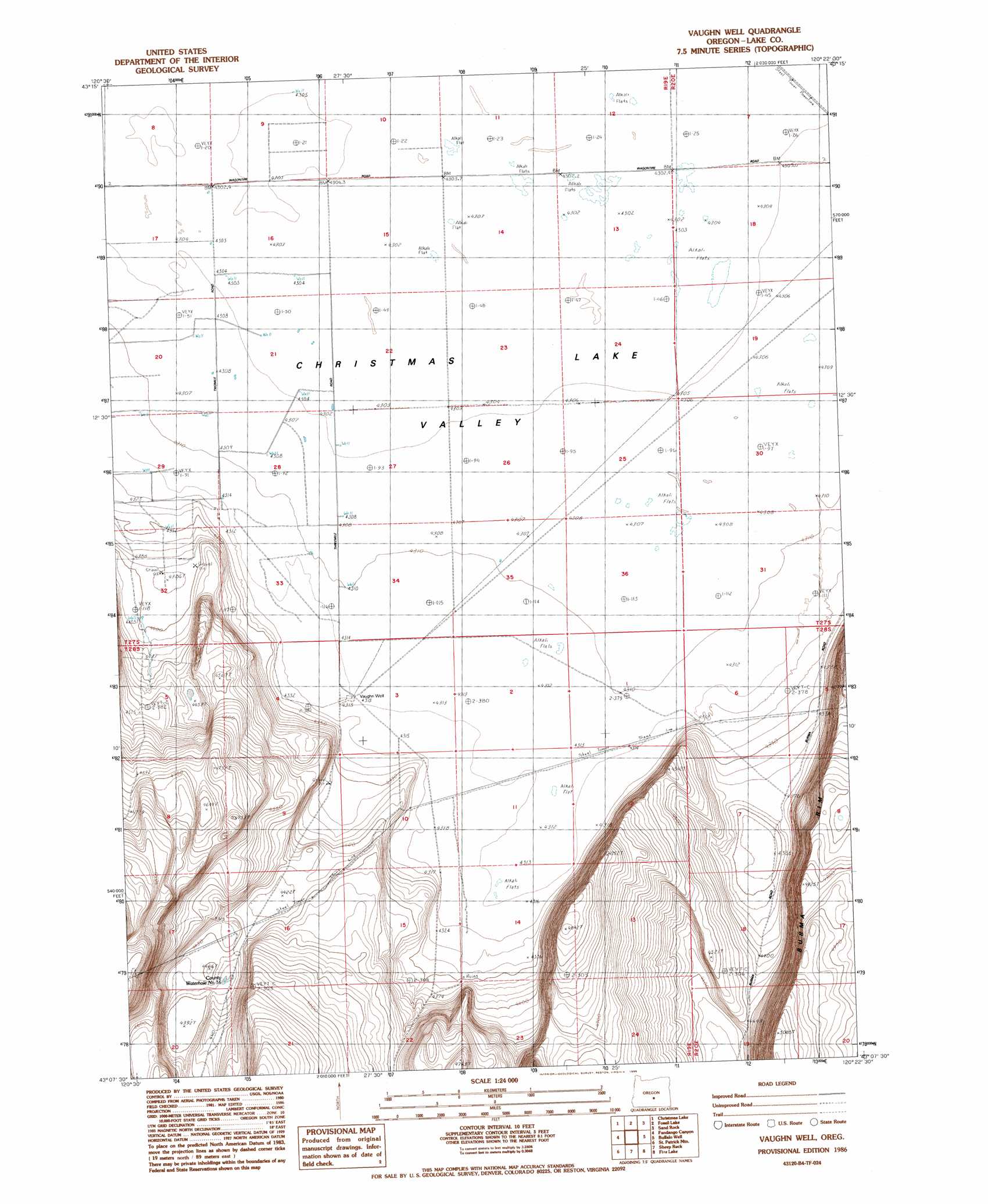
USGS Topo Quad 43120b4 - 1:24,000 scale
| Topo Map Name: | Vaughn Well |
| USGS Topo Quad ID: | 43120b4 |
| Print Size: | ca. 21 1/4" wide x 27" high |
| Southeast Coordinates: | 43.125° N latitude / 120.375° W longitude |
| Map Center Coordinates: | 43.1875° N latitude / 120.4375° W longitude |
| U.S. State: | OR |
| Filename: | o43120b4.jpg |
| Download Map JPG Image: | Vaughn Well topo map 1:24,000 scale |
| Map Type: | Topographic |
| Topo Series: | 7.5´ |
| Map Scale: | 1:24,000 |
| Source of Map Images: | United States Geological Survey (USGS) |
| Alternate Map Versions: |
Vaughn Well OR 1986, updated 1986 Download PDF Buy paper map Vaughn Well OR 2011 Download PDF Buy paper map Vaughn Well OR 2014 Download PDF Buy paper map |
1:24,000 Topo Quads surrounding Vaughn Well
Jacks Place |
Peters Creek Sink |
Mean Rock Well |
Moonlight Butte |
Chicago Valley |
Crack In The Ground |
Christmas Lake |
Fossil Lake |
Sand Rock |
Elk Butte |
Christmas Valley |
Fandango Canyon |
Vaughn Well |
Buffalo Well |
Horse Mountain |
Sheeplick Draw |
Saint Patrick Mountain |
Sheep Rock |
Fire Lake |
Poverty Basin North |
Ana River |
Diablo Peak |
Bull Lake |
Diatomite Reservoir |
Poverty Basin South |
> Back to 43120a1 at 1:100,000 scale
> Back to 43120a1 at 1:250,000 scale
> Back to U.S. Topo Maps home
Vaughn Well topo map: Gazetteer
Vaughn Well: Cliffs
Burma Rim elevation 1442m 4730′Vaughn Well: Wells
Vaughn Well elevation 1316m 4317′Vaughn Well digital topo map on disk
Buy this Vaughn Well topo map showing relief, roads, GPS coordinates and other geographical features, as a high-resolution digital map file on DVD: