West Butte Topo Map Oregon
To zoom in, hover over the map of West Butte
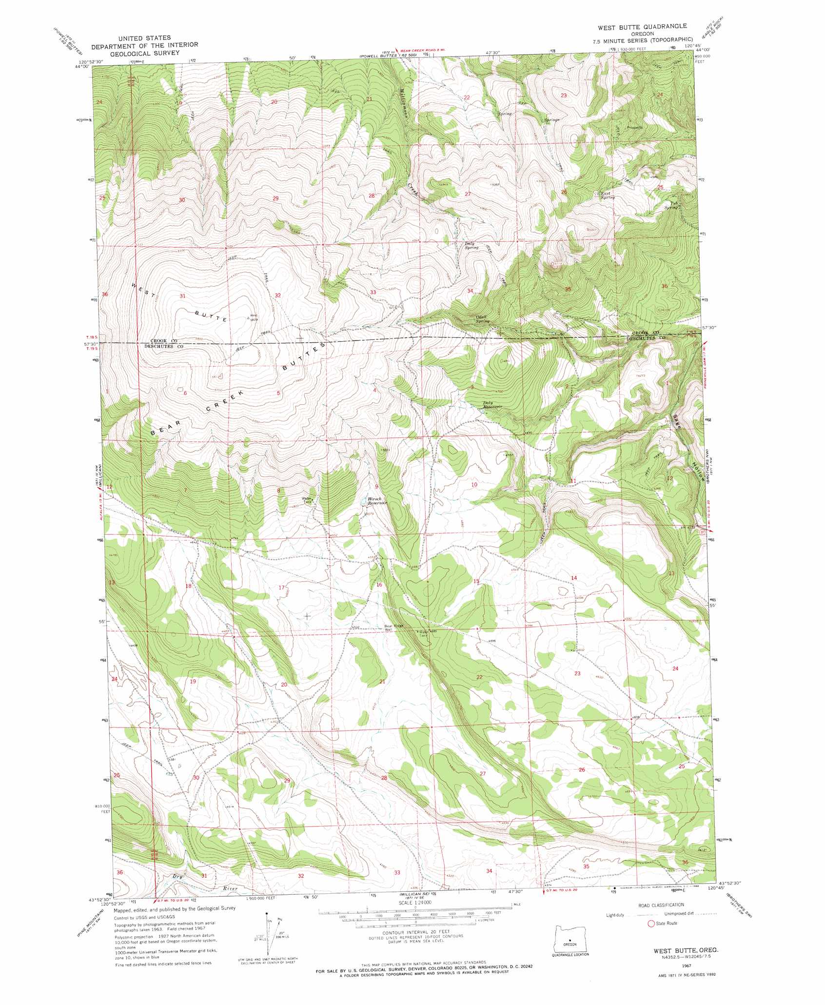
USGS Topo Quad 43120h7 - 1:24,000 scale
| Topo Map Name: | West Butte |
| USGS Topo Quad ID: | 43120h7 |
| Print Size: | ca. 21 1/4" wide x 27" high |
| Southeast Coordinates: | 43.875° N latitude / 120.75° W longitude |
| Map Center Coordinates: | 43.9375° N latitude / 120.8125° W longitude |
| U.S. State: | OR |
| Filename: | o43120h7.jpg |
| Download Map JPG Image: | West Butte topo map 1:24,000 scale |
| Map Type: | Topographic |
| Topo Series: | 7.5´ |
| Map Scale: | 1:24,000 |
| Source of Map Images: | United States Geological Survey (USGS) |
| Alternate Map Versions: |
West Butte OR 1967, updated 1968 Download PDF Buy paper map West Butte OR 2011 Download PDF Buy paper map West Butte OR 2014 Download PDF Buy paper map |
1:24,000 Topo Quads surrounding West Butte
Powell Butte |
Powell Buttes |
Stearns Butte |
Eagle Rock |
Pilot Butte |
Alfalfa |
Horse Butte |
Bowman Dam |
Alkali Flat |
Conant Basin |
Horse Ridge |
Millican |
West Butte |
Rodman Ridge |
Sugarloaf Butte |
Evans Well |
Pine Mountain |
Millican Se |
Brothers Sw |
Brothers |
China Hat |
Firestone Butte |
Plot Butte |
Dickerson Flat |
Soldiers Gap |
> Back to 43120e1 at 1:100,000 scale
> Back to 43120a1 at 1:250,000 scale
> Back to U.S. Topo Maps home
West Butte topo map: Gazetteer
West Butte: Post Offices
Perham Post Office (historical) elevation 1567m 5141′West Butte: Reservoirs
Daly Reservoir elevation 1403m 4603′Hirsch Reservoir elevation 1443m 4734′
West Butte: Springs
Daly Spring elevation 1471m 4826′East Spring elevation 1399m 4589′
Odell Spring elevation 1501m 4924′
Tub Spring elevation 1312m 4304′
West Butte: Summits
Bear Creek Buttes elevation 1710m 5610′West Butte elevation 1784m 5853′
West Butte: Valleys
Sage Hollow elevation 1164m 3818′West Butte: Wells
Bear Ridge Well elevation 1378m 4520′West Butte digital topo map on disk
Buy this West Butte topo map showing relief, roads, GPS coordinates and other geographical features, as a high-resolution digital map file on DVD: