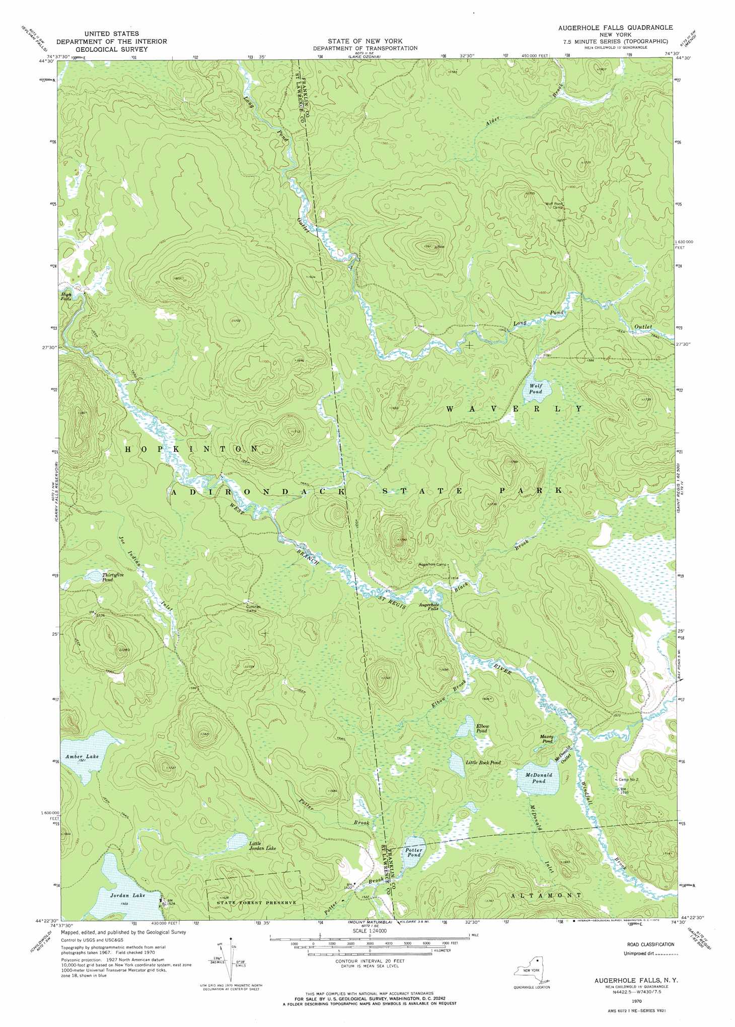
Augerhole Falls Topo Map New York
To zoom in, hover over the map of Augerhole Falls
USGS Topo Quad 44074d5 - 1:24,000 scale
| Topo Map Name: | Augerhole Falls |
| USGS Topo Quad ID: | 44074d5 |
| Print Size: | ca. 21 1/4" wide x 27" high |
| Southeast Coordinates: | 44.375° N latitude / 74.5° W longitude |
| Map Center Coordinates: | 44.4375° N latitude / 74.5625° W longitude |
| U.S. State: | NY |
| Filename: | o44074d5.jpg |
| Download Map JPG Image: | Augerhole Falls topo map 1:24,000 scale |
| Map Type: | Topographic |
| Topo Series: | 7.5´ |
| Map Scale: | 1:24,000 |
| Source of Map Images: | United States Geological Survey (USGS) |
| Alternate Map Versions: |
Augerhole Falls NY 1970, updated 1972 Download PDF Buy paper map Augerhole Falls NY 2010 Download PDF Buy paper map Augerhole Falls NY 2013 Download PDF Buy paper map Augerhole Falls NY 2016 Download PDF Buy paper map |
1:24,000 Topo Quads surrounding Augerhole Falls
Parishville |
Nicholville |
Saint Regis Falls |
Santa Clara |
Lake Titus |
Rainbow Falls |
Sylvan Falls |
Lake Ozonia |
Meno |
Meacham Lake |
Stark |
Carry Falls Reservoir |
Augerhole Falls |
Saint Regis Mountain |
|
Brother Ponds |
Childwold |
Mount Matumbla |
Upper Saranac Lake |
|
Cranberry Lake |
Pierce Field |
Stony Creek Mountain |
> Back to 44074a1 at 1:100,000 scale
> Back to 44074a1 at 1:250,000 scale
> Back to U.S. Topo Maps home
Augerhole Falls topo map: Gazetteer
Augerhole Falls: Falls
Augerhole Falls elevation 462m 1515′High Falls elevation 445m 1459′
Augerhole Falls: Lakes
Amber Lake elevation 464m 1522′Elbow Pond elevation 468m 1535′
Jordan Lake elevation 458m 1502′
Little Jordan Lake elevation 466m 1528′
Little Rock Pond elevation 467m 1532′
Maxey Pond elevation 466m 1528′
McDonald Pond elevation 466m 1528′
Potter Pond elevation 463m 1519′
Thirtyfive Pond elevation 460m 1509′
Wolf Pond elevation 472m 1548′
Augerhole Falls: Streams
Black Brook elevation 457m 1499′Elbow Brook elevation 457m 1499′
McDonald Inlet elevation 466m 1528′
McDonald Outlet elevation 462m 1515′
Windfall Brook elevation 462m 1515′
Augerhole Falls digital topo map on disk
Buy this Augerhole Falls topo map showing relief, roads, GPS coordinates and other geographical features, as a high-resolution digital map file on DVD:
New York, Vermont, Connecticut & Western Massachusetts
Buy digital topo maps: New York, Vermont, Connecticut & Western Massachusetts