New Prague Topo Map Minnesota
To zoom in, hover over the map of New Prague
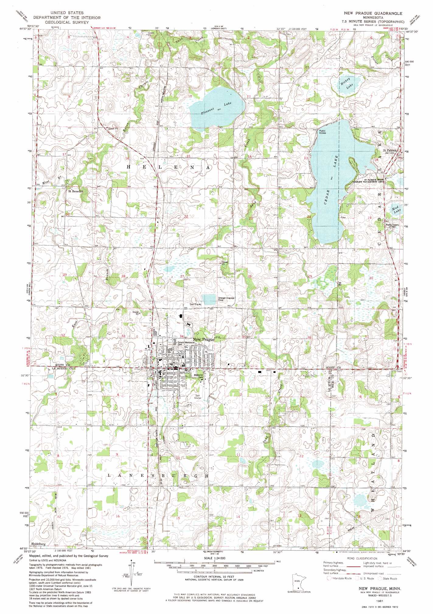
USGS Topo Quad 44093e5 - 1:24,000 scale
| Topo Map Name: | New Prague |
| USGS Topo Quad ID: | 44093e5 |
| Print Size: | ca. 21 1/4" wide x 27" high |
| Southeast Coordinates: | 44.5° N latitude / 93.5° W longitude |
| Map Center Coordinates: | 44.5625° N latitude / 93.5625° W longitude |
| U.S. State: | MN |
| Filename: | o44093e5.jpg |
| Download Map JPG Image: | New Prague topo map 1:24,000 scale |
| Map Type: | Topographic |
| Topo Series: | 7.5´ |
| Map Scale: | 1:24,000 |
| Source of Map Images: | United States Geological Survey (USGS) |
| Alternate Map Versions: |
New Prague MN 1981, updated 1982 Download PDF Buy paper map New Prague MN 2010 Download PDF Buy paper map New Prague MN 2013 Download PDF Buy paper map New Prague MN 2016 Download PDF Buy paper map |
1:24,000 Topo Quads surrounding New Prague
Waconia |
Victoria |
Shakopee |
Eden Prairie |
Bloomington |
Belle Plaine North |
Jordan West |
Jordan East |
Prior Lake |
Orchard Lake |
Belle Plaine South |
Union Hill |
New Prague |
Veseli |
New Market |
Saint Thomas |
Le Center |
Montgomery |
Lonsdale |
Little Chicago |
Cleveland |
Cordova |
Kilkenny |
Shieldsville |
Faribault |
> Back to 44093e1 at 1:100,000 scale
> Back to 44092a1 at 1:250,000 scale
> Back to U.S. Topo Maps home
New Prague topo map: Gazetteer
New Prague: Airports
Loon Lane Seaplane Base elevation 288m 944′New Prague: Canals
County Ditch Number Sixtytwo elevation 299m 980′New Prague: Dams
Cedar Lake Dam elevation 287m 941′New Prague: Lakes
Cedar Lake elevation 288m 944′Hickey Lake elevation 289m 948′
Mud Lake elevation 294m 964′
Pleasant Lake elevation 276m 905′
New Prague: Parks
Foundry Hill Park elevation 304m 997′Greenway Park elevation 301m 987′
Memorial Park elevation 304m 997′
Northside Park elevation 308m 1010′
Southside Park elevation 301m 987′
New Prague: Populated Places
East Gate Estates elevation 305m 1000′New Prague elevation 301m 987′
Saint Benedict elevation 280m 918′
Saint Patrick elevation 302m 990′
New Prague: Post Offices
Benedict Post Office (historical) elevation 281m 921′New Prague Post Office elevation 303m 994′
Saint Patrick Post Office (historical) elevation 298m 977′
New Prague: Reservoirs
Cedar Lake elevation 287m 941′New Prague: Streams
East Branch Raven Stream elevation 278m 912′Philipps Creek elevation 286m 938′
Raven Stream elevation 269m 882′
West Branch Raven Stream elevation 278m 912′
New Prague digital topo map on disk
Buy this New Prague topo map showing relief, roads, GPS coordinates and other geographical features, as a high-resolution digital map file on DVD: