Belle Plaine North Topo Map Minnesota
To zoom in, hover over the map of Belle Plaine North
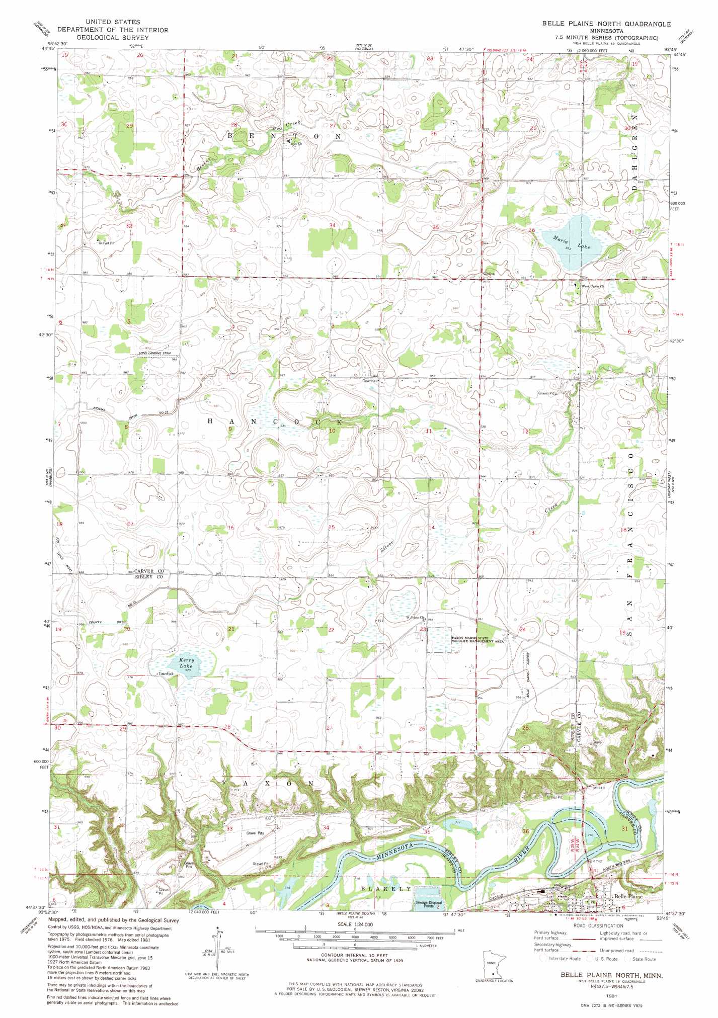
USGS Topo Quad 44093f7 - 1:24,000 scale
| Topo Map Name: | Belle Plaine North |
| USGS Topo Quad ID: | 44093f7 |
| Print Size: | ca. 21 1/4" wide x 27" high |
| Southeast Coordinates: | 44.625° N latitude / 93.75° W longitude |
| Map Center Coordinates: | 44.6875° N latitude / 93.8125° W longitude |
| U.S. State: | MN |
| Filename: | o44093f7.jpg |
| Download Map JPG Image: | Belle Plaine North topo map 1:24,000 scale |
| Map Type: | Topographic |
| Topo Series: | 7.5´ |
| Map Scale: | 1:24,000 |
| Source of Map Images: | United States Geological Survey (USGS) |
| Alternate Map Versions: |
Belle Plaine North MN 1981, updated 1982 Download PDF Buy paper map Belle Plaine North MN 2010 Download PDF Buy paper map Belle Plaine North MN 2013 Download PDF Buy paper map Belle Plaine North MN 2016 Download PDF Buy paper map |
1:24,000 Topo Quads surrounding Belle Plaine North
Winsted |
Mayer |
Watertown |
Mound |
Excelsior |
Plato |
Norwood |
Waconia |
Victoria |
Shakopee |
Green Isle |
Hamburg |
Belle Plaine North |
Jordan West |
Jordan East |
Arlington |
Henderson |
Belle Plaine South |
Union Hill |
New Prague |
Norseland |
Le Sueur |
Saint Thomas |
Le Center |
Montgomery |
> Back to 44093e1 at 1:100,000 scale
> Back to 44092a1 at 1:250,000 scale
> Back to U.S. Topo Maps home
Belle Plaine North topo map: Gazetteer
Belle Plaine North: Airports
Belle Plaine Airport elevation 291m 954′Sons Landing Strip elevation 297m 974′
Belle Plaine North: Canals
Judicial Ditch Number Twentyone elevation 299m 980′Judicial Ditch Number Twentytwo elevation 292m 958′
Belle Plaine North: Lakes
Kerry Lake elevation 297m 974′Maria Lake elevation 285m 935′
Belle Plaine North: Parks
Faxon Marsh State Wildlife Management Area elevation 293m 961′Fountain Park elevation 223m 731′
Belle Plaine North: Populated Places
Gotha elevation 294m 964′Valley View Terrace elevation 235m 770′
Belle Plaine North: Post Offices
Gotha Post Office (historical) elevation 294m 964′Belle Plaine North: Streams
Robert Creek elevation 212m 695′Belle Plaine North: Swamps
Bachman Lake elevation 302m 990′Belle Plaine North digital topo map on disk
Buy this Belle Plaine North topo map showing relief, roads, GPS coordinates and other geographical features, as a high-resolution digital map file on DVD: