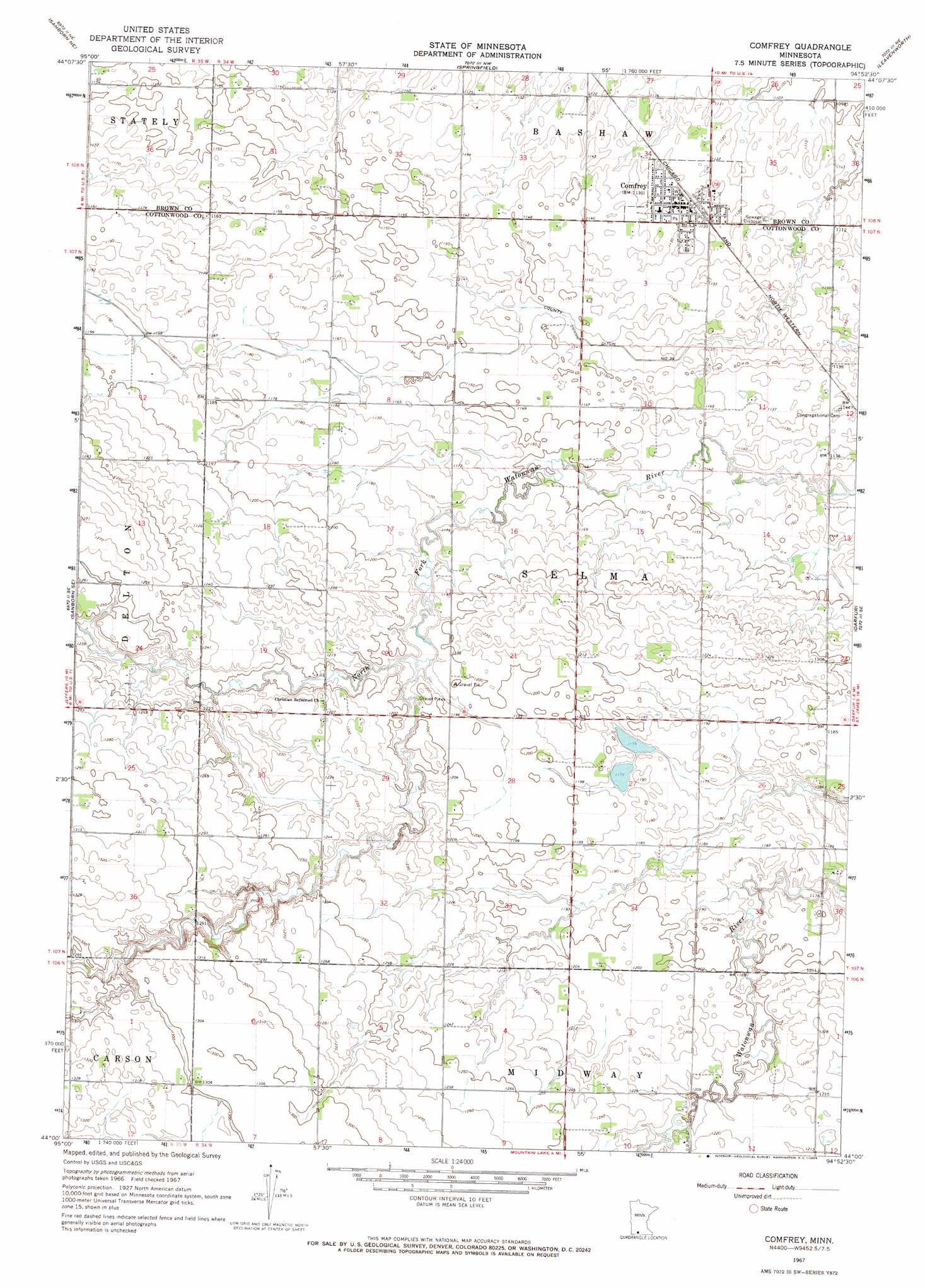
Comfrey Topo Map Minnesota
To zoom in, hover over the map of Comfrey
USGS Topo Quad 44094a8 - 1:24,000 scale
| Topo Map Name: | Comfrey |
| USGS Topo Quad ID: | 44094a8 |
| Print Size: | ca. 21 1/4" wide x 27" high |
| Southeast Coordinates: | 44° N latitude / 94.875° W longitude |
| Map Center Coordinates: | 44.0625° N latitude / 94.9375° W longitude |
| U.S. State: | MN |
| Filename: | o44094a8.jpg |
| Download Map JPG Image: | Comfrey topo map 1:24,000 scale |
| Map Type: | Topographic |
| Topo Series: | 7.5´ |
| Map Scale: | 1:24,000 |
| Source of Map Images: | United States Geological Survey (USGS) |
| Alternate Map Versions: |
Comfrey MN 1967, updated 1969 Download PDF Buy paper map Comfrey MN 2010 Download PDF Buy paper map Comfrey MN 2013 Download PDF Buy paper map Comfrey MN 2016 Download PDF Buy paper map |
1:24,000 Topo Quads surrounding Comfrey
Wanda |
Clements Se |
Boise Lake |
Evan |
Sleepy Eye |
Sanborn |
Sanborn Ne |
Springfield |
Leavenworth |
Lake Hanska West |
Jeffers |
Sanborn Se |
Comfrey |
Darfur |
Godahl |
Harder Lake |
Bingham Lake |
Mountain Lake |
Butterfield |
Saint James West |
Wilder |
Windom |
Bergen |
Mountain Lake Se |
Trimont |
> Back to 44094a1 at 1:100,000 scale
> Back to 44094a1 at 1:250,000 scale
> Back to U.S. Topo Maps home
Comfrey topo map: Gazetteer
Comfrey: Canals
County Ditch Number Thirtynine elevation 345m 1131′Comfrey: Populated Places
Comfrey elevation 342m 1122′Comfrey: Post Offices
Comfrey Post Office elevation 342m 1122′Comfrey digital topo map on disk
Buy this Comfrey topo map showing relief, roads, GPS coordinates and other geographical features, as a high-resolution digital map file on DVD: