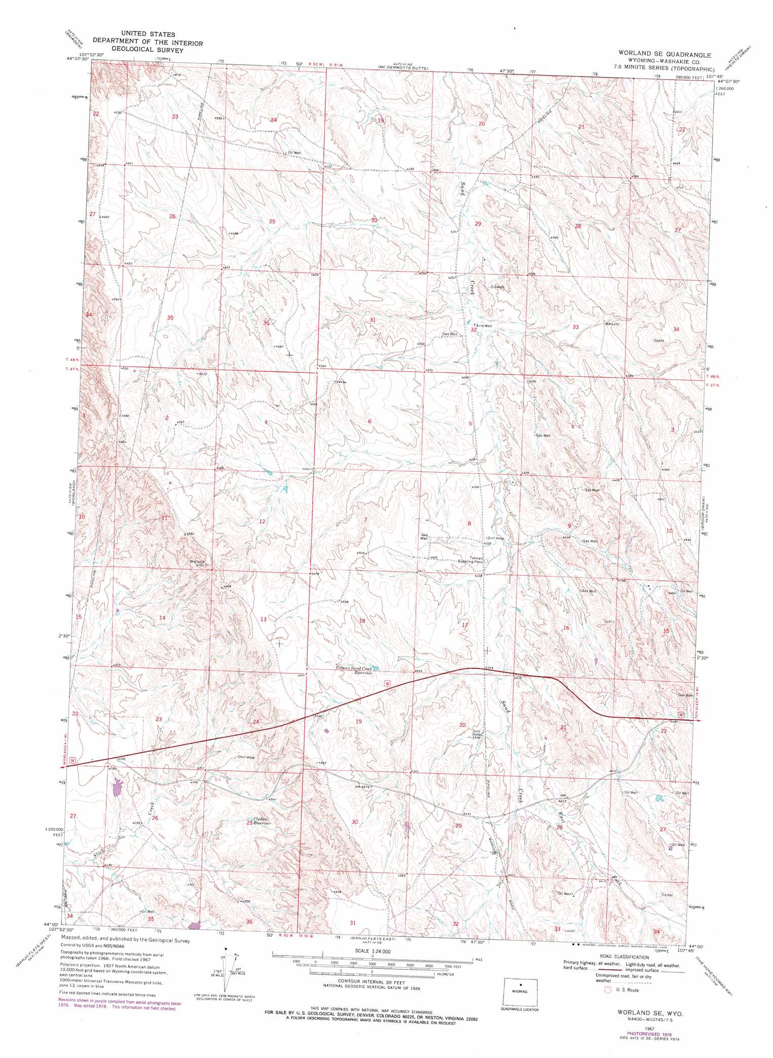
Worland Se Topo Map Wyoming
To zoom in, hover over the map of Worland Se
USGS Topo Quad 44107a7 - 1:24,000 scale
| Topo Map Name: | Worland Se |
| USGS Topo Quad ID: | 44107a7 |
| Print Size: | ca. 21 1/4" wide x 27" high |
| Southeast Coordinates: | 44° N latitude / 107.75° W longitude |
| Map Center Coordinates: | 44.0625° N latitude / 107.8125° W longitude |
| U.S. State: | WY |
| Filename: | o44107a7.jpg |
| Download Map JPG Image: | Worland Se topo map 1:24,000 scale |
| Map Type: | Topographic |
| Topo Series: | 7.5´ |
| Map Scale: | 1:24,000 |
| Source of Map Images: | United States Geological Survey (USGS) |
| Alternate Map Versions: |
Worland SE WY 1967, updated 1971 Download PDF Buy paper map Worland SE WY 1967, updated 1978 Download PDF Buy paper map Worland SE WY 2012 Download PDF Buy paper map Worland SE WY 2015 Download PDF Buy paper map |
1:24,000 Topo Quads surrounding Worland Se
Orchard Bench |
Manderson |
Manderson Se |
Flitner Reservoir |
Hyatt Ranch |
Schuster Flats Ne |
Rairden |
Mcdermotts Butte |
Weintz Draw |
Hyattville |
Schuster Flats Se |
Worland |
Worland Se |
Broom Draw |
Wild Horse Hill |
Neiber |
Banjo Flats West |
Banjo Flats East |
Cabin Fork |
Castle Gardens |
Cedar Mountain |
Zimmerman Buttes |
Henry Draw |
Wagon Prong |
Deadline Draw |
> Back to 44107a1 at 1:100,000 scale
> Back to 44106a1 at 1:250,000 scale
> Back to U.S. Topo Maps home
Worland Se topo map: Gazetteer
Worland Se: Mines
North Ten Sleep Mine elevation 1349m 4425′Worland Se: Reservoirs
Clydeos Reservoir elevation 1322m 4337′Tolman Sand Creek Reservoir elevation 1349m 4425′
Worland Se: Streams
East Fork Sand Creek elevation 1329m 4360′Worland Se: Wells
Faure Well elevation 1301m 4268′Worland Se digital topo map on disk
Buy this Worland Se topo map showing relief, roads, GPS coordinates and other geographical features, as a high-resolution digital map file on DVD:
Eastern Wyoming & Western South Dakota
Buy digital topo maps: Eastern Wyoming & Western South Dakota