Big Grassy Topo Map Idaho
To zoom in, hover over the map of Big Grassy
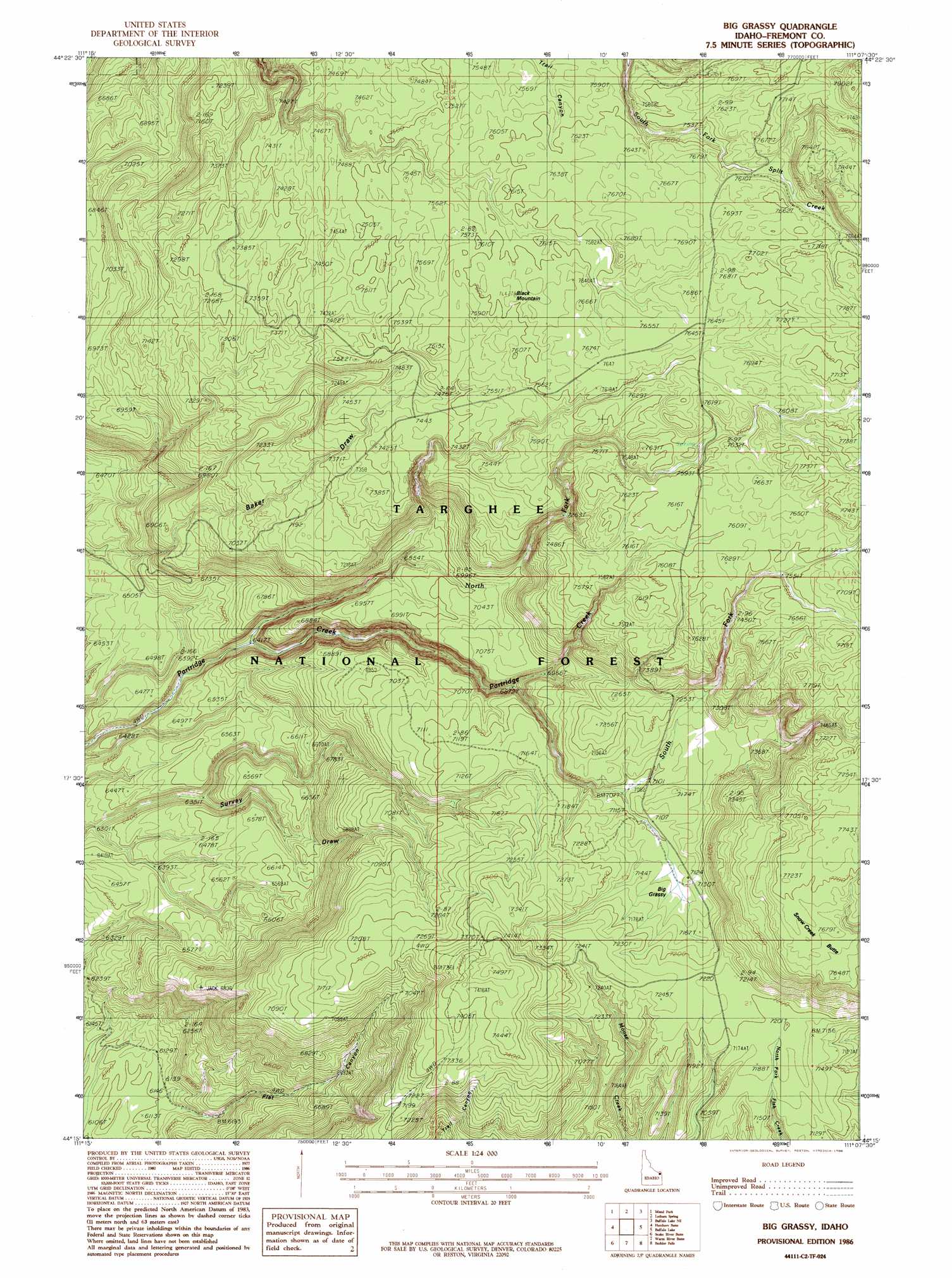
USGS Topo Quad 44111c2 - 1:24,000 scale
| Topo Map Name: | Big Grassy |
| USGS Topo Quad ID: | 44111c2 |
| Print Size: | ca. 21 1/4" wide x 27" high |
| Southeast Coordinates: | 44.25° N latitude / 111.125° W longitude |
| Map Center Coordinates: | 44.3125° N latitude / 111.1875° W longitude |
| U.S. State: | ID |
| Filename: | o44111c2.jpg |
| Download Map JPG Image: | Big Grassy topo map 1:24,000 scale |
| Map Type: | Topographic |
| Topo Series: | 7.5´ |
| Map Scale: | 1:24,000 |
| Source of Map Images: | United States Geological Survey (USGS) |
| Alternate Map Versions: |
Big Grassy ID 1986, updated 1986 Download PDF Buy paper map Big Grassy ID 2011 Download PDF Buy paper map Big Grassy ID 2013 Download PDF Buy paper map |
| FStopo: | US Forest Service topo Big Grassy is available: Download FStopo PDF Download FStopo TIF |
1:24,000 Topo Quads surrounding Big Grassy
Sawtell Peak |
Big Springs |
Reas Pass |
Jack Straw Basin |
Buffalo Meadows |
Island Park Dam |
Island Park |
Latham Spring |
Buffalo Lake Ne |
Summit Lake |
Last Chance |
Hatchery Butte |
Big Grassy |
Buffalo Lake |
Trischman Knob |
Lookout Butte |
Snake River Butte |
Warm River Butte |
Bechler Falls |
Cave Falls |
Ashton |
Warm River |
Porcupine Lake |
Sheep Falls |
Hominy Peak |
> Back to 44111a1 at 1:100,000 scale
> Back to 44110a1 at 1:250,000 scale
> Back to U.S. Topo Maps home
Big Grassy topo map: Gazetteer
Big Grassy: Flats
Big Grassy elevation 2170m 7119′Big Grassy: Streams
North Fork Partridge Creek elevation 1963m 6440′South Fork Partridge Creek elevation 2102m 6896′
Big Grassy: Summits
Black Mountain elevation 2324m 7624′Big Grassy digital topo map on disk
Buy this Big Grassy topo map showing relief, roads, GPS coordinates and other geographical features, as a high-resolution digital map file on DVD: