Spring Hill Topo Map Idaho
To zoom in, hover over the map of Spring Hill
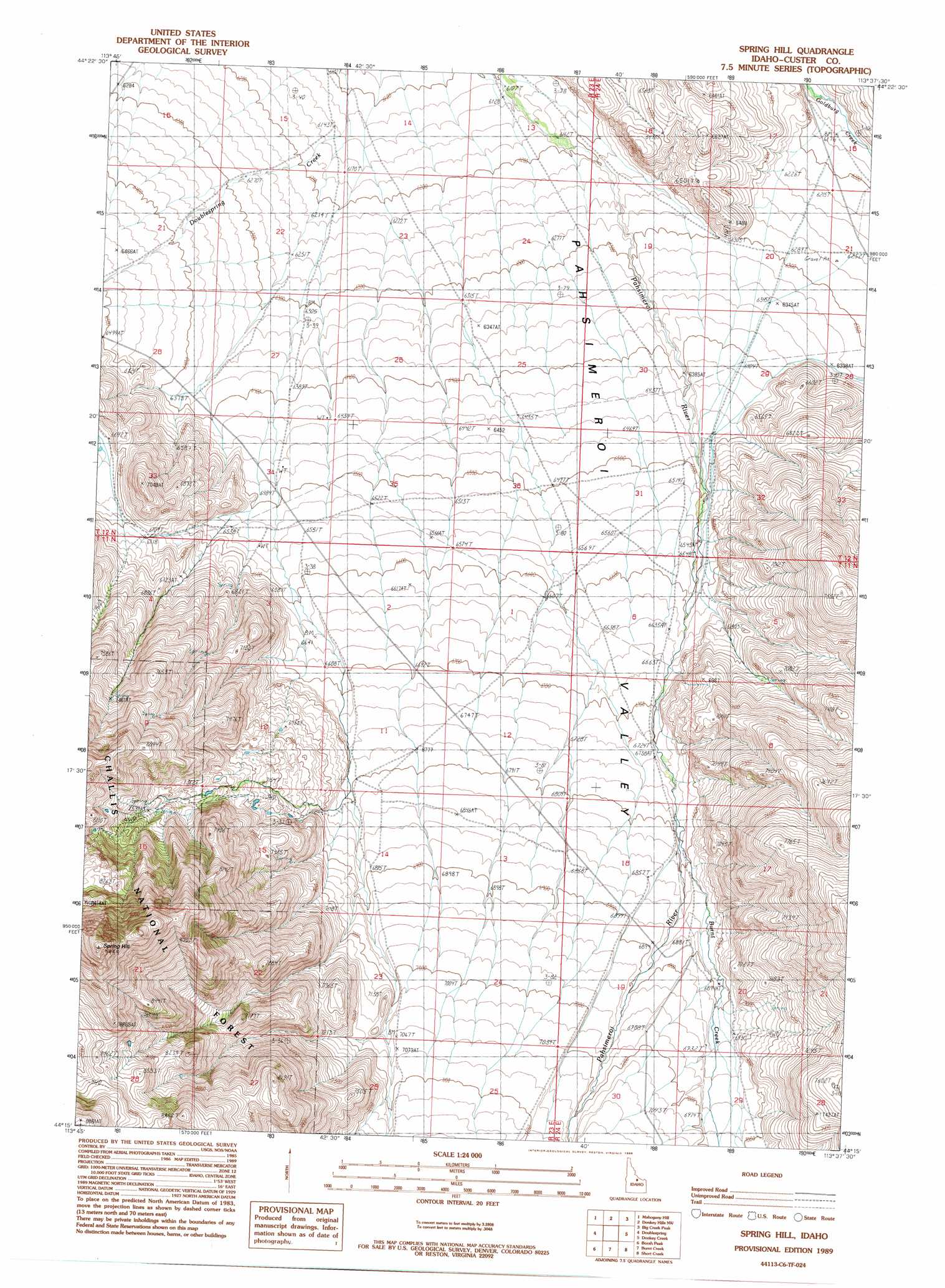
USGS Topo Quad 44113c6 - 1:24,000 scale
| Topo Map Name: | Spring Hill |
| USGS Topo Quad ID: | 44113c6 |
| Print Size: | ca. 21 1/4" wide x 27" high |
| Southeast Coordinates: | 44.25° N latitude / 113.625° W longitude |
| Map Center Coordinates: | 44.3125° N latitude / 113.6875° W longitude |
| U.S. State: | ID |
| Filename: | o44113c6.jpg |
| Download Map JPG Image: | Spring Hill topo map 1:24,000 scale |
| Map Type: | Topographic |
| Topo Series: | 7.5´ |
| Map Scale: | 1:24,000 |
| Source of Map Images: | United States Geological Survey (USGS) |
| Alternate Map Versions: |
Spring Hill ID 1989, updated 1989 Download PDF Buy paper map Spring Hill ID 2011 Download PDF Buy paper map Spring Hill ID 2013 Download PDF Buy paper map |
| FStopo: | US Forest Service topo Spring Hill is available: Download FStopo PDF Download FStopo TIF |
1:24,000 Topo Quads surrounding Spring Hill
May |
East Of May |
Patterson |
Yellow Peak |
Sheephorn Peak |
Meadow Peak |
Mahogany Hill |
Donkey Hills Nw |
Big Creek Peak |
Iron Creek Point |
Grouse Creek Mountain |
Doublespring |
Spring Hill |
Donkey Creek |
Moffett Springs |
Dickey Peak |
Borah Peak |
Burnt Creek |
Short Creek |
Red Hills |
Chilly Buttes |
Elkhorn Creek |
Leatherman Peak |
Massacre Mountain |
Warren Mountain |
> Back to 44113a1 at 1:100,000 scale
> Back to 44112a1 at 1:250,000 scale
> Back to U.S. Topo Maps home
Spring Hill topo map: Gazetteer
Spring Hill: Streams
Burnt Creek elevation 2074m 6804′Spring Hill: Summits
Spring Hill elevation 2772m 9094′Spring Hill digital topo map on disk
Buy this Spring Hill topo map showing relief, roads, GPS coordinates and other geographical features, as a high-resolution digital map file on DVD: