Rail Creek Butte Topo Map Oregon
To zoom in, hover over the map of Rail Creek Butte
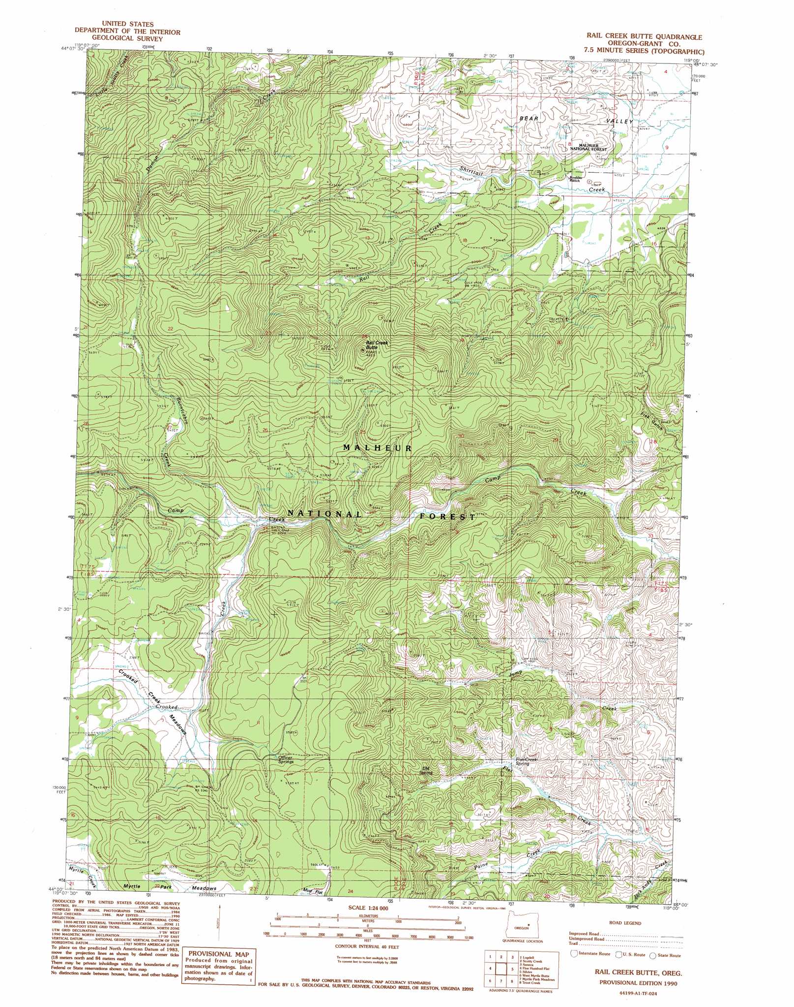
USGS Topo Quad 44119a1 - 1:24,000 scale
| Topo Map Name: | Rail Creek Butte |
| USGS Topo Quad ID: | 44119a1 |
| Print Size: | ca. 21 1/4" wide x 27" high |
| Southeast Coordinates: | 44° N latitude / 119° W longitude |
| Map Center Coordinates: | 44.0625° N latitude / 119.0625° W longitude |
| U.S. State: | OR |
| Filename: | o44119a1.jpg |
| Download Map JPG Image: | Rail Creek Butte topo map 1:24,000 scale |
| Map Type: | Topographic |
| Topo Series: | 7.5´ |
| Map Scale: | 1:24,000 |
| Source of Map Images: | United States Geological Survey (USGS) |
| Alternate Map Versions: |
Rail Creek Butte OR 1990, updated 1990 Download PDF Buy paper map Rail Creek Butte OR 1998, updated 2000 Download PDF Buy paper map Rail Creek Butte OR 2011 Download PDF Buy paper map Rail Creek Butte OR 2014 Download PDF Buy paper map |
| FStopo: | US Forest Service topo Rail Creek Butte is available: Download FStopo PDF Download FStopo TIF |
1:24,000 Topo Quads surrounding Rail Creek Butte
Big Weasel Sprs |
Mcclellan Mountain |
Fall Mountain |
Canyon Mountain |
Pine Creek Mountain |
Flagtail Mountain |
Logdell |
Scotty Creek |
Seneca |
Big Canyon |
Lewis Creek |
Five Hundred Flat |
Rail Creek Butte |
Silvies |
Jumpoff Joe Mountain |
Alsup Mountain |
West Myrtle Butte |
Myrtle Park Meadows |
Trout Creek |
Calamity Butte |
Hughet Valley |
Landing Creek |
Mosquito Flat |
Devine Ridge North |
Telephone Butte |
> Back to 44119a1 at 1:100,000 scale
> Back to 44118a1 at 1:250,000 scale
> Back to U.S. Topo Maps home
Rail Creek Butte topo map: Gazetteer
Rail Creek Butte: Flats
Crooked Creek Meadows elevation 1606m 5269′Rail Creek Butte: Springs
D M Spring elevation 1521m 4990′Flat Creek Spring elevation 1484m 4868′
Gibb Spring elevation 1473m 4832′
Laycock Spring elevation 1602m 5255′
Officer Springs elevation 1681m 5515′
Rail Creek Butte: Streams
Burntcabin Creek elevation 1554m 5098′Crooked Creek elevation 1548m 5078′
Paine Creek elevation 1449m 4753′
Rail Creek elevation 1488m 4881′
Rail Creek Butte: Summits
Rail Creek Butte elevation 1803m 5915′Rail Creek Butte digital topo map on disk
Buy this Rail Creek Butte topo map showing relief, roads, GPS coordinates and other geographical features, as a high-resolution digital map file on DVD: