Royalton Topo Map Minnesota
To zoom in, hover over the map of Royalton
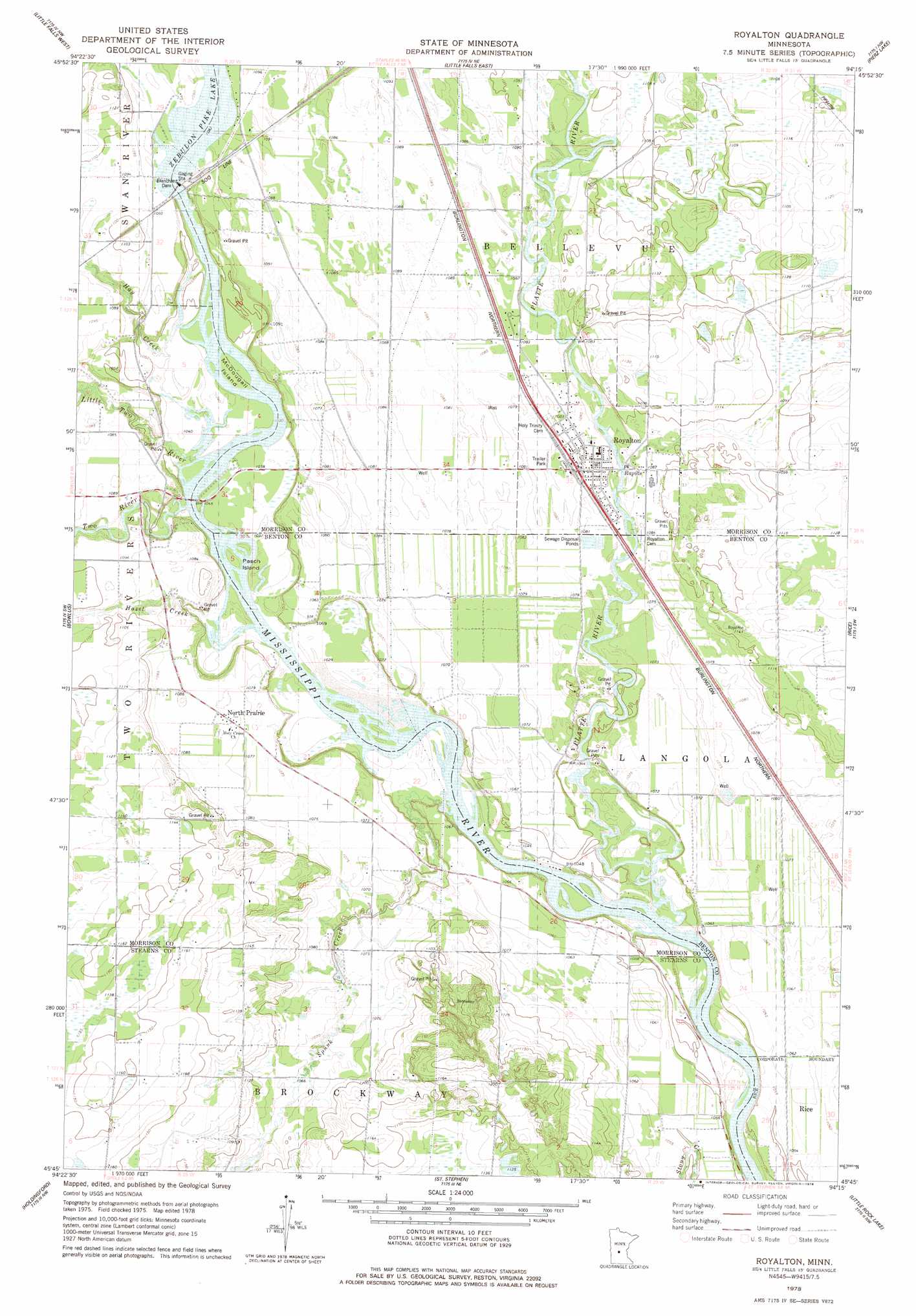
USGS Topo Quad 45094g3 - 1:24,000 scale
| Topo Map Name: | Royalton |
| USGS Topo Quad ID: | 45094g3 |
| Print Size: | ca. 21 1/4" wide x 27" high |
| Southeast Coordinates: | 45.75° N latitude / 94.25° W longitude |
| Map Center Coordinates: | 45.8125° N latitude / 94.3125° W longitude |
| U.S. State: | MN |
| Filename: | o45094g3.jpg |
| Download Map JPG Image: | Royalton topo map 1:24,000 scale |
| Map Type: | Topographic |
| Topo Series: | 7.5´ |
| Map Scale: | 1:24,000 |
| Source of Map Images: | United States Geological Survey (USGS) |
| Alternate Map Versions: |
Royalton MN 1978, updated 1978 Download PDF Buy paper map Royalton MN 2010 Download PDF Buy paper map Royalton MN 2013 Download PDF Buy paper map Royalton MN 2016 Download PDF Buy paper map |
1:24,000 Topo Quads surrounding Royalton
Randall West |
Randall |
Belle Prairie |
Freedhem |
Lastrup |
Flensburg |
Little Falls West |
Little Falls East |
Pierz Lake |
Pierz |
Upsala |
Bowlus |
Royalton |
Rice |
Little Rock |
Albany |
Holdingford |
Saint Stephen |
Little Rock Lake |
Mayhew |
Farming |
Avon |
Saint Joseph |
Saint Cloud |
Cable |
> Back to 45094e1 at 1:100,000 scale
> Back to 45094a1 at 1:250,000 scale
> Back to U.S. Topo Maps home
Royalton topo map: Gazetteer
Royalton: Dams
Blanchard Dam elevation 331m 1085′Blanchard Dam elevation 326m 1069′
Royalton: Islands
McDougall Island elevation 315m 1033′Pasch Island elevation 314m 1030′
Royalton: Parks
Two Rivers Park elevation 321m 1053′Royalton: Populated Places
North Prairie elevation 330m 1082′Royalton elevation 329m 1079′
Royalton: Post Offices
North Prairie Post Office (historical) elevation 329m 1079′Royalton: Reservoirs
Zebulon Pike Lake elevation 314m 1030′Royalton: Streams
Hay Creek elevation 314m 1030′Hazel Creek elevation 311m 1020′
Little Two River elevation 314m 1030′
Platte River elevation 309m 1013′
Spunk Creek elevation 309m 1013′
Two River elevation 314m 1030′
Royalton digital topo map on disk
Buy this Royalton topo map showing relief, roads, GPS coordinates and other geographical features, as a high-resolution digital map file on DVD: