Ward Springs Topo Map Minnesota
To zoom in, hover over the map of Ward Springs
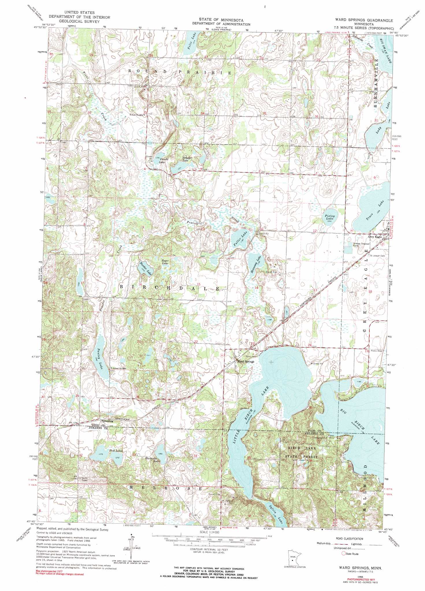
USGS Topo Quad 45094g7 - 1:24,000 scale
| Topo Map Name: | Ward Springs |
| USGS Topo Quad ID: | 45094g7 |
| Print Size: | ca. 21 1/4" wide x 27" high |
| Southeast Coordinates: | 45.75° N latitude / 94.75° W longitude |
| Map Center Coordinates: | 45.8125° N latitude / 94.8125° W longitude |
| U.S. State: | MN |
| Filename: | o45094g7.jpg |
| Download Map JPG Image: | Ward Springs topo map 1:24,000 scale |
| Map Type: | Topographic |
| Topo Series: | 7.5´ |
| Map Scale: | 1:24,000 |
| Source of Map Images: | United States Geological Survey (USGS) |
| Alternate Map Versions: |
Ward Springs MN 1966, updated 1968 Download PDF Buy paper map Ward Springs MN 2010 Download PDF Buy paper map Ward Springs MN 2013 Download PDF Buy paper map Ward Springs MN 2016 Download PDF Buy paper map |
1:24,000 Topo Quads surrounding Ward Springs
Clotho |
Browerville Sw |
Browerville |
Lake Beauty |
Randall West |
Lake Osakis East |
Round Prairie |
Long Prairie |
Swanville |
Flensburg |
West Union |
Sauk Lake |
Ward Springs |
Burtrum |
Upsala |
Raymond Lake |
Sauk Centre |
Melrose |
Freeport |
Albany |
Padua |
Elrosa |
Greenwald |
Saint Martin |
Farming |
> Back to 45094e1 at 1:100,000 scale
> Back to 45094a1 at 1:250,000 scale
> Back to U.S. Topo Maps home
Ward Springs topo map: Gazetteer
Ward Springs: Dams
Big Birch Lake Dam elevation 361m 1184′D Peschel Pond Dam elevation 363m 1190′
Ward Springs: Lakes
Big Birch Lake elevation 361m 1184′Bunker Lake elevation 380m 1246′
Feucht Lake elevation 367m 1204′
Fuller Lake elevation 361m 1184′
Hartnette Lake elevation 385m 1263′
Hennessy Lake elevation 361m 1184′
Little Birch Lake elevation 360m 1181′
Pauley Lake elevation 378m 1240′
Pixley Lake elevation 367m 1204′
Schafer Lake elevation 375m 1230′
Stub Lakes elevation 388m 1272′
Trace Lake elevation 368m 1207′
Zager Lake elevation 393m 1289′
Ward Springs: Parks
Birch Lakes State Forest elevation 386m 1266′Ward Springs: Populated Places
Spaulding elevation 396m 1299′Ward Springs elevation 372m 1220′
Ward Springs: Post Offices
Ward Springs Post Office (historical) elevation 370m 1213′Ward Springs: Reservoirs
Big Birch Lake elevation 361m 1184′D Peschel Pond elevation 363m 1190′
Ward Springs: Streams
Prairie Creek elevation 361m 1184′Schwanke Creek elevation 364m 1194′
Trout Creek elevation 366m 1200′
Ward Springs digital topo map on disk
Buy this Ward Springs topo map showing relief, roads, GPS coordinates and other geographical features, as a high-resolution digital map file on DVD: