Cottonwood Creek Nw Topo Map South Dakota
To zoom in, hover over the map of Cottonwood Creek Nw
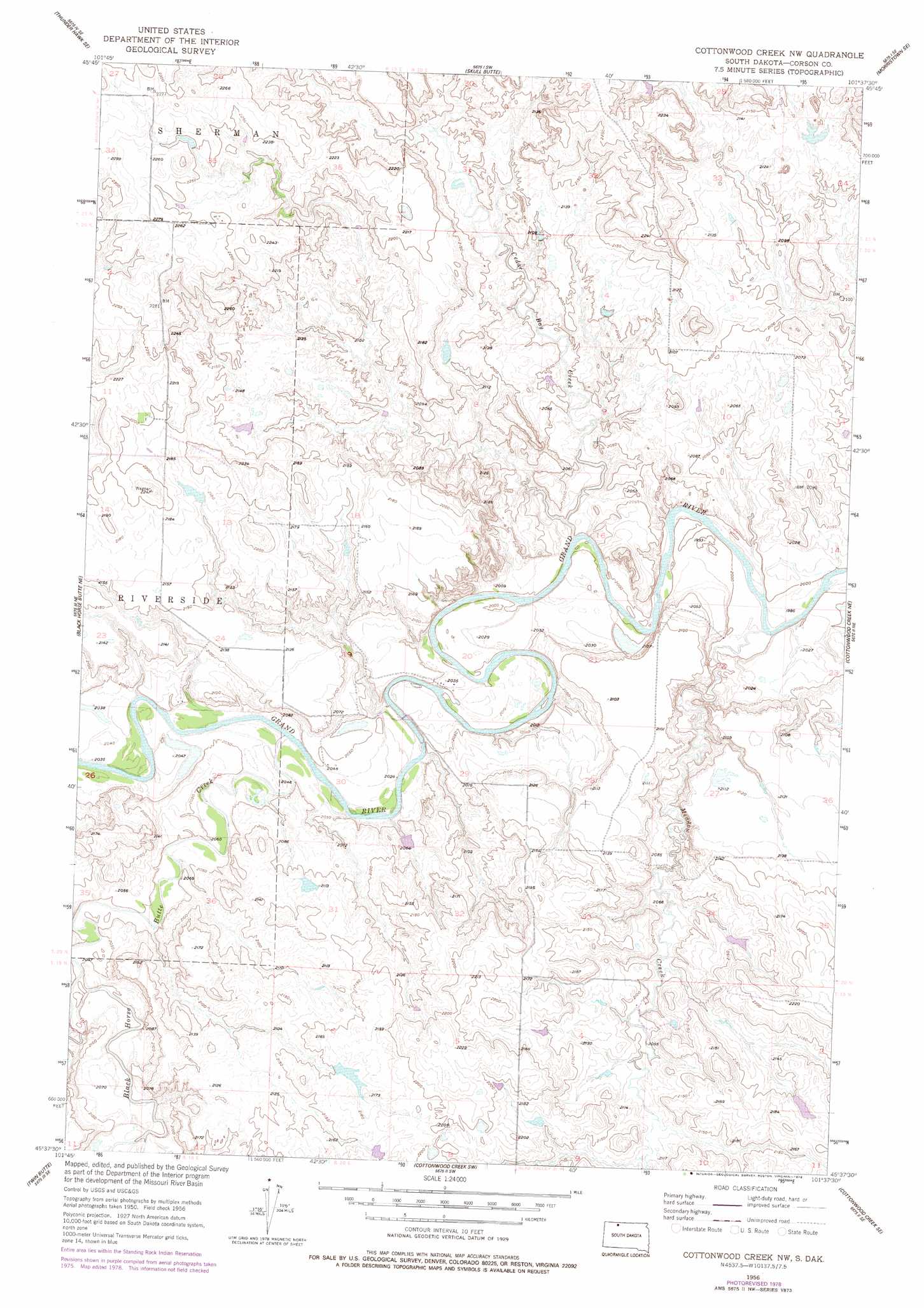
USGS Topo Quad 45101f6 - 1:24,000 scale
| Topo Map Name: | Cottonwood Creek Nw |
| USGS Topo Quad ID: | 45101f6 |
| Print Size: | ca. 21 1/4" wide x 27" high |
| Southeast Coordinates: | 45.625° N latitude / 101.625° W longitude |
| Map Center Coordinates: | 45.6875° N latitude / 101.6875° W longitude |
| U.S. State: | SD |
| Filename: | o45101f6.jpg |
| Download Map JPG Image: | Cottonwood Creek Nw topo map 1:24,000 scale |
| Map Type: | Topographic |
| Topo Series: | 7.5´ |
| Map Scale: | 1:24,000 |
| Source of Map Images: | United States Geological Survey (USGS) |
| Alternate Map Versions: |
Cottonwood Creek NW SD 1956, updated 1957 Download PDF Buy paper map Cottonwood Creek NW SD 1956, updated 1978 Download PDF Buy paper map Cottonwood Creek NW SD 2012 Download PDF Buy paper map Cottonwood Creek NW SD 2015 Download PDF Buy paper map |
1:24,000 Topo Quads surrounding Cottonwood Creek Nw
Thunder Hawk |
Keldron |
Morristown |
Watauga |
Hump Butte |
Thunder Hawk Sw |
Thunder Hawk Se |
Skull Butte |
Morristown Se |
Mcintosh Sw |
Black Horse Butte Nw |
Black Horse Butte Ne |
Cottonwood Creek Nw |
Cottonwood Creek Ne |
Black Horse |
Black Horse Butte |
Twin Butte |
Cottonwood Creek Sw |
Cottonwood Creek Se |
Black Horse Sw |
Glad Valley Nw |
Glad Valley |
Irish Creek Nw |
Irish Creek Ne |
Isabel |
> Back to 45101e1 at 1:100,000 scale
> Back to 45100a1 at 1:250,000 scale
> Back to U.S. Topo Maps home
Cottonwood Creek Nw topo map: Gazetteer
Cottonwood Creek Nw: Dams
Richard Cobb Dam elevation 686m 2250′Thomas Dugan Dam elevation 665m 2181′
Woodrow Hayes Dam elevation 661m 2168′
Cottonwood Creek Nw: Streams
Black Horse Butte Creek elevation 612m 2007′Cedar Boy Creek elevation 609m 1998′
Meadow Creek elevation 606m 1988′
Cottonwood Creek Nw digital topo map on disk
Buy this Cottonwood Creek Nw topo map showing relief, roads, GPS coordinates and other geographical features, as a high-resolution digital map file on DVD:
Eastern North Dakota & Eastern South Dakota
Buy digital topo maps: Eastern North Dakota & Eastern South Dakota