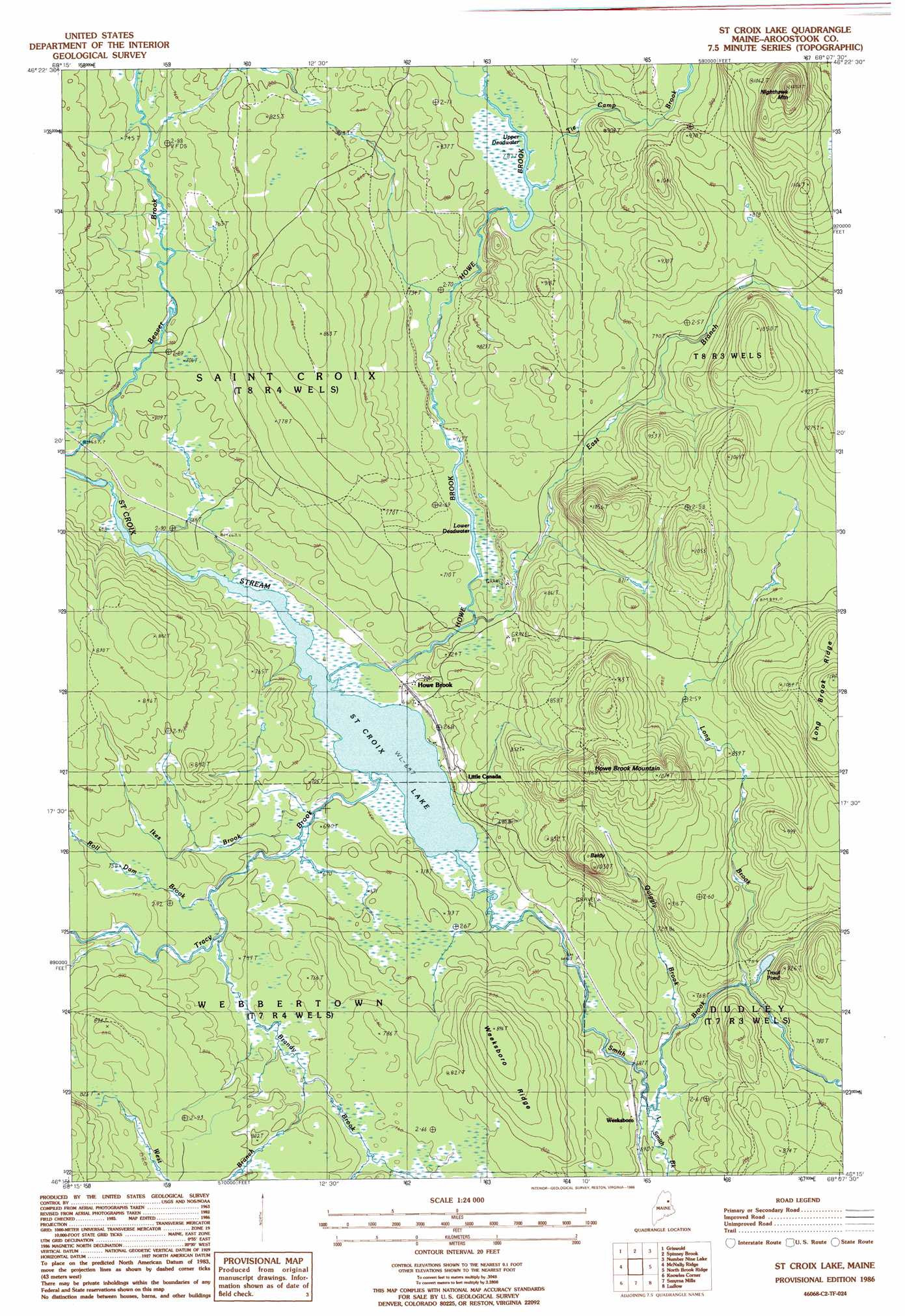
Saint Croix Lake Topo Map Maine
To zoom in, hover over the map of Saint Croix Lake
USGS Topo Quad 46068c2 - 1:24,000 scale
| Topo Map Name: | Saint Croix Lake |
| USGS Topo Quad ID: | 46068c2 |
| Print Size: | ca. 21 1/4" wide x 27" high |
| Southeast Coordinates: | 46.25° N latitude / 68.125° W longitude |
| Map Center Coordinates: | 46.3125° N latitude / 68.1875° W longitude |
| U.S. State: | ME |
| Filename: | o46068c2.jpg |
| Download Map JPG Image: | Saint Croix Lake topo map 1:24,000 scale |
| Map Type: | Topographic |
| Topo Series: | 7.5´ |
| Map Scale: | 1:24,000 |
| Source of Map Images: | United States Geological Survey (USGS) |
| Alternate Map Versions: |
Howe Brook SW ME 1975, updated 1981 Download PDF Buy paper map St. Croix Lake ME 1986, updated 1986 Download PDF Buy paper map Saint Croix Lake ME 2011 Download PDF Buy paper map Saint Croix Lake ME 2014 Download PDF Buy paper map |
1:24,000 Topo Quads surrounding Saint Croix Lake
Squa Pan |
Squa Pan Lake West |
Squa Pan Lake East |
Echo Lake |
Westfield |
Oxbow East |
Griswold |
Spinney Brook |
Number Nine Lake |
Packard Lake |
Umcolcus Lake |
Mcnally Ridge |
Saint Croix Lake |
North Brook Ridge |
Harvey |
Green Mountain |
Knowles Corner |
Smyrna Mills |
Ludlow |
Twin Brook |
Mount Chase |
Island Falls |
Oakfield |
Meduxnekeag Lake |
Linneus |
> Back to 46068a1 at 1:100,000 scale
> Back to 46068a1 at 1:250,000 scale
> Back to U.S. Topo Maps home
Saint Croix Lake topo map: Gazetteer
Saint Croix Lake: Lakes
Lower Deadwater elevation 216m 708′Saint Croix Lake elevation 197m 646′
Trout Pond elevation 222m 728′
Upper Deadwater elevation 241m 790′
Saint Croix Lake: Populated Places
Howe Brook elevation 201m 659′Little Canada elevation 203m 666′
Weeksboro elevation 214m 702′
Saint Croix Lake: Ridges
Weeksboro Ridge elevation 271m 889′Saint Croix Lake: Streams
Brandy Brook elevation 226m 741′East Branch Howe Brook elevation 213m 698′
Howe Brook elevation 198m 649′
Ikes Brook elevation 202m 662′
Little Smith Brook elevation 209m 685′
Long Brook elevation 226m 741′
Quiggly Brook elevation 213m 698′
Roll Dam Brook elevation 215m 705′
Smith Brook elevation 197m 646′
Tie Camp Brook elevation 240m 787′
Tracy Brook elevation 199m 652′
West Branch Brandy Brook elevation 244m 800′
Saint Croix Lake: Summits
Baldy elevation 303m 994′Howe Brook Mountain elevation 336m 1102′
Long Brook Ridge elevation 360m 1181′
Nighthawk Mountain elevation 410m 1345′
Saint Croix Lake digital topo map on disk
Buy this Saint Croix Lake topo map showing relief, roads, GPS coordinates and other geographical features, as a high-resolution digital map file on DVD:
Maine, New Hampshire, Rhode Island & Eastern Massachusetts
Buy digital topo maps: Maine, New Hampshire, Rhode Island & Eastern Massachusetts