Lake Beauty Topo Map Minnesota
To zoom in, hover over the map of Lake Beauty
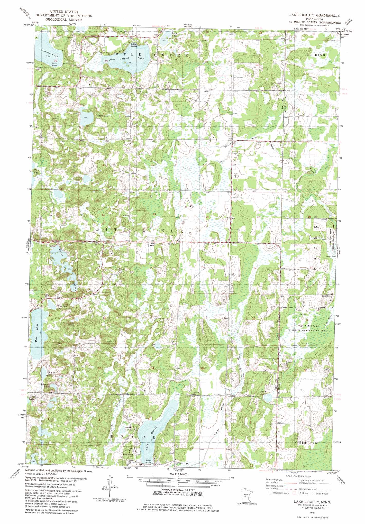
USGS Topo Quad 46094a6 - 1:24,000 scale
| Topo Map Name: | Lake Beauty |
| USGS Topo Quad ID: | 46094a6 |
| Print Size: | ca. 21 1/4" wide x 27" high |
| Southeast Coordinates: | 46° N latitude / 94.625° W longitude |
| Map Center Coordinates: | 46.0625° N latitude / 94.6875° W longitude |
| U.S. State: | MN |
| Filename: | o46094a6.jpg |
| Download Map JPG Image: | Lake Beauty topo map 1:24,000 scale |
| Map Type: | Topographic |
| Topo Series: | 7.5´ |
| Map Scale: | 1:24,000 |
| Source of Map Images: | United States Geological Survey (USGS) |
| Alternate Map Versions: |
Lake Beauty MN 1981, updated 1982 Download PDF Buy paper map Lake Beauty MN 2010 Download PDF Buy paper map Lake Beauty MN 2013 Download PDF Buy paper map Lake Beauty MN 2016 Download PDF Buy paper map |
1:24,000 Topo Quads surrounding Lake Beauty
Aldrich South |
Staples |
Motley |
Motley Se |
Pillager |
Clarissa |
Browerville Ne |
Lincoln |
Cushing |
Belle Prairie Nw |
Browerville Sw |
Browerville |
Lake Beauty |
Randall West |
Randall |
Round Prairie |
Long Prairie |
Swanville |
Flensburg |
Little Falls West |
Sauk Lake |
Ward Springs |
Burtrum |
Upsala |
Bowlus |
> Back to 46094a1 at 1:100,000 scale
> Back to 46094a1 at 1:250,000 scale
> Back to U.S. Topo Maps home
Lake Beauty topo map: Gazetteer
Lake Beauty: Dams
R Biermeier Pond Dam elevation 387m 1269′Lake Beauty: Lakes
Beauty Lake elevation 365m 1197′Chain of Lakes elevation 408m 1338′
Howard Lake elevation 367m 1204′
Hudallas Lake elevation 407m 1335′
Little Mill Lake elevation 406m 1332′
Loon Lake elevation 403m 1322′
Mill Lake elevation 404m 1325′
Mud Lake elevation 367m 1204′
Pine Island Lake elevation 398m 1305′
Steinerts Lake elevation 419m 1374′
Wintergreen Lake elevation 403m 1322′
Lake Beauty: Parks
Little Elk State Wildlife Management Area elevation 365m 1197′Lake Beauty: Reservoirs
R Biermeier Pond elevation 387m 1269′Lake Beauty: Summits
Tower Hill elevation 452m 1482′Lake Beauty digital topo map on disk
Buy this Lake Beauty topo map showing relief, roads, GPS coordinates and other geographical features, as a high-resolution digital map file on DVD: