Texas Ridge Topo Map Idaho
To zoom in, hover over the map of Texas Ridge
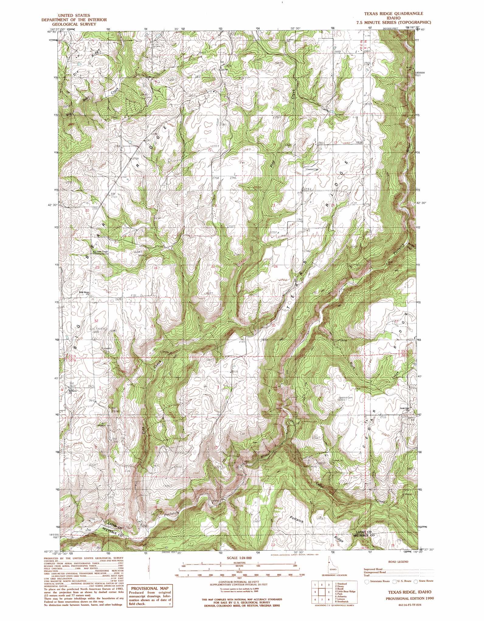
USGS Topo Quad 46116f5 - 1:24,000 scale
| Topo Map Name: | Texas Ridge |
| USGS Topo Quad ID: | 46116f5 |
| Print Size: | ca. 21 1/4" wide x 27" high |
| Southeast Coordinates: | 46.625° N latitude / 116.5° W longitude |
| Map Center Coordinates: | 46.6875° N latitude / 116.5625° W longitude |
| U.S. State: | ID |
| Filename: | o46116f5.jpg |
| Download Map JPG Image: | Texas Ridge topo map 1:24,000 scale |
| Map Type: | Topographic |
| Topo Series: | 7.5´ |
| Map Scale: | 1:24,000 |
| Source of Map Images: | United States Geological Survey (USGS) |
| Alternate Map Versions: |
Texas Ridge ID 1990, updated 1991 Download PDF Buy paper map Texas Ridge ID 1994, updated 1998 Download PDF Buy paper map Texas Ridge ID 2011 Download PDF Buy paper map Texas Ridge ID 2014 Download PDF Buy paper map |
| FStopo: | US Forest Service topo Texas Ridge is available: Download FStopo PDF Download FStopo TIF |
1:24,000 Topo Quads surrounding Texas Ridge
Princeton |
Harvard |
Sand Mountain |
Abes Knob |
Bechtel Butte |
Moscow Mountain |
Stanford |
Deary |
Bovill |
Mcgary Butte |
Troy |
Little Bear Ridge |
Texas Ridge |
Park |
Alderman Ridge |
Green Knob |
Juliaetta |
Lenore |
Southwick |
Ahsahka |
Lapwai |
Culdesac North |
Gifford |
Peck |
Orofino West |
> Back to 46116e1 at 1:100,000 scale
> Back to 46116a1 at 1:250,000 scale
> Back to U.S. Topo Maps home
Texas Ridge topo map: Gazetteer
Texas Ridge: Ridges
Big Bear Ridge elevation 915m 3001′Huffman Ridge elevation 836m 2742′
Texas Ridge elevation 872m 2860′
Texas Ridge: Streams
Boulder Creek elevation 559m 1833′Cedar Creek elevation 465m 1525′
Pine Creek elevation 412m 1351′
Rock Creek elevation 519m 1702′
Texas Ridge: Summits
Bean Hill elevation 832m 2729′Texas Ridge digital topo map on disk
Buy this Texas Ridge topo map showing relief, roads, GPS coordinates and other geographical features, as a high-resolution digital map file on DVD: