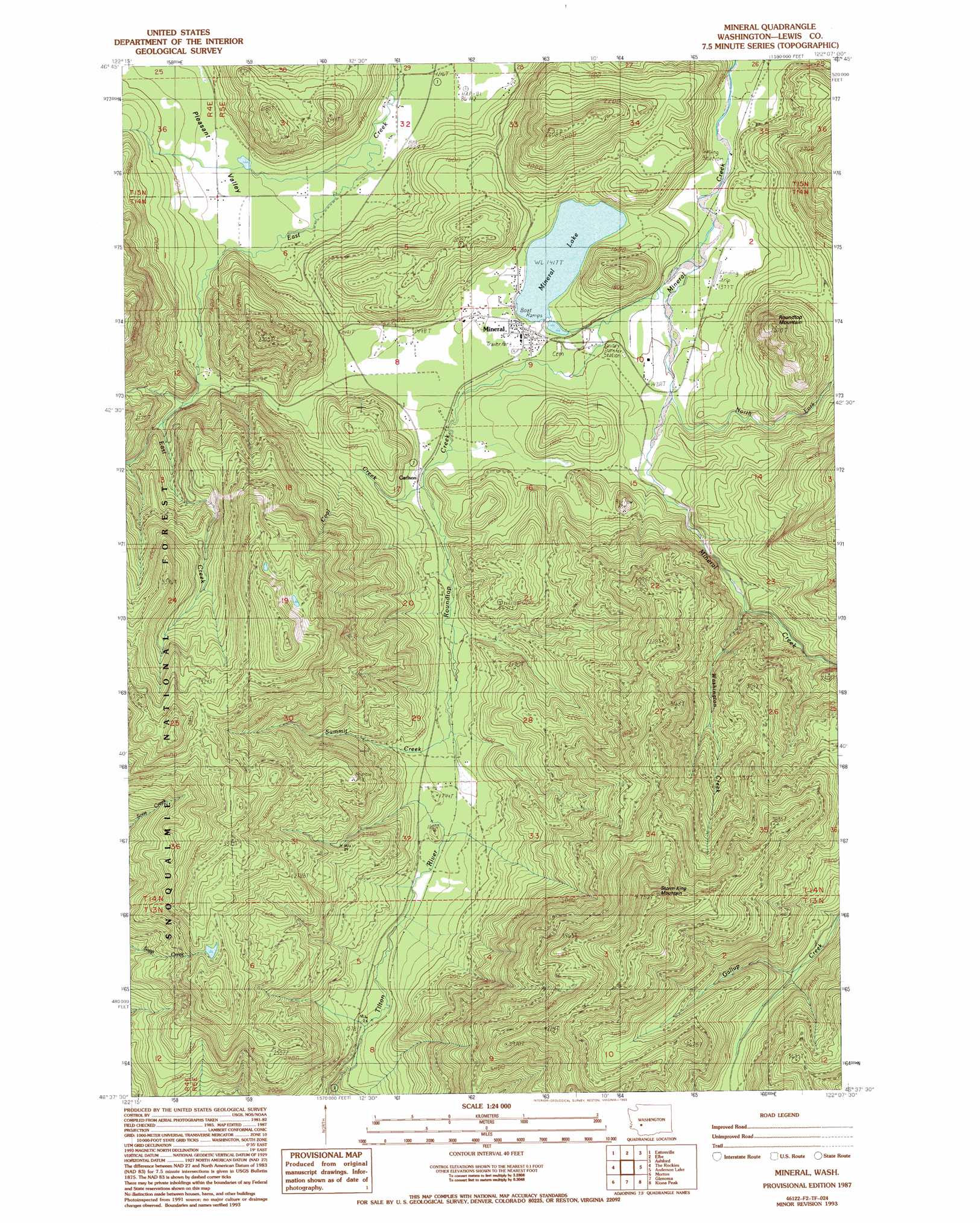
Mineral Topo Map Washington
To zoom in, hover over the map of Mineral
USGS Topo Quad 46122f2 - 1:24,000 scale
| Topo Map Name: | Mineral |
| USGS Topo Quad ID: | 46122f2 |
| Print Size: | ca. 21 1/4" wide x 27" high |
| Southeast Coordinates: | 46.625° N latitude / 122.125° W longitude |
| Map Center Coordinates: | 46.6875° N latitude / 122.1875° W longitude |
| U.S. State: | WA |
| Filename: | o46122f2.jpg |
| Download Map JPG Image: | Mineral topo map 1:24,000 scale |
| Map Type: | Topographic |
| Topo Series: | 7.5´ |
| Map Scale: | 1:24,000 |
| Source of Map Images: | United States Geological Survey (USGS) |
| Alternate Map Versions: |
Mineral WA 1987, updated 1987 Download PDF Buy paper map Mineral WA 1987, updated 1993 Download PDF Buy paper map Mineral WA 1998, updated 2003 Download PDF Buy paper map Mineral WA 2011 Download PDF Buy paper map Mineral WA 2013 Download PDF Buy paper map |
| FStopo: | US Forest Service topo Mineral is available: Download FStopo PDF Download FStopo TIF |
1:24,000 Topo Quads surrounding Mineral
Harts Lake |
Tanwax Lake |
Lake Kapowsin |
Le Dout Creek |
Golden Lakes |
Bald Hill |
Eatonville |
Elbe |
Ashford |
Mount Wow |
Newaukum Lake |
The Rockies |
Mineral |
Anderson Lake |
Sawtooth Ridge |
Mossyrock |
Morton |
Glenoma |
Kiona Peak |
Randle |
Coyote Mountain |
Winters Mountain |
Vanson Peak |
Cowlitz Falls |
Greenhorn Buttes |
> Back to 46122e1 at 1:100,000 scale
> Back to 46122a1 at 1:250,000 scale
> Back to U.S. Topo Maps home
Mineral topo map: Gazetteer
Mineral: Airports
Mineral Landing Strip elevation 420m 1377′Mineral: Dams
Mineral Lake Dam elevation 434m 1423′Mineral: Populated Places
Carlson elevation 462m 1515′Mineral elevation 443m 1453′
Mineral: Reservoirs
Mineral Lake elevation 434m 1423′Mineral: Streams
Coal Creek elevation 464m 1522′North Fork Mineral Creek elevation 433m 1420′
Roundtop Creek elevation 418m 1371′
Summit Creek elevation 505m 1656′
Washington Creek elevation 546m 1791′
Mineral: Summits
Roundtop Mountain elevation 805m 2641′Storm King Mountain elevation 1445m 4740′
Mineral digital topo map on disk
Buy this Mineral topo map showing relief, roads, GPS coordinates and other geographical features, as a high-resolution digital map file on DVD: