Bearshack Creek Topo Map Montana
To zoom in, hover over the map of Bearshack Creek
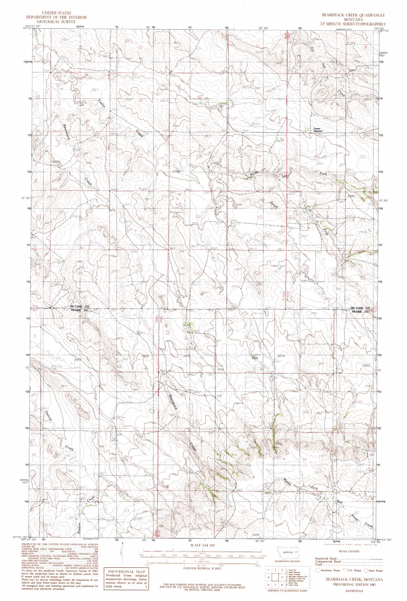
USGS Topo Quad 47105b5 - 1:24,000 scale
| Topo Map Name: | Bearshack Creek |
| USGS Topo Quad ID: | 47105b5 |
| Print Size: | ca. 21 1/4" wide x 27" high |
| Southeast Coordinates: | 47.125° N latitude / 105.5° W longitude |
| Map Center Coordinates: | 47.1875° N latitude / 105.5625° W longitude |
| U.S. State: | MT |
| Filename: | o47105b5.jpg |
| Download Map JPG Image: | Bearshack Creek topo map 1:24,000 scale |
| Map Type: | Topographic |
| Topo Series: | 7.5´ |
| Map Scale: | 1:24,000 |
| Source of Map Images: | United States Geological Survey (USGS) |
| Alternate Map Versions: |
Bearshack Creek MT 1983, updated 1983 Download PDF Buy paper map Bearshack Creek MT 2011 Download PDF Buy paper map Bearshack Creek MT 2014 Download PDF Buy paper map |
1:24,000 Topo Quads surrounding Bearshack Creek
Brockway Ne |
Youngquist Mine |
Circle |
Woodworth Hill |
Olson Coulee North |
Brockway |
Circle Sw |
Quick Reservoir |
Mount Antelope |
Olson Coulee South |
Watkins |
Big Sheep Mountain Nw |
Bearshack Creek |
Diamond G Butte Nw |
Union School |
Watkins Se |
Big Sheep Mountain |
Becker Dam |
North Coulee |
Diamond G Butte |
Little Sheep Mountain |
South Fork Reservoir |
Mccloud |
Papps Reservoir |
Diamond G Creek |
> Back to 47105a1 at 1:100,000 scale
> Back to 47104a1 at 1:250,000 scale
> Back to U.S. Topo Maps home
Bearshack Creek topo map: Gazetteer
Bearshack Creek: Dams
Schwartz Dam elevation 947m 3106′Bearshack Creek: Streams
Bearshack Creek elevation 820m 2690′North Fork Tusler Creek elevation 844m 2769′
South Fork Tusler Creek elevation 844m 2769′
Bearshack Creek: Summits
Lower Summit elevation 890m 2919′Bearshack Creek: Wells
16N48E01ACC_01 Well elevation 903m 2962′16N48E02CCD_01 Well elevation 908m 2979′
16N49E16DDDD01 Well elevation 1004m 3293′
16N49E21BBBB01 Well elevation 1023m 3356′
17N48E12ADDA01 Well elevation 891m 2923′
17N48E35DBBA01 Well elevation 892m 2926′
17N49E17BCBD01 Well elevation 905m 2969′
Bearshack Creek digital topo map on disk
Buy this Bearshack Creek topo map showing relief, roads, GPS coordinates and other geographical features, as a high-resolution digital map file on DVD:
Eastern Montana & Western North Dakota
Buy digital topo maps: Eastern Montana & Western North Dakota