Lindstrom Peak Topo Map Idaho
To zoom in, hover over the map of Lindstrom Peak
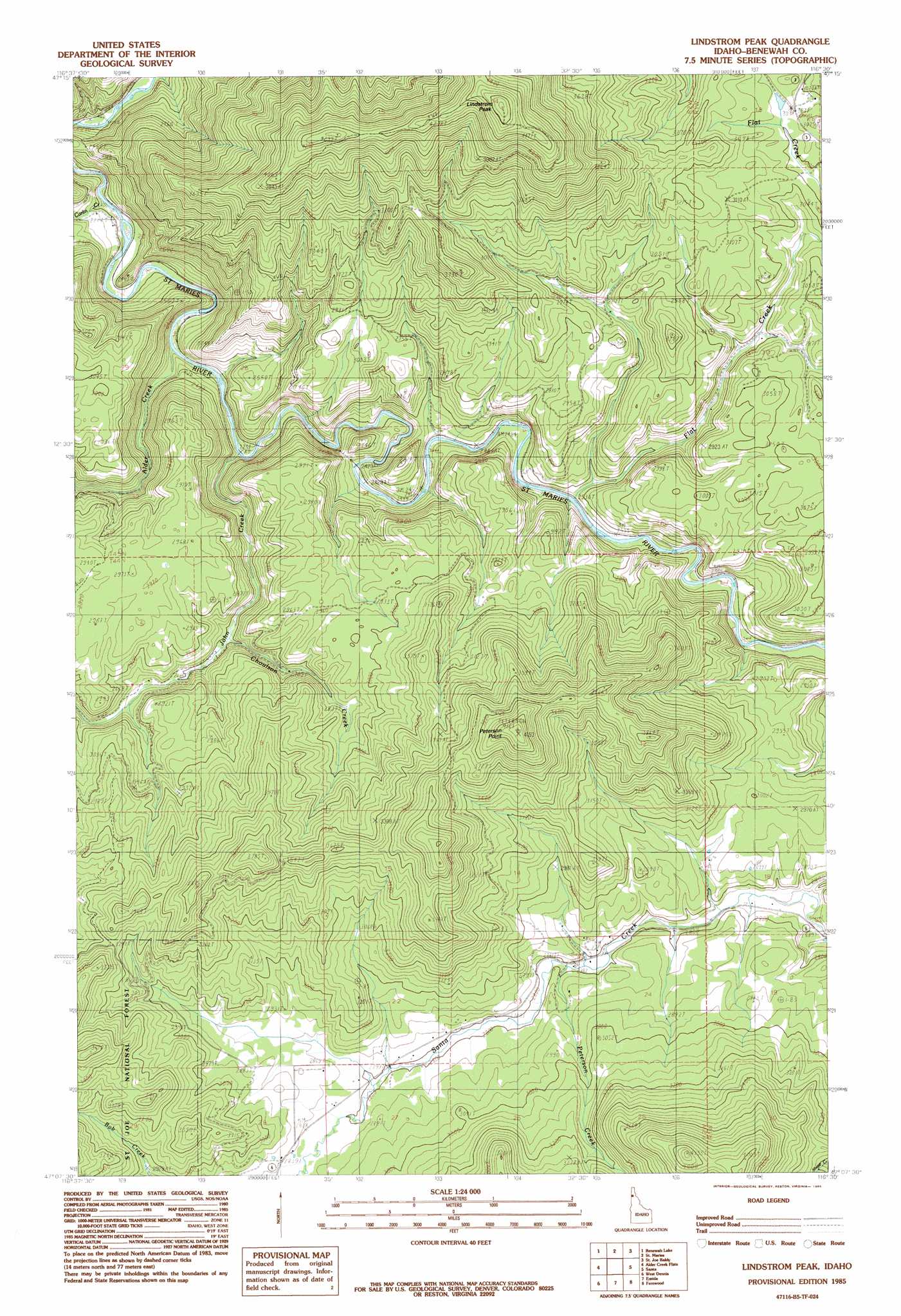
USGS Topo Quad 47116b5 - 1:24,000 scale
| Topo Map Name: | Lindstrom Peak |
| USGS Topo Quad ID: | 47116b5 |
| Print Size: | ca. 21 1/4" wide x 27" high |
| Southeast Coordinates: | 47.125° N latitude / 116.5° W longitude |
| Map Center Coordinates: | 47.1875° N latitude / 116.5625° W longitude |
| U.S. State: | ID |
| Filename: | o47116b5.jpg |
| Download Map JPG Image: | Lindstrom Peak topo map 1:24,000 scale |
| Map Type: | Topographic |
| Topo Series: | 7.5´ |
| Map Scale: | 1:24,000 |
| Source of Map Images: | United States Geological Survey (USGS) |
| Alternate Map Versions: |
Lindstrom Peak ID 1985, updated 1985 Download PDF Buy paper map Lindstrom Peak ID 1995, updated 1998 Download PDF Buy paper map Lindstrom Peak ID 2011 Download PDF Buy paper map Lindstrom Peak ID 2013 Download PDF Buy paper map |
| FStopo: | US Forest Service topo Lindstrom Peak is available: Download FStopo PDF Download FStopo TIF |
1:24,000 Topo Quads surrounding Lindstrom Peak
Harrison |
Black Lake |
Medimont |
Rochat Peak |
Twin Crags |
Chatcolet |
Benewah Lake |
Saint Maries |
Saint Joe Baldy |
Saint Joe |
Benewah |
Alder Creek Flats |
Lindstrom Peak |
Santa |
Crystal Peak |
Sanders |
West Dennis |
Emida |
Fernwood |
Clarkia |
Princeton |
Harvard |
Sand Mountain |
Abes Knob |
Bechtel Butte |
> Back to 47116a1 at 1:100,000 scale
> Back to 47116a1 at 1:250,000 scale
> Back to U.S. Topo Maps home
Lindstrom Peak topo map: Gazetteer
Lindstrom Peak: Populated Places
Alder Creek elevation 676m 2217′Cardwell elevation 765m 2509′
Lotus elevation 661m 2168′
Rover elevation 742m 2434′
Lindstrom Peak: Streams
Alder Creek elevation 677m 2221′Carlin Creek elevation 660m 2165′
Choulson Creek elevation 789m 2588′
Flat Creek elevation 769m 2522′
John Creek elevation 700m 2296′
Peterson Creek elevation 852m 2795′
Lindstrom Peak: Summits
Lindstrom Peak elevation 1423m 4668′Peterson Point elevation 1265m 4150′
Lindstrom Peak digital topo map on disk
Buy this Lindstrom Peak topo map showing relief, roads, GPS coordinates and other geographical features, as a high-resolution digital map file on DVD: