Mansfield Topo Map Washington
To zoom in, hover over the map of Mansfield
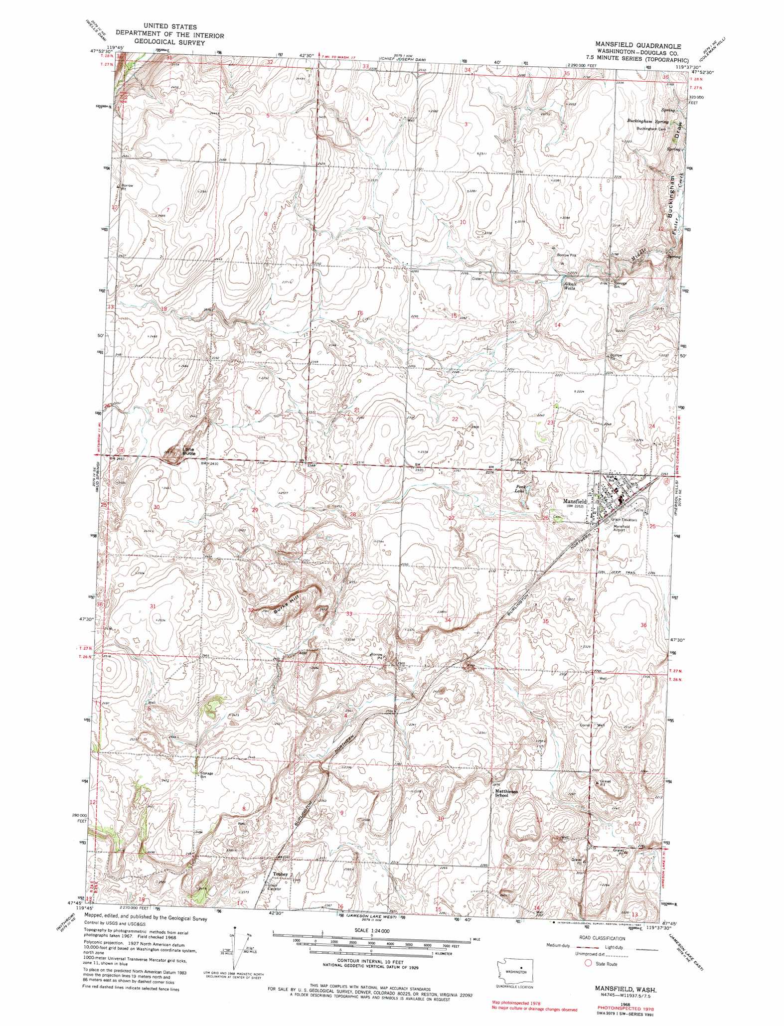
USGS Topo Quad 47119g6 - 1:24,000 scale
| Topo Map Name: | Mansfield |
| USGS Topo Quad ID: | 47119g6 |
| Print Size: | ca. 21 1/4" wide x 27" high |
| Southeast Coordinates: | 47.75° N latitude / 119.625° W longitude |
| Map Center Coordinates: | 47.8125° N latitude / 119.6875° W longitude |
| U.S. State: | WA |
| Filename: | o47119g6.jpg |
| Download Map JPG Image: | Mansfield topo map 1:24,000 scale |
| Map Type: | Topographic |
| Topo Series: | 7.5´ |
| Map Scale: | 1:24,000 |
| Source of Map Images: | United States Geological Survey (USGS) |
| Alternate Map Versions: |
Mansfield WA 1968, updated 1971 Download PDF Buy paper map Mansfield WA 1968, updated 1982 Download PDF Buy paper map Mansfield WA 2011 Download PDF Buy paper map Mansfield WA 2014 Download PDF Buy paper map |
1:24,000 Topo Quads surrounding Mansfield
Pateros |
Brewster |
Bridgeport |
Bridgeport Point |
Stubblefield Point |
Azwell |
Wells Dam |
Chief Joseph Dam |
Coleman Hill |
Leahy |
Chelan Falls |
Mud Spring |
Mansfield |
Piersol Hills |
Barnes Butte |
Lamoine |
Withrow |
Jameson Lake West |
Jameson Lake East |
Saint Andrews |
Alstown |
Farmer |
Jameson Lake Sw |
Jameson Lake Se |
Park Lake |
> Back to 47119e1 at 1:100,000 scale
> Back to 47118a1 at 1:250,000 scale
> Back to U.S. Topo Maps home
Mansfield topo map: Gazetteer
Mansfield: Airports
Mansfield Airport elevation 694m 2276′Mansfield: Lakes
Perk Lake elevation 683m 2240′Mansfield: Populated Places
Mansfield elevation 692m 2270′Matthiesen (historical) elevation 693m 2273′
Touhey elevation 721m 2365′
Mansfield: Springs
Buckingham Spring elevation 645m 2116′Mansfield: Summits
Burke Hill elevation 762m 2500′Lone Butte elevation 770m 2526′
Mansfield: Wells
Alkali Wells elevation 673m 2208′Mansfield digital topo map on disk
Buy this Mansfield topo map showing relief, roads, GPS coordinates and other geographical features, as a high-resolution digital map file on DVD: