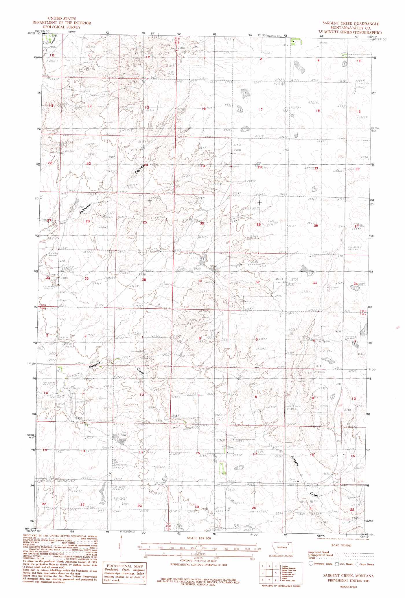
Sargent Creek Topo Map Montana
To zoom in, hover over the map of Sargent Creek
USGS Topo Quad 48106c3 - 1:24,000 scale
| Topo Map Name: | Sargent Creek |
| USGS Topo Quad ID: | 48106c3 |
| Print Size: | ca. 21 1/4" wide x 27" high |
| Southeast Coordinates: | 48.25° N latitude / 106.25° W longitude |
| Map Center Coordinates: | 48.3125° N latitude / 106.3125° W longitude |
| U.S. State: | MT |
| Filename: | o48106c3.jpg |
| Download Map JPG Image: | Sargent Creek topo map 1:24,000 scale |
| Map Type: | Topographic |
| Topo Series: | 7.5´ |
| Map Scale: | 1:24,000 |
| Source of Map Images: | United States Geological Survey (USGS) |
| Alternate Map Versions: |
Sargent Creek MT 1983, updated 1983 Download PDF Buy paper map Sargent Creek MT 2011 Download PDF Buy paper map Sargent Creek MT 2014 Download PDF Buy paper map |
1:24,000 Topo Quads surrounding Sargent Creek
Dry Fork Creek |
Cameron Point |
Baylor Se |
Larslan |
Blink Springs |
Chapman Coulee Ne |
Lookout |
Bullhead Reservoir |
Spring Valley West |
Spring Valley East |
Hawk Coulee |
Uhlan Coulee |
Sargent Creek |
Spring Creek Sw |
Hauck Coulee |
Whately |
Lindeke Coulee |
Nashua |
Milk River Coulee |
Dubbe Reservoir |
Wheeler |
Fort Peck |
Milk River Hills |
Kintyre |
Frazer |
> Back to 48106a1 at 1:100,000 scale
> Back to 48106a1 at 1:250,000 scale
> Back to U.S. Topo Maps home
Sargent Creek topo map: Gazetteer
Sargent Creek: Dams
Fort Peck Reservation Number 4 Dam elevation 792m 2598′Sargent Creek: Wells
29N42E03BCCC01 Well elevation 844m 2769′29N42E15CAAB01 Well elevation 784m 2572′
30N42E33DDDD01 Well elevation 839m 2752′
Sargent Creek digital topo map on disk
Buy this Sargent Creek topo map showing relief, roads, GPS coordinates and other geographical features, as a high-resolution digital map file on DVD:
Eastern Montana & Western North Dakota
Buy digital topo maps: Eastern Montana & Western North Dakota