Ethridge Topo Map Montana
To zoom in, hover over the map of Ethridge
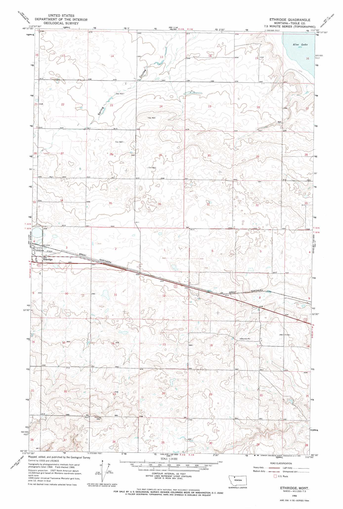
USGS Topo Quad 48112e1 - 1:24,000 scale
| Topo Map Name: | Ethridge |
| USGS Topo Quad ID: | 48112e1 |
| Print Size: | ca. 21 1/4" wide x 27" high |
| Southeast Coordinates: | 48.5° N latitude / 112° W longitude |
| Map Center Coordinates: | 48.5625° N latitude / 112.0625° W longitude |
| U.S. State: | MT |
| Filename: | o48112e1.jpg |
| Download Map JPG Image: | Ethridge topo map 1:24,000 scale |
| Map Type: | Topographic |
| Topo Series: | 7.5´ |
| Map Scale: | 1:24,000 |
| Source of Map Images: | United States Geological Survey (USGS) |
| Alternate Map Versions: |
Ethridge MT 1966, updated 1969 Download PDF Buy paper map Ethridge MT 2011 Download PDF Buy paper map Ethridge MT 2014 Download PDF Buy paper map |
1:24,000 Topo Quads surrounding Ethridge
Headlight Butte |
Glacier Colony |
Mountain View School |
Kevin North |
Ferdig |
Cut Bank |
Ethridge Nw |
Aloe |
Kevin South |
Oilmont |
Cut Bank Se |
Boru Spring |
Ethridge |
Virden |
Shelby |
Rock City |
Abbott Lake |
Cactus Flat |
Ledger Nw |
Naismith |
Valier West |
Valier East |
Belgian Hill |
Pioneer School |
Ledger |
> Back to 48112e1 at 1:100,000 scale
> Back to 48112a1 at 1:250,000 scale
> Back to U.S. Topo Maps home
Ethridge topo map: Gazetteer
Ethridge: Airports
Torgerson Airport elevation 1081m 3546′Ethridge: Lakes
Aloe Lake elevation 998m 3274′Ethridge: Populated Places
Ethridge elevation 1080m 3543′Ethridge: Post Offices
Ethridge Post Office elevation 1081m 3546′Simla Post Office (historical) elevation 1059m 3474′
Ethridge: Wells
32N04W27BB__01 Well elevation 1174m 3851′32N04W28AA__01 Well elevation 1157m 3795′
Ethridge digital topo map on disk
Buy this Ethridge topo map showing relief, roads, GPS coordinates and other geographical features, as a high-resolution digital map file on DVD: