Mount Stimson Topo Map Montana
To zoom in, hover over the map of Mount Stimson
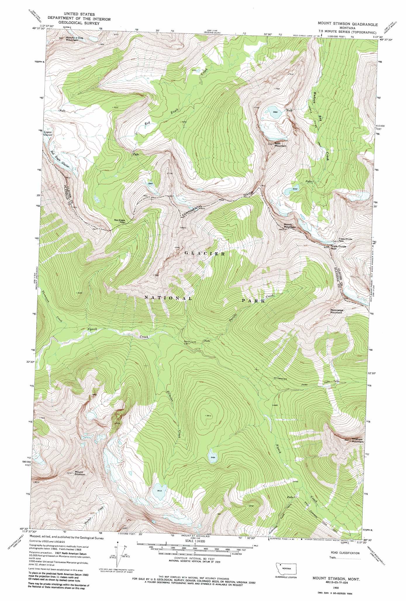
USGS Topo Quad 48113e5 - 1:24,000 scale
| Topo Map Name: | Mount Stimson |
| USGS Topo Quad ID: | 48113e5 |
| Print Size: | ca. 21 1/4" wide x 27" high |
| Southeast Coordinates: | 48.5° N latitude / 113.5° W longitude |
| Map Center Coordinates: | 48.5625° N latitude / 113.5625° W longitude |
| U.S. State: | MT |
| Filename: | o48113e5.jpg |
| Download Map JPG Image: | Mount Stimson topo map 1:24,000 scale |
| Map Type: | Topographic |
| Topo Series: | 7.5´ |
| Map Scale: | 1:24,000 |
| Source of Map Images: | United States Geological Survey (USGS) |
| Alternate Map Versions: |
Mount Stimson MT 1968, updated 1972 Download PDF Buy paper map Mount Stimson MT 1968, updated 1985 Download PDF Buy paper map Mount Stimson MT 2011 Download PDF Buy paper map Mount Stimson MT 2014 Download PDF Buy paper map |
1:24,000 Topo Quads surrounding Mount Stimson
Ahern Pass |
Many Glacier |
Lake Sherburne |
Babb |
Duck Lake |
Mount Cannon |
Logan Pass |
Rising Sun |
Saint Mary |
Fox Creek |
Lake Mcdonald East |
Mount Jackson |
Mount Stimson |
Cut Bank Pass |
Kiowa |
Nyack |
Stanton Lake |
Mount Saint Nicholas |
Mount Rockwell |
Squaw Mountain |
Mount Grant |
Pinnacle |
Essex |
Blacktail |
Summit |
> Back to 48113e1 at 1:100,000 scale
> Back to 48112a1 at 1:250,000 scale
> Back to U.S. Topo Maps home
Mount Stimson topo map: Gazetteer
Mount Stimson: Gaps
Red Eagle Pass elevation 2022m 6633′Triple Divide Pass elevation 2248m 7375′
Mount Stimson: Glaciers
Red Eagle Glacier elevation 2147m 7043′Mount Stimson: Streams
Pacific Creek elevation 1332m 4370′Stimson Creek elevation 1271m 4169′
Thompson Creek elevation 1220m 4002′
Mount Stimson: Summits
Almost-a-Dog Mountain elevation 2719m 8920′Mount Stimson elevation 3076m 10091′
Norris Mountain elevation 2716m 8910′
Razoredge Mountain elevation 2612m 8569′
Split Mountain elevation 2673m 8769′
Tinkham Mountain elevation 2516m 8254′
Triple Divide Peak elevation 2433m 7982′
Mount Stimson: Trails
Triple Divide Trail elevation 1677m 5501′West Dawson Pass Trail elevation 1497m 4911′
Mount Stimson digital topo map on disk
Buy this Mount Stimson topo map showing relief, roads, GPS coordinates and other geographical features, as a high-resolution digital map file on DVD: