Cedonia Topo Map Washington
To zoom in, hover over the map of Cedonia
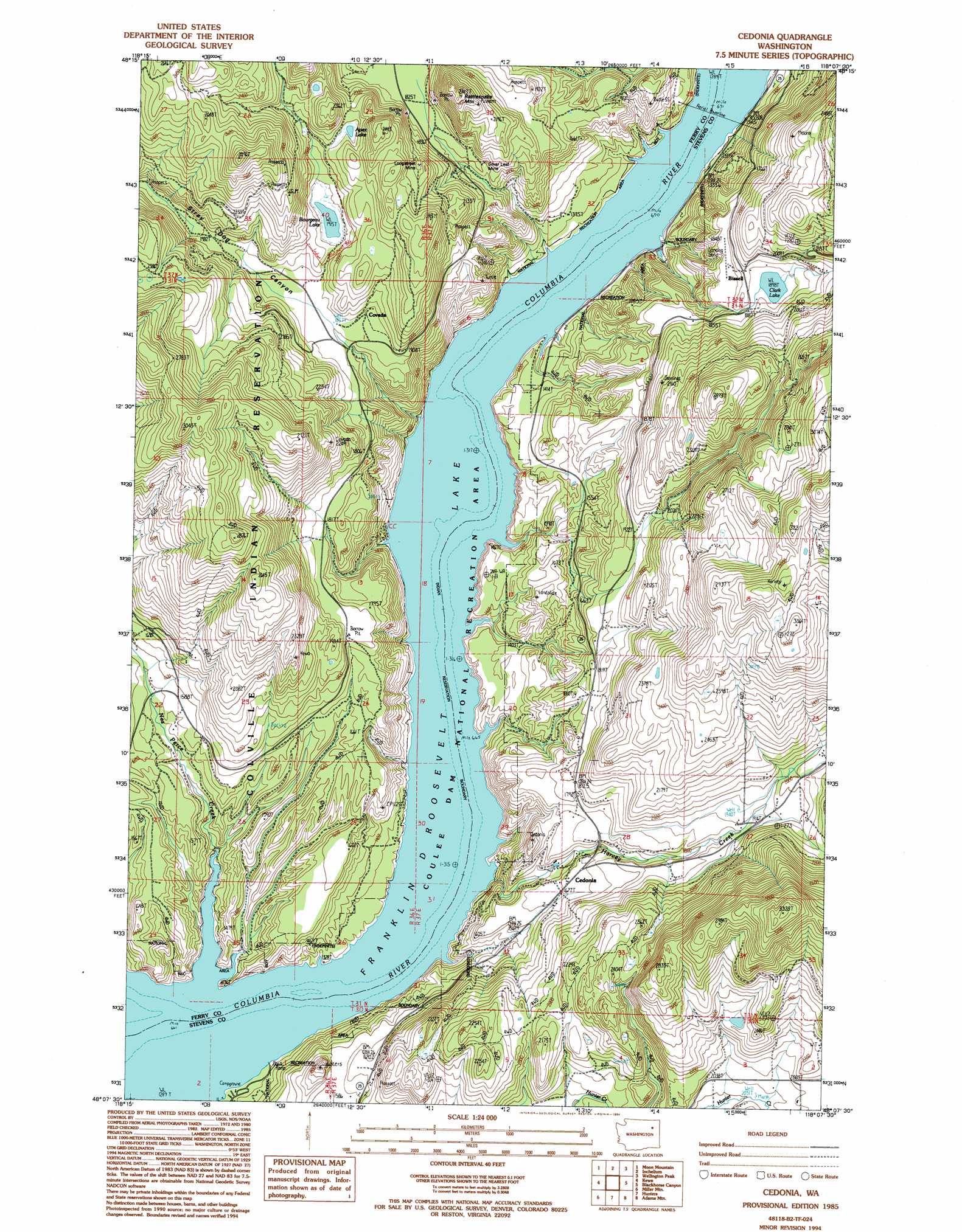
USGS Topo Quad 48118b2 - 1:24,000 scale
| Topo Map Name: | Cedonia |
| USGS Topo Quad ID: | 48118b2 |
| Print Size: | ca. 21 1/4" wide x 27" high |
| Southeast Coordinates: | 48.125° N latitude / 118.125° W longitude |
| Map Center Coordinates: | 48.1875° N latitude / 118.1875° W longitude |
| U.S. State: | WA |
| Filename: | o48118b2.jpg |
| Download Map JPG Image: | Cedonia topo map 1:24,000 scale |
| Map Type: | Topographic |
| Topo Series: | 7.5´ |
| Map Scale: | 1:24,000 |
| Source of Map Images: | United States Geological Survey (USGS) |
| Alternate Map Versions: |
Cedonia WA 1985, updated 1985 Download PDF Buy paper map Cedonia WA 1985, updated 1994 Download PDF Buy paper map Cedonia WA 2011 Download PDF Buy paper map Cedonia WA 2014 Download PDF Buy paper map |
1:24,000 Topo Quads surrounding Cedonia
Sitdown Mountain |
La Fleur Lake |
Rice |
Kentry Ridge |
Arden |
Twin Lakes |
Moon Mountain |
Inchelium |
Wellington Peak |
Dunn Mountain |
Gold Mountain |
Kewa |
Cedonia |
Blackhorse Canyon |
Stensgar Mountain |
Ninemile Flat |
Miller Mountain |
Hunters |
Adams Mountain |
Empey Mountain |
Johnny George Mountain |
Fort Spokane |
Mccoy Lake |
Turtle Lake |
Wellpinit |
> Back to 48118a1 at 1:100,000 scale
> Back to 48118a1 at 1:250,000 scale
> Back to U.S. Topo Maps home
Cedonia topo map: Gazetteer
Cedonia: Lakes
Apex Lake elevation 623m 2043′Bourgeau Lake elevation 584m 1916′
Clark Lake elevation 580m 1902′
Cedonia: Mines
Longstreet Mine elevation 670m 2198′Silver Leaf Mine elevation 577m 1893′
Cedonia: Populated Places
Bissel elevation 587m 1925′Cedonia elevation 524m 1719′
Covada elevation 573m 1879′
Cedonia: Streams
Harvey Creek elevation 411m 1348′Nez Perce Creek elevation 394m 1292′
Cedonia: Summits
Rattlesnake Mountain elevation 694m 2276′Cedonia: Valleys
Stray Dog Canyon elevation 571m 1873′Cedonia digital topo map on disk
Buy this Cedonia topo map showing relief, roads, GPS coordinates and other geographical features, as a high-resolution digital map file on DVD: