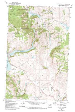
Conconully East Topo Map Washington
To zoom in, hover over the map of Conconully East
USGS Topo Quad 48119e6 - 1:24,000 scale
| Topo Map Name: | Conconully East |
| USGS Topo Quad ID: | 48119e6 |
| Print Size: | ca. 21 1/4" wide x 27" high |
| Southeast Coordinates: | 48.5° N latitude / 119.625° W longitude |
| Map Center Coordinates: | 48.5625° N latitude / 119.6875° W longitude |
| U.S. State: | WA |
| Filename: | o48119e6.jpg |
| Download Map JPG Image: | Conconully East topo map 1:24,000 scale |
| Map Type: | Topographic |
| Topo Series: | 7.5´ |
| Map Scale: | 1:24,000 |
| Source of Map Images: | United States Geological Survey (USGS) |
| Alternate Map Versions: |
Conconully East WA 1981, updated 1981 Download PDF Buy paper map Conconully East WA 2001, updated 2004 Download PDF Buy paper map Conconully East WA 2011 Download PDF Buy paper map Conconully East WA 2014 Download PDF Buy paper map |
| FStopo: | US Forest Service topo Conconully East is available: Download FStopo PDF Download FStopo TIF |
1:24,000 Topo Quads surrounding Conconully East
> Back to 48119e1 at 1:100,000 scale
> Back to 48118a1 at 1:250,000 scale
> Back to U.S. Topo Maps home
Conconully East topo map: Gazetteer
Conconully East: Basins
Scotch Creek Basin elevation 447m 1466′Conconully East: Dams
Conconully Dam elevation 684m 2244′Fish Lake Dam elevation 553m 1814′
Salmon Lake Dam elevation 708m 2322′
Sasse Reservoir Dam elevation 727m 2385′
Schallow Lake Dam elevation 517m 1696′
Conconully East: Flats
Graveyard Flat elevation 707m 2319′Conconully East: Lakes
Andrew Lake elevation 702m 2303′Cow Lake elevation 615m 2017′
Doheney Lake elevation 477m 1564′
Hess Lake elevation 427m 1400′
Honey Lake elevation 654m 2145′
Mud Lake elevation 644m 2112′
Roberts Lake elevation 834m 2736′
Sasse Pond elevation 727m 2385′
Schalow Pond elevation 517m 1696′
Sugarloaf Lake elevation 708m 2322′
Conconully East: Mines
Peacock Mine elevation 919m 3015′Conconully East: Parks
Conconully National Wildlife Refuge elevation 770m 2526′Conconully East: Populated Places
Conconully elevation 702m 2303′Conconully East: Reservoirs
Conconully Lake elevation 708m 2322′Conconully Reservoir elevation 684m 2244′
Fish Lake elevation 553m 1814′
Sasse Reservoir elevation 727m 2385′
Schallow Lake elevation 559m 1833′
Conconully East: Streams
Coulee Creek elevation 465m 1525′Gibson Creek elevation 551m 1807′
North Fork Salmon Creek elevation 708m 2322′
Scotch Creek elevation 427m 1400′
Spikeman Creek elevation 726m 2381′
Conconully East: Summits
Dunn Mountain elevation 1064m 3490′Funk Mountain elevation 1562m 5124′
Happy Hill elevation 816m 2677′
Schalow Mountain elevation 1157m 3795′
Silver Hill elevation 967m 3172′
Conconully East digital topo map on disk
Buy this Conconully East topo map showing relief, roads, GPS coordinates and other geographical features, as a high-resolution digital map file on DVD:


