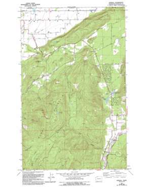
Kendall Topo Map Washington
To zoom in, hover over the map of Kendall
USGS Topo Quad 48122h2 - 1:24,000 scale
| Topo Map Name: | Kendall |
| USGS Topo Quad ID: | 48122h2 |
| Print Size: | ca. 21 1/4" wide x 27" high |
| Southeast Coordinates: | 48.875° N latitude / 122.125° W longitude |
| Map Center Coordinates: | 48.9375° N latitude / 122.1875° W longitude |
| U.S. State: | WA |
| Filename: | o48122h2.jpg |
| Download Map JPG Image: | Kendall topo map 1:24,000 scale |
| Map Type: | Topographic |
| Topo Series: | 7.5´ |
| Map Scale: | 1:24,000 |
| Source of Map Images: | United States Geological Survey (USGS) |
| Alternate Map Versions: |
Kendall WA 1972, updated 1976 Download PDF Buy paper map Kendall WA 1972, updated 1994 Download PDF Buy paper map Kendall WA 2011 Download PDF Buy paper map Kendall WA 2014 Download PDF Buy paper map |
1:24,000 Topo Quads surrounding Kendall
Lynden |
Sumas |
Kendall |
Maple Falls |
Glacier |
Bellingham North |
Lawrence |
Deming |
Canyon Lake |
Groat Mountain |
Bellingham South |
Lake Whatcom |
Acme |
Cavanaugh Creek |
Twin Sisters Mountain |
> Back to 48122e1 at 1:100,000 scale
> Back to 48122a1 at 1:250,000 scale
> Back to U.S. Topo Maps home
Kendall topo map: Gazetteer
Kendall: Gaps
South Pass elevation 157m 515′Kendall: Lakes
Anderson Lake elevation 168m 551′Kendall Lake elevation 134m 439′
Lost Lake elevation 866m 2841′
Sprague Lake elevation 134m 439′
Kendall: Populated Places
Balford elevation 141m 462′Columbia elevation 169m 554′
Kendall elevation 135m 442′
Limestone Junction elevation 158m 518′
Nooksack Salmon Hatchery elevation 121m 396′
Peaceful Valley elevation 142m 465′
Kendall: Streams
Coal Creek elevation 110m 360′Collins Creek elevation 133m 436′
Johnson Creek elevation 11m 36′
Kendall Creek elevation 116m 380′
Racehorse Creek elevation 117m 383′
Kendall: Summits
Haystack Hill elevation 200m 656′Lone Tree Hill elevation 248m 813′
Reese Hill elevation 107m 351′
Sugarloaf Hill elevation 281m 921′
Sumas Mountain elevation 1041m 3415′
Vedder Mountain elevation 498m 1633′
Kendall: Valleys
Columbia Valley elevation 138m 452′Paradise Valley elevation 295m 967′
Kendall digital topo map on disk
Buy this Kendall topo map showing relief, roads, GPS coordinates and other geographical features, as a high-resolution digital map file on DVD:


