Verna Topo Map Florida
To zoom in, hover over the map of Verna
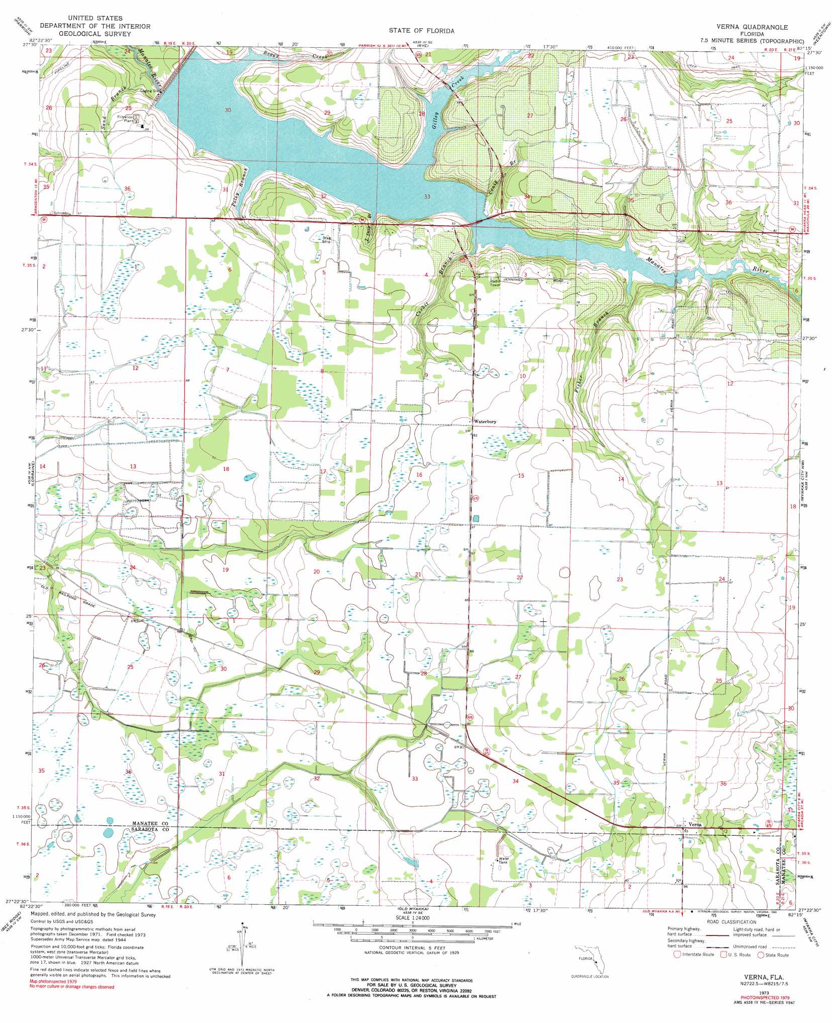
USGS Topo Quad 27082d3 - 1:24,000 scale
| Topo Map Name: | Verna |
| USGS Topo Quad ID: | 27082d3 |
| Print Size: | ca. 21 1/4" wide x 27" high |
| Southeast Coordinates: | 27.375° N latitude / 82.25° W longitude |
| Map Center Coordinates: | 27.4375° N latitude / 82.3125° W longitude |
| U.S. State: | FL |
| Filename: | O27082D3.jpg |
| Download Map JPG Image: | Verna topo map 1:24,000 scale |
| Map Type: | Topographic |
| Topo Series: | 7.5´ |
| Map Scale: | 1:24,000 |
| Source of Map Images: | United States Geological Survey (USGS) |
| Alternate Map Versions: |
Verna FL 1944, updated 1961 Download PDF Buy paper map Verna FL 1973, updated 1975 Download PDF Buy paper map Verna FL 1973, updated 1990 Download PDF Buy paper map Verna FL 2012 Download PDF Buy paper map Verna FL 2015 Download PDF Buy paper map |
1:24,000 Topo Quads surrounding Verna
Cockroach Bay |
Ruskin |
Wimauma |
Fort Lonesome |
Duette Ne |
Palmetto |
Parrish |
Rye |
Keentown |
Duette |
Bradenton |
Lorraine |
Verna |
Myakka City Nw |
Myakka Head |
Sarasota |
Bee Ridge |
Old Myakka |
Myakka City |
Edgeville |
Bird Keys |
Laurel |
Lower Myakka Lake |
Murdock Nw |
Murdock Ne |
> Back to 27082a1 at 1:100,000 scale
> Back to 27082a1 at 1:250,000 scale
> Back to U.S. Topo Maps home
Verna topo map: Gazetteer
Verna: Bridges
Sullivan Bridge elevation 11m 36′Verna: Parks
Lake Manatee State Park elevation 21m 68′Verna: Populated Places
Bethany elevation 20m 65′Verna elevation 28m 91′
Waterbury elevation 24m 78′
Verna: Reservoirs
Lake Manatee elevation 11m 36′Verna: Streams
Boggy Creek elevation 11m 36′Corbit Branch elevation 11m 36′
Craig Branch elevation 12m 39′
Fisher Branch elevation 11m 36′
Gilley Creek elevation 11m 36′
Little Deep Branch elevation 11m 36′
Poley Branch elevation 11m 36′
Sand Branch elevation 1m 3′
Verna digital topo map on disk
Buy this Verna topo map showing relief, roads, GPS coordinates and other geographical features, as a high-resolution digital map file on DVD: